Sari County
Sari County (Persian: شهرستان ساری) is in Mazandaran province, Iran. Its capital is the city of Sari.
Sari County
Persian: شهرستان ساری | |
|---|---|
County | |
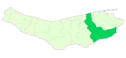 Location of Sari County in Mazandaran province | |
 Location of Mazandaran province in Iran | |
| Coordinates: 36°24′N 53°25′E[1] | |
| Country | |
| Province | Mazandaran |
| Capital | Sari |
| Districts | Central, Chahardangeh, Dodangeh, Kolijan Rostaq, Rudpey, Rudpey-ye Shomali |
| Area | |
| • Total | 3,685.30 km2 (1,422.90 sq mi) |
| Population (2016) | |
| • Total | 504,298 |
| • Density | 140/km2 (350/sq mi) |
| Time zone | UTC+3:30 (IRST) |
| Sari County can be found at GEOnet Names Server, at this link, by opening the Advanced Search box, entering "-3196738" in the "Unique Feature Id" form, and clicking on "Search Database". | |
At the 2006 census, the county's population was 490,830 in 132,919 households.[3] The following census in 2011 counted 478,370 people in 145,339 households, by which time Miandorud District had been separated from the county to form Miandorud County.[4] At the 2016 census, the county's population was 504,298 in 165,467 households.[5]
Administrative divisions
The population history and structural changes of Sari County's administrative divisions over three consecutive censuses are shown in the following table. The latest census shows six districts, 15 rural districts, and four cities.[5]
| Administrative Divisions | 2006[3] | 2011[4] | 2016[5] |
|---|---|---|---|
| Central District | 395,716 | 405,850 | 429,620 |
| Esfivard-e Shurab RD | 25,400 | 26,172 | 27,291 |
| Kolijan Rostaq-e Sofla RD | 16,953 | 21,579 | 21,813 |
| Mazkureh RD | 25,883 | 27,302 | 33,310 |
| Miandorud-e Kuchak RD | 33,905 | 34,380 | 37,386 |
| Rudpey-ye Jonubi RD | 20,548 | ||
| Rudpey-ye Shomali RD | 13,943 | ||
| Sari (city) | 259,084 | 296,417 | 309,820 |
| Chahardangeh District | 19,969 | 15,796 | 17,376 |
| Chahardangeh RD | 5,884 | 4,081 | 4,864 |
| Garmab RD | 6,610 | 5,533 | 5,804 |
| Poshtkuh RD | 3,885 | 3,345 | 3,324 |
| Kiasar (city) | 3,590 | 2,837 | 3,384 |
| Dodangeh District | 8,140 | 7,705 | 7,653 |
| Banaft RD | 3,209 | 2,979 | 2,759 |
| Farim RD | 4,751 | 4,454 | 4,525 |
| Farim (city) | 180 | 272 | 369 |
| Kolijan Rostaq District | 13,143 | 11,732 | 12,024 |
| Kolijan Rostaq-e Olya RD | 9,543 | 9,183 | 8,461 |
| Tangeh Soleyman RD | 3,600 | 2,549 | 2,607 |
| Pain Hular (city) | 956 | ||
| Miandorud District1 | 53,862 | ||
| Kuhdasht RD | 20,601 | ||
| Miandorud-e Bozorg RD | 24,444 | ||
| Surak (city) | 8,817 | ||
| Rudpey District | 37,287 | 22,126 | |
| Rudpey-ye Gharbi RD | 9,762 | ||
| Rudpey-ye Jonubi RD | 21,830 | ||
| Rudpey-ye Sharqi RD | 12,364 | ||
| Rudpey-ye Shomali RD | 15,457 | ||
| Akand (city)2 | |||
| Rudpey-ye Shomali District | 15,496 | ||
| Farahabad-e Jonubi RD | 5,826 | ||
| Farahabad-e Shomali RD | 9,670 | ||
| Farahabad (city)2 | |||
| Total | 490,830 | 478,370 | 504,298 |
| RD: Rural District 1Became a part of Miandorud County 2Became a city after the 2016 census[6][7] | |||
Wikimedia Commons has media related to Sari County.
References
- OpenStreetMap contributors (29 May 2023). "Sari County" (Map). OpenStreetMap. Retrieved 29 May 2023.
- Management and Planning Organization of Mazandaran, 2006
- "Census of the Islamic Republic of Iran, 1385 (2006)". AMAR (in Persian). The Statistical Center of Iran. p. 02. Archived from the original (Excel) on 20 September 2011. Retrieved 25 September 2022.
- "Census of the Islamic Republic of Iran, 1390 (2011)" (Excel). Iran Data Portal (in Persian). The Statistical Center of Iran. p. 02. Retrieved 19 December 2022.
- "Census of the Islamic Republic of Iran, 1395 (2016)". AMAR (in Persian). The Statistical Center of Iran. p. 02. Archived from the original (Excel) on 7 October 2021. Retrieved 19 December 2022.
- Fazli, Rahmani (12 December 2019). "Akand village becomes a city". Softinja (in Persian). Ministry of Interior. Archived from the original on 29 May 2023. Retrieved 29 May 2023.
- "Notification of the approval of the Ministry of Interior regarding the conversion of Farahabad village". DOTIC (in Persian). 18 October 2016. Retrieved 29 May 2023.
The decision of the Ministry of Interior regarding the transformation of Farahabad village, the center of Rudpey-ye Shomali District of Sari County, into a city was announced. No. 171182—10/18/2016. [Google snippet]
This article is issued from Wikipedia. The text is licensed under Creative Commons - Attribution - Sharealike. Additional terms may apply for the media files.