Sunan Yugur Autonomous County
Sunan Yugur Autonomous County (Chinese: 肃南裕固族自治县) is an autonomous county under the administration of the prefecture-level city of Zhangye, Gansu Province, China, bordering Qinghai province to the south. It is home to the majority of the Yugur ethnic group. The seat of government is in the town of Hongwansi (红湾寺镇).
Sunan County
肃南县 | |
|---|---|
| 肃南裕固族自治县 Sunan Yugur Autonomous County | |
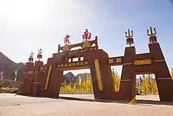 Sunan gate, on the Chinese Yugur Scenic Corridor | |
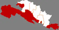 Sunan in Zhangye | |
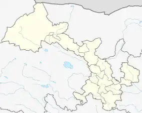
.png.webp) Zhangye in Gansu | |
 Sunan Location of the seat in Gansu 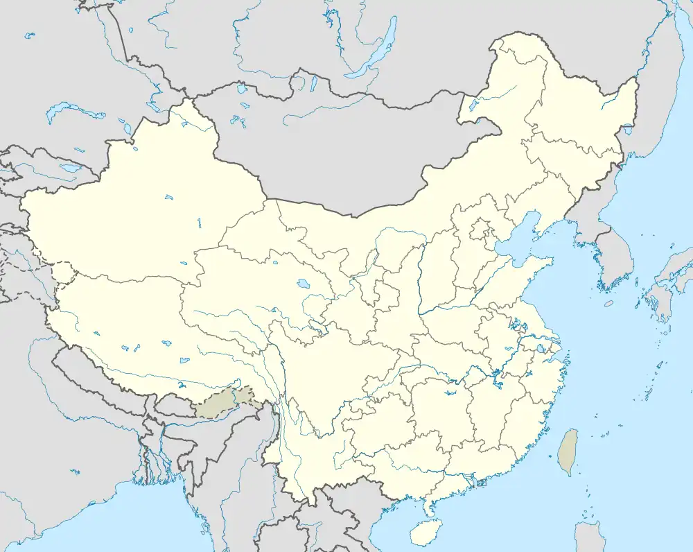 Sunan Sunan (China) | |
| Coordinates: 38°50′19″N 99°37′07″E | |
| Country | China |
| Province | Gansu |
| Prefecture-level city | Zhangye |
| County seat | Hongwansi |
| Area | |
| • Total | 20,176.7 km2 (7,790.3 sq mi) |
| Population (2020)[1] | |
| • Total | 27,762 |
| • Density | 1.4/km2 (3.6/sq mi) |
| Time zone | UTC+8 (China Standard) |
| Postal code | 734400 |
| Website | www |
| Sunan Yugur Autonomous County | |||||||||||
|---|---|---|---|---|---|---|---|---|---|---|---|
| Chinese name | |||||||||||
| Traditional Chinese | 肅南裕固族自治縣 | ||||||||||
| Simplified Chinese | 肃南裕固族自治县 | ||||||||||
| |||||||||||
| Tibetan name | |||||||||||
| Tibetan | སུའུ་ནན་ཡུས་ཀུའུ་རིགས་རང་སྐྱོང་རྫོང་། | ||||||||||
| |||||||||||
| Mongolian name | |||||||||||
| Mongolian Cyrillic | Сүнань ёгорын үндэстний өөртөө засах шянь | ||||||||||
| Mongolian script | ᠰᠦᠨᠠᠨᠢ ᠶᠣᠭᠣᠷ ᠤᠨ ᠦᠨᠳᠦᠰᠦᠲᠡᠨ ᠦ ᠥᠪᠡᠷᠲᠡᠭᠡᠨ ᠵᠠᠰᠠᠬᠤ ᠰᠢᠶᠠᠨ | ||||||||||
| |||||||||||
The autonomous county spans an area of 20,176.7 square kilometres (7,790.3 sq mi), and is home to a total population of 39,283 as of 2021.[2] The autonomous county is ethnically diverse, with large populations of Han Chinese, Yugurs, and Tibetans, with none comprising a majority.[2]
Sunan Yugur Autonomous County consists of three separate areas: Mínghua District, situated in the plains in the northwest, and Huángcheng District, situated in the mountains in the southeast, are separated from the main part of the county.
Toponymy
The autonomous county's name refers to its location to the south (Chinese: 南; pinyin: nán) of Suzhou (Chinese: 肃州; pinyin: Sùzhōu), the former name of Jiuquan.[2]
History
Sunan Yugur Autonomous County was established in 1954.[2]
Geography
Sunan Yugur Autonomous County is located in the middle portion of the Hexi Corridor, along the northern foot of Qilian Mountains.[2] The autonomous county is particularly long and narrow, extending just 120 kilometres (75 mi) to 200 kilometres (120 mi) from north to south, but spans over 650 kilometres (400 mi) from east to west.[2]
The autonomous county is bordered by Bairi Tibetan Autonomous County to the east and Subei Mongol Autonomous County to the west.[2] The autonomous county's northern border is formed by Liangzhou District, Suzhou District, Jiayuguan, and Yumen from east to west.[2] Sunan Yugur Autonomous County is bordered by Menyuan Hui Autonomous County of Qinghai to the south.
The physical geography of the region includes many mountains, canyons, and alluvial plains.[2] The southern portion of the autonomous county is more mountainous, while the northern portion includes more plains.[2] Elevation within Sunan Yugur Autonomous County ranges from 1,327 metres (4,354 ft) to 5,564 metres (18,255 ft) above sea level, with an average elevation of about 3,200 metres (10,500 ft) above sea level.[2] Prominent mountains within the autonomous county include Suzhu Lian (Chinese: 素珠链; pinyin: Sùzhū Liàn) and the July 1 Glacier.[2] Major rivers that flow through Sunan Yugur Autonomous County include the Ruo Shui, the Shiyang River, and the Shule River.[2]
Climate
Sunan Yugur Autonomous County has an semi-arid alpine climate, with cold winters and cool summers.[2] The average temperature in the autonomous county is 4.2 °C (39.6 °F), with cooler regions in the northwest averaging −3.0 °C (26.6 °F), and warmer regions in the southeast averaging 8.0 °C (46.4 °F).[2] There is more precipitation in summer months than winter months.[2] The average annual precipitation in the autonomous county is 267.1 millimetres (10.52 in), with drier regions in the northwest averaging about 100 millimetres (3.9 in), and wetter regions in the southeast averaging about 500 millimetres (20 in).[2] The autonomous county has short frost-free periods, and a high amount of sunshine.[2]
| Climate data for Sunan (1991–2020 normals, extremes 1981–2010) | |||||||||||||
|---|---|---|---|---|---|---|---|---|---|---|---|---|---|
| Month | Jan | Feb | Mar | Apr | May | Jun | Jul | Aug | Sep | Oct | Nov | Dec | Year |
| Record high °C (°F) | 14.7 (58.5) |
20.3 (68.5) |
21.4 (70.5) |
28.3 (82.9) |
28.5 (83.3) |
30.2 (86.4) |
33.4 (92.1) |
30.9 (87.6) |
30.0 (86.0) |
24.7 (76.5) |
20.1 (68.2) |
16.5 (61.7) |
33.4 (92.1) |
| Average high °C (°F) | −0.9 (30.4) |
2.1 (35.8) |
7.0 (44.6) |
13.3 (55.9) |
17.9 (64.2) |
21.6 (70.9) |
23.5 (74.3) |
22.5 (72.5) |
18.2 (64.8) |
12.2 (54.0) |
5.8 (42.4) |
0.8 (33.4) |
12.0 (53.6) |
| Daily mean °C (°F) | −9.6 (14.7) |
−6.4 (20.5) |
−0.8 (30.6) |
6.0 (42.8) |
11.0 (51.8) |
15.3 (59.5) |
17.2 (63.0) |
15.8 (60.4) |
11.2 (52.2) |
4.3 (39.7) |
−2.4 (27.7) |
−8.0 (17.6) |
4.5 (40.0) |
| Average low °C (°F) | −15.9 (3.4) |
−12.7 (9.1) |
−6.8 (19.8) |
0.0 (32.0) |
4.7 (40.5) |
9.5 (49.1) |
11.7 (53.1) |
10.3 (50.5) |
5.8 (42.4) |
−1.3 (29.7) |
−8.1 (17.4) |
−14.2 (6.4) |
−1.4 (29.4) |
| Record low °C (°F) | −25.8 (−14.4) |
−23.5 (−10.3) |
−21.1 (−6.0) |
−14.9 (5.2) |
−8.5 (16.7) |
−0.2 (31.6) |
4.1 (39.4) |
2.1 (35.8) |
−4.9 (23.2) |
−13.8 (7.2) |
−21.5 (−6.7) |
−27.2 (−17.0) |
−27.2 (−17.0) |
| Average precipitation mm (inches) | 2.0 (0.08) |
2.2 (0.09) |
5.8 (0.23) |
12.2 (0.48) |
33.1 (1.30) |
44.9 (1.77) |
68.3 (2.69) |
52.5 (2.07) |
35.1 (1.38) |
10.5 (0.41) |
3.4 (0.13) |
2.1 (0.08) |
272.1 (10.71) |
| Average precipitation days (≥ 0.1 mm) | 3.9 | 3.7 | 4.9 | 6.2 | 9.4 | 11.4 | 14.7 | 14.3 | 9.6 | 5.2 | 3.5 | 3.5 | 90.3 |
| Average snowy days | 5.4 | 5.7 | 7.2 | 6.1 | 2.3 | 0.1 | 0 | 0 | 0.2 | 3.9 | 4.8 | 5.1 | 40.8 |
| Average relative humidity (%) | 44 | 41 | 41 | 40 | 44 | 50 | 57 | 59 | 57 | 50 | 47 | 45 | 48 |
| Mean monthly sunshine hours | 227.0 | 217.4 | 242.4 | 250.6 | 260.4 | 240.3 | 234.7 | 228.0 | 220.6 | 248.7 | 233.9 | 223.9 | 2,827.9 |
| Percent possible sunshine | 74 | 71 | 65 | 63 | 59 | 54 | 52 | 55 | 60 | 73 | 79 | 77 | 65 |
| Source: China Meteorological Administration[3][4] | |||||||||||||
Administrative divisions
Sunan Yugur Autonomous County is divided into 3 towns, 2 townships, 3 ethnic townships and 2 other township-level divisions.[5] These township-level divisions then, in turn, administer 102 village-level divisions.[2]The town of Hongwansi serves as the seat of government.[2]
| Name | Simplified Chinese | Hanyu Pinyin | Administrative division code | Notes |
|---|---|---|---|---|
| Towns | ||||
| Hongwansi Town | 红湾寺镇 | Hóngwānsì Zhèn | 620721100 | |
| Huangcheng Town | 皇城镇 | Huángchéng Zhèn | 620721101 | |
| Kangle Town | 康乐镇 | Kānglè Zhèn | 620721102 | |
| Townships | ||||
| Dahe Township | 大河乡 | Dàhé Xiāng | 620721203 | |
| Minghua Township | 明花乡 | Mínghuā Xiāng | 620721204 | |
| Ethnic townships | ||||
| Mati Tibetan Ethnic Township | 马蹄藏族乡 | Mǎtí Zàngzú Xiāng | 620721200 | (Tibetan) མཱ་ཐིས་བོད་རིགས་ཤང་། mā this bod-rigs shang Mati Poirig Xang |
| Qufin Tibetan Ethnic Township | 祁丰藏族乡 | Qífēng Zàngzú Xiāng | 620721205 | (Tibetan) ཆུའུ་ཧྥིན་བོད་རིགས་ཤང་། chuʼu hphin bod-rigs shang Qufin Poirig Xang |
| Bayan Mongol Ethnic Township | 白银蒙古族乡 | Báiyín Ménggǔzú Xiāng | 620721202 | (Mongolian) ᠪᠠᠶᠠᠨ ᠮᠣᠩᠭᠣᠯ ᠦᠨᠳᠦᠰᠦᠲᠡᠨ ᠦ ᠰᠢᠶᠠᠩ bayan moŋɣol ündüsüten-ü šiyaŋ |
| Township-level divisions | ||||
| Gansu Provincial Sheep Breeding Farm | 甘肃省绵羊育种场 | Gānsù Miányáng Yùzhǒngchǎng | 620721500 | |
| Zhangye Baopinghe Ranch | 张掖宝瓶河牧场 | Zhāngyè Bǎopínghé Mùchǎng | 620721501 | |
Demographics
As of 2021, Sunan Yugur Autonomous County has a population of 39,283, an increase of 25 people from 2020.[2] This figure is up from 35,869 in 1999,[6] and 35,500 in 1993.[7] The autonomous county recorded 14,932 households that year, down 56 from 2020, giving it an average household size of 2.63 people.[2]
Ethnic groups
Sunan Yugur Autonomous County is an ethnically diverse area. No single ethnic group comprises a majority of its population as of 2021.[2] The largest ethnic groups in the autonomous county are the Han Chinese, Yugurs, and Tibetans.[2] Other groups with sizable populations within the autonomous county include the Hui, the Monguor, and the Mongols.[7] A large amount of ethnic Tibetans lived in the now-defunct Xishui Tibetan Ethnic Township.[8]
| 1993[7] | 2021[2] | |||
|---|---|---|---|---|
| Ethnic group | Population | Percentage | Population | Percentage |
| Han Chinese | 16,976 | 47.82% | 16,693 | 42.49% |
| Yugur | 8,825 | 24.86% | 10,684 | 27.20% |
| Tibetan | 8,393 | 23.64% | 10,323 | 26.28% |
| Hui | 614 | 1.73% | N/A | N/A |
| Monguor | 356 | 1.00% | N/A | N/A |
| Mongol | 316 | 0.89% | N/A | N/A |
| Others | 20 | 0.06% | 1,583 | 4.03% |
Historic ethnic composition
| Ethnic composition by administrative division (1993)[7] | |||||||
|---|---|---|---|---|---|---|---|
| Towns and Townships | Total | Yugur | Han | Tibetan | Hui | Monguor | Mongol |
| Total | 35500 | 8825 | 16976 | 8393 | 614 | 356 | 316 |
| Hongwansì Town | 5637 | 1193 | 3568 | 754 | 48 | 38 | 24 |
| Huangcheng Town | 7408 | 1486 | 3530 | 2037 | 193 | 145 | 12 |
| Beitan Township | 1504 | 456 | 818 | 168 | 49 | 2 | 11 |
| Dongtan Township | 2052 | 578 | 1333 | 36 | 100 | 4 | 0 |
| Huajian Township | 1509 | 29 | 928 | 477 | 33 | 38 | 0 |
| Mayíng Township | 650 | 419 | 215 | 16 | 0 | 0 | 0 |
| Yangxiang Township | 1693 | 4 | 236 | 1340 | 11 | 101 | 1 |
| Mati Town | 5265 | 43 | 2801 | 2343 | 28 | 35 | 15 |
| Daquangou Township | 1974 | 8 | 1442 | 524 | 0 | 0 | 0 |
| Dadouma Township | 2034 | 21 | 1142 | 815 | 8 | 35 | 13 |
| Xishui Township | 1257 | 14 | 217 | 1004 | 20 | 0 | 2 |
| Kangle Town | 4466 | 1831 | 2057 | 196 | 170 | 63 | 257 |
| Baiyin Township | 831 | 28 | 556 | 29 | 9 | 0 | 218 |
| Hongshiwo Township | 1655 | 1156 | 404 | 45 | 4 | 8 | 38 |
| Qinglong Township | 1456 | 267 | 889 | 98 | 146 | 55 | 0 |
| Yangge Township | 524 | 380 | 108 | 24 | 11 | 0 | 1 |
| Dahe Town | 5802 | 2131 | 3174 | 260 | 162 | 72 | 4 |
| Jiucaigou Township | 1729 | 1103 | 561 | 28 | 32 | 1 | 4 |
| Lamawan Township | 1149 | 74 | 1038 | 0 | 29 | 8 | 0 |
| Shuiguan Township | 618 | 336 | 170 | 111 | 1 | 0 | 0 |
| Xuequan Township | 2306 | 618 | 1404 | 121 | 100 | 63 | 0 |
| Minghua Town | 2418 | 2088 | 307 | 19 | 0 | 1 | 2 |
| Minghai Township | 1052 | 1002 | 47 | 1 | 0 | 0 | 1 |
| Lianhua Township | 890 | 779 | 93 | 17 | 0 | 0 | 1 |
| Qiantan Township | 476 | 307 | 167 | 1 | 0 | 1 | 0 |
| Qifeng District | 3408 | 50 | 558 | 2787 | 8 | 2 | 2 |
| Qílian Township | 1088 | 3 | 77 | 1007 | 0 | 1 | 0 |
| Qílin Township | 654 | 7 | 67 | 580 | 0 | 0 | 0 |
| Qíwen Township | 1181 | 40 | 374 | 760 | 4 | 1 | 2 |
| Qiqing Township | 485 | 0 | 40 | 440 | 4 | 0 | 0 |
| Nomads | 1096 | 3 | 1082 | 6 | 5 | 0 | 0 |
Economy
Sunan Yugur Autonomous County had a total gross domestic product (GDP) of 3.306 billion renminbi (RMB) as of 2021, an increase of 5.8% from 2020.[2] Of this, the primary sector constituted 829 million RMB (25.08% of total GDP), an increase of 7.2% from 2020; the secondary sector totaled 1.244 billion RMB (37.63% of total GDP), an increase of 5.2% from 2020; the tertiary sector totaled 1.232 billion RMB (37.27% of total GDP), an increase of 5.3% from 2020.[2] Total retail sales totaled 617 million RMB in 2021, a 12.3% increase from 2020.[2] In 2021, the per capita disposable income of the autonomous county's urban residents totaled 33,531 RMB, a 7.5% increase from 2020; the disposable income of rural residents totaled 21,783 RMB, a 10.0% increase from 2020.[2]
Tourism accounts for a significant portion of Sunan Yugur Autonomous County's economy. In 2021, the autonomous county received a total of 3.15 million tourists, a 23.7% increase from 2020.[2] Total revenue from tourism totaled 1.572 billion RMB, a 29.2% increase from 2020.[2]
Sunan Yugur Autonomous county is home to a sizable mining industry, and rich in deposits of coal, copper, iron, tungsten, chromium, manganese, and other mineral resources.[2]
See also
References
- "张掖市第七次全国人口普查公报" (in Chinese). Government of Zhangye. 2021-06-01.
- 肃南概况 [Sunan Overview]. gssn.gov.cn (in Chinese). Sunan Yugur Autonomous County People's Government. 2022-05-11. Archived from the original on 2022-09-10. Retrieved 2022-09-10.
- 中国气象数据网 – WeatherBk Data (in Simplified Chinese). China Meteorological Administration. Retrieved 27 August 2023.
- 中国气象数据网 (in Simplified Chinese). China Meteorological Administration. Retrieved 27 August 2023.
- 2021年统计用区划代码(肃南裕固族自治县) [2021 Statistical Division Codes (Sunan Yugur Autonomous County)] (in Chinese). National Bureau of Statistics of China. 2021. Archived from the original on 2022-07-12. Retrieved 2022-09-10.
- National Population Statistics Materials by County and City - 1999 Period, in China County & City Population 1999, Harvard China Historical GIS
- "Table of the Administrative Divisions of Sùnán Yugur Autonomous County". members.home.nl. Archived from the original on 2016-03-03. Retrieved 2022-09-10.
- "Ethnic Minorities Development Plan for Xishui Tibetan Autonomous Township" (PDF). worldbank.org. Xiaogushan Hydro Power Company Ltd. 2004-08-12. Archived (PDF) from the original on 2022-09-10. Retrieved 2022-09-10.