Tamboerskloof
Tamboerskloof is a neighbourhood and suburb of Cape Town, South Africa.[3] It lies on the slopes of Lion's Head and Signal Hill, adjacent to the neighbourhoods of Gardens and Bo-Kaap. Tamboerskloof is one of the contiguous group of neighbourhoods referred to as the City Bowl.
Tamboerskloof | |
|---|---|
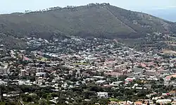 Tamboerskloof seen from Tafelberg Road on Table Mountain | |
 Tamboerskloof 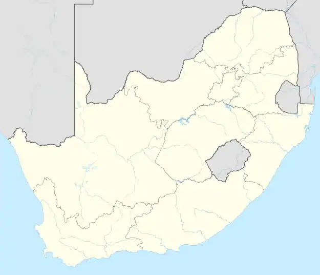 Tamboerskloof | |
| Coordinates: 33°55′45″S 18°24′15″E | |
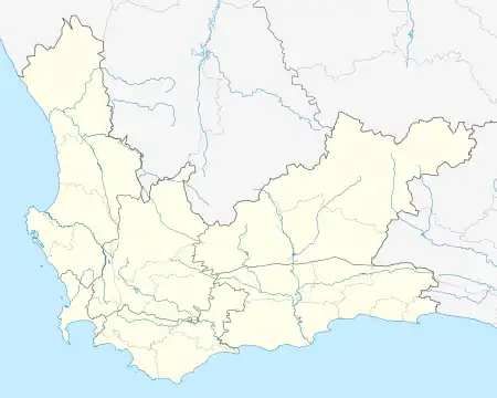
| Country | South Africa |
| Province | Western Cape |
| Municipality | City of Cape Town |
| Main Place | Cape Town |
| Government | |
| • Type | Subcouncil 16 / Ward 77 |
| • Councillor | Francine Higham (DA) |
| Area | |
| • Total | 1.04 km2 (0.40 sq mi) |
| Population (2011)[2] | |
| • Total | 2,984 |
| • Density | 2,900/km2 (7,400/sq mi) |
| Racial makeup (2011) | |
| • Black African | 14.7% |
| • Coloured | 5.1% |
| • Indian/Asian | 1.6% |
| • White | 75.8% |
| • Other | 2.7% |
| First languages (2011) | |
| • English | 62.6% |
| • Afrikaans | 27.6% |
| • Other | 9.9% |
| Time zone | UTC+2 (SAST) |
| Postal code (street) | 8001 |
| Area code | 021 |
| Website | www |

Etymology
The name Tamboerskloof is derived from the Dutch and Afrikaans words tamboer (drum) and kloof (valley). When Dutch settlers arrived and set up farms in the 1650s, they established the first of a series of lookout points at the site where Tamboerskloof lies today. From these lookout points, watchmen would beat drums to alert farmers in the area to the approach of a ship. Thanks to this, farmers would know that it was time to make their way to Cape Town harbour with their crops.[4]
Neighbourhood Watch
There is a very active neighbourhood watch called Tamboerskloof Neighbourhood Watch (TBKWatch) which assists the community with volunteer patrols, a radio network, a CCTV network and reporting of service issues such as out of order street lights, traffic lights, potholes, and blocked drains. They work very closely with a community control room (Watchcom), the South African Police Service, City of Cape Town Metro Police, nearby City Improvement Districts, as well as local armed response companies.
Schools
Several schools can be found within Tamboerskloof, including:
- Tamboerskloof Primary School
- German International School Cape Town[5]
- Jan van Riebeek Primary School
- Jan van Riebeek High School.
Demographics
According to the 2001 Census, the population of Tamboerskloof was 2 921. The following tables show various demographic data about Tamboerskloof from that census.[6]
- Gender
| Gender | Population | % |
|---|---|---|
| Female | 1 375 | 47.07% |
| Male | 1 546 | 52.93% |
- Ethnic Group
| Group | Population | % |
|---|---|---|
| Black African | 166 | 5.68% |
| Coloured | 168 | 5.75% |
| Indian/Asian | 27 | 0.92% |
| White | 2 559 | 87.61% |
- Home Language
| Language | Population | % |
|---|---|---|
| English | 1 914 | 65.53% |
| Afrikaans | 693 | 23.72% |
| Xhosa | 58 | 1.99% |
| Other African languages | 35 | 1.20% |
| Other languages | 221 | 7.57% |
References
- "Councillor details: Francine Higham". City of Cape Town. Retrieved 18 October 2023.
- "Sub Place Tamboerskloof". Census 2011.
- "Official planning suburbs". Retrieved 17 March 2019.
- "Cape Town in Western Cape Area Overview". www.seeff.com. Retrieved 7 February 2023.
- "Location of School" (Archive). German International School Cape Town. Retrieved 8 August 2015. Address: "28 Bay View Avenue, Tamboerskloof, 8001, Kapstadt, Südafrika" Directions in German (Archive), Main campus building map (Archive), Main campus direction map (Archive).
- "Tamboerskloof". City of Cape Town - Census 2001. City of Cape Town. Retrieved 10 March 2010.
External links
- Tamboerskloof Neighbourhood Watch
- Cape Town Central Watchcom (community control room)
- Tamboerskloof Primary School