Mšeno
Mšeno (Czech pronunciation: [ˈm̩ʃɛno]; German: Wemschen) is a town in Mělník District the Central Bohemian Region of the Czech Republic. It has about 1,400 inhabitants. The historic town centre is well preserved and is protected by law as an urban monument zone.
Mšeno | |
|---|---|
.jpg.webp) Míru Square, the centre of the town | |
 Flag  Coat of arms | |
 Mšeno Location in the Czech Republic | |
| Coordinates: 50°26′16″N 14°37′52″E | |
| Country | |
| Region | Central Bohemian |
| District | Mělník |
| First mentioned | 1306 |
| Government | |
| • Mayor | Jiří Guttenberg |
| Area | |
| • Total | 26.73 km2 (10.32 sq mi) |
| Elevation | 358 m (1,175 ft) |
| Population (2023-01-01)[1] | |
| • Total | 1,417 |
| • Density | 53/km2 (140/sq mi) |
| Time zone | UTC+1 (CET) |
| • Summer (DST) | UTC+2 (CEST) |
| Postal code | 277 35 |
| Website | www |
Administrative parts
Villages of Brusné 2.díl, Hradsko, Olešno, Ráj, Romanov, Sedlec, Skramouš and Vojtěchov are administrative parts of Mšeno.
Geography
Mšeno is located about 14 kilometres (9 mi) northeast of Mělník and 37 km (23 mi) north of Prague. It lies on the border between the Jizera Table and Ralsko Uplands. The highest point is the hill Uhelný vrch at 451 m (1,480 ft) above sea level. A large part of the municipal territory lies in the Kokořínsko – Máchův kraj Protected Landscape Area.
History
The Slavic people settled the town area probably in the 5th–6th centuries. The first written mention of Mšeno is from 1306, in a document signed by Wenceslaus III awarding the then-village to aristocrat Hynek of Dubá. He, and his son after him, ensured the growing prosperity of the area. In 1367, Charles IV promoted Mšeno to a town.[3]
During the Thirty Years' War the town suffered, but in the 17th and 18th centuries, the town prospered and the population grew. In 1879, the railroad was built, and in 1901, the school was opened.[3]
Demographics
|
|
| ||||||||||||||||||||||||||||||||||||||||||||||||||||||
| Source: Censuses[4][5] | ||||||||||||||||||||||||||||||||||||||||||||||||||||||||
Sights

A valuable and numerous set of two-storey timbered and half-timbered small-town architecture is typical for the outskirts of the town. Most of the older buildings on the square disappeared during a large fire in 1867. The current appearance of the main urban spaces is determined by the late Neoclassical and eclectic buildings.[6]
In 1842, the town hall was built, then it was rebuilt and raised in the neo-Gothic style in 1864.[6]
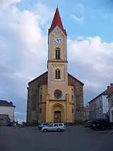
The predecessor of today's parish church was allegedly the Romanesque Church of Saint Wenceslaus. In 1876–1879, the Church of Saint Martin was built. It has a high tower and it is the main urban and landscape landmark.[6]
Notable people
- Wojciech Żywny (1756–1842), Czech-Polish pianist
- Johann Baptist Pischek (1814–1873), Czech-Austrian opera singer
- Anna Bayerová (1853–1924), physician
References
- "Population of Municipalities – 1 January 2023". Czech Statistical Office. 2023-05-23.
- Profous, Antonín (1951). Místní jména v Čechách III: M–Ř (in Czech). p. 151.
- "Historie Mšena" (in Czech). Město Mšeno. Retrieved 2021-07-08.
- "Historický lexikon obcí České republiky 1869–2011 – Okres Mělník" (in Czech). Czech Statistical Office. 2015-12-21. pp. 7–8.
- "Population Census 2021: Population by sex". Public Database. Czech Statistical Office. 2021-03-27.
- "Městská památková zóna" (in Czech). Město Mšeno. Retrieved 2021-07-08.