Barkal Upazila
Barkal (Bengali: বরকল) is an upazila (sub-district) of Rangamati District[1] in the Division of Chittagong, Bangladesh. Tribal people call it as Borhol বড়হল .
Barkal
Barkal | |
|---|---|
 Barkal Location in Bangladesh | |
| Coordinates: 22°44′N 92°21.5′E | |
| Country | |
| Division | Chittagong Division |
| District | Rangamati District |
| Area | |
| • Total | 760.88 km2 (293.78 sq mi) |
| Population (2011) | |
| • Total | 47,523 |
| • Density | 62/km2 (160/sq mi) |
| Time zone | UTC+6 (BST) |
| Website | Official Map of Barkal |
Geography
Barkal is located at 22.7333°N 92.3583°E. It has a total area of 760.88 km2.
Demographics
| Year | Pop. (000) | ±% |
|---|---|---|
| 1981 | 20 | — |
| 1991 | 29 | +45.0% |
| 2001 | 40 | +37.9% |
| 2011 | 48 | +20.0% |
| Source: Bangladesh Bureau of Statistics[2] | ||
According to the 2011 Bangladesh census, Barkal Upazila had 9,396 households and a population of 47,523, 4.1% of whom lived in urban areas. 11.2% of the population was under the age of 5. The literacy rate (age 7 and over) was 44.5%, compared to the national average of 51.8%.[3][4]

Administration
Barkal Upazila is divided into five union parishads: Aimachara, Barkal, Bushanchara, Borohorina, and Subalong. The union parishads are subdivided into 28 mauzas and 180 villages.[2]
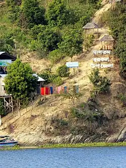
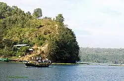
Subalong Union is known for its waterfalls and the natural environment of Kaptai Lake. Barkal Union is situated on the banks of the Karnafuli River.
References
- Atikur Rahman (2012), "Barkal Upazila", in Sirajul Islam and Ahmed A. Jamal (ed.), Banglapedia: National Encyclopedia of Bangladesh (Second ed.), Asiatic Society of Bangladesh
- "District Statistics 2011: Rangamati" (PDF). Bangladesh Bureau of Statistics. Archived from the original (PDF) on 13 November 2014. Retrieved 14 July 2014.
- "Community Report: Rangamati" (PDF). Population & Housing Census 2011. Bangladesh Bureau of Statistics. Retrieved 15 August 2018.
- "Population and Housing Census 2011: Bangladesh at a Glance" (PDF). Bangladesh Bureau of Statistics. Archived from the original (PDF) on 28 July 2014. Retrieved 21 July 2014.
| Upazila/Thana: | ||
|---|---|---|
