Citadel Peak
Citadel Peak is located on the border of Alberta and British Columbia on the Continental Divide. It was named in 1913 by Arthur O. Wheeler.[1][2]
| Citadel Peak | |
|---|---|
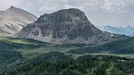 Northwest aspect | |
| Highest point | |
| Elevation | 2,625 m (8,612 ft)[1] |
| Prominence | 248 m (814 ft) |
| Coordinates | 51°00′59″N 115°43′08″W |
| Geography | |
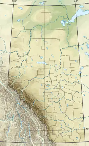 Citadel Peak Location in Alberta and British Columbia 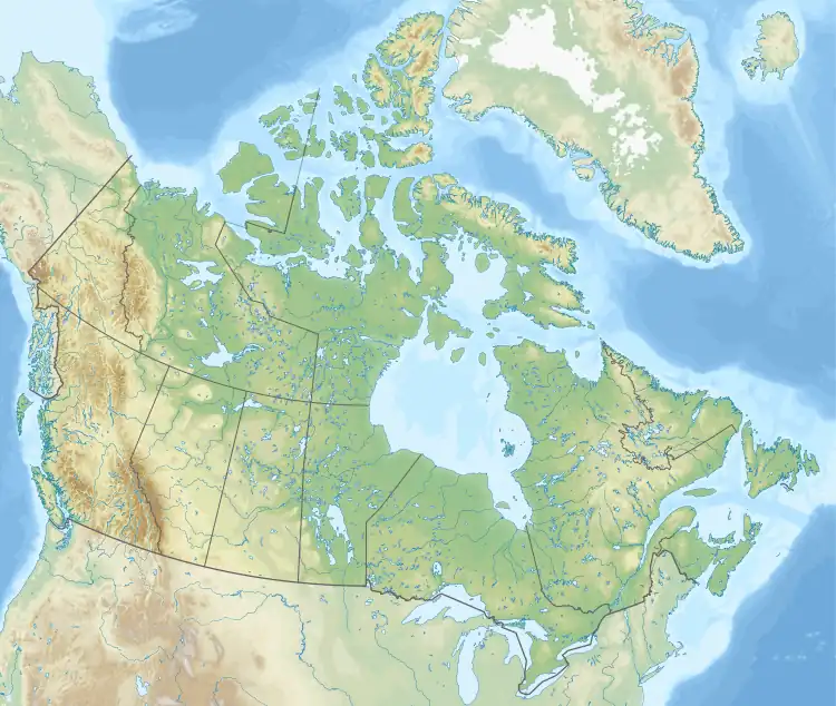 Citadel Peak Citadel Peak (Canada) | |
| Country | Canada |
| Province | Alberta / British Columbia |
| Protected area | Banff National Park / Mount Assiniboine Provincial Park |
| Parent range | Canadian Rockies |
| Topo map | NTS 82O4 Banff |
Geology
Citadel Peak is composed of sedimentary rock laid down during the Precambrian to Jurassic periods. Formed in shallow seas, this sedimentary rock was pushed east and over the top of younger rock during the Laramide orogeny.[3]
Climate
Based on the Köppen climate classification, Citadel Peak is located in a subarctic climate zone with cold, snowy winters, and mild summers.[4] Winter temperatures can drop below −20 °C with wind chill factors below −30 °C.
See also
References
- "Citadel Peak". cdnrockiesdatabases.ca. Retrieved 2019-08-11.
- "Citadel Peak". Bivouac.com.
- Gadd, Ben (2008), Geology of the Rocky Mountains and Columbias
- Peel, M. C.; Finlayson, B. L.; McMahon, T. A. (2007). "Updated world map of the Köppen−Geiger climate classification". Hydrol. Earth Syst. Sci. 11: 1633–1644. ISSN 1027-5606.
This article is issued from Wikipedia. The text is licensed under Creative Commons - Attribution - Sharealike. Additional terms may apply for the media files.