Clarensac
Clarensac (French pronunciation: [klaʁɑ̃sak]; Occitan: Clarençac) is a commune in the Gard department in southern France.
Clarensac | |
|---|---|
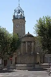 The clock tower in Clarensac | |
.svg.png.webp) Coat of arms | |
Location of Clarensac | |
 Clarensac  Clarensac | |
| Coordinates: 43°49′40″N 4°13′08″E | |
| Country | France |
| Region | Occitania |
| Department | Gard |
| Arrondissement | Nîmes |
| Canton | Saint-Gilles |
| Intercommunality | CA Nîmes Métropole |
| Government | |
| • Mayor (2020–2026) | Patrick Gervais[1] |
| Area 1 | 14.49 km2 (5.59 sq mi) |
| Population | 4,190 |
| • Density | 290/km2 (750/sq mi) |
| Time zone | UTC+01:00 (CET) |
| • Summer (DST) | UTC+02:00 (CEST) |
| INSEE/Postal code | 30082 /30870 |
| Elevation | 42–212 m (138–696 ft) (avg. 72 m or 236 ft) |
| 1 French Land Register data, which excludes lakes, ponds, glaciers > 1 km2 (0.386 sq mi or 247 acres) and river estuaries. | |
Population
| Year | Pop. | ±% p.a. |
|---|---|---|
| 1968 | 532 | — |
| 1975 | 727 | +4.56% |
| 1982 | 1,597 | +11.90% |
| 1990 | 2,208 | +4.13% |
| 1999 | 2,654 | +2.07% |
| 2007 | 3,504 | +3.53% |
| 2012 | 4,037 | +2.87% |
| 2017 | 4,263 | +1.10% |
| Source: INSEE[3] | ||
See also
References
- "Répertoire national des élus: les maires". data.gouv.fr, Plateforme ouverte des données publiques françaises (in French). 9 August 2021.
- "Populations légales 2020". The National Institute of Statistics and Economic Studies. 29 December 2022.
- Population en historique depuis 1968, INSEE
Wikimedia Commons has media related to Clarensac.
This article is issued from Wikipedia. The text is licensed under Creative Commons - Attribution - Sharealike. Additional terms may apply for the media files.