Diorite Peak
Diorite Peak is a 12,761-foot-elevation (3,890-meter) mountain summit on the common boundary shared by La Plata County and Montezuma County in Colorado.
| Diorite Peak | |
|---|---|
 North-northeast aspect | |
| Highest point | |
| Elevation | 12,761 ft (3,890 m)[1][2] |
| Prominence | 441 ft (134 m)[3] |
| Parent peak | Mount Moss (13,192 ft)[3] |
| Isolation | 1.24 mi (2.00 km)[3] |
| Coordinates | 37°26′24″N 108°03′03″W[4] |
| Naming | |
| Etymology | Diorite |
| Geography | |
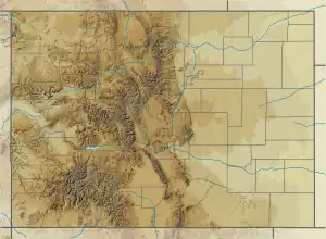
 Diorite Peak Location in Colorado  Diorite Peak Diorite Peak (the United States) | |
| Country | United States |
| State | Colorado |
| County | Montezuma / La Plata |
| Parent range | Rocky Mountains San Juan Mountains La Plata Mountains[3] |
| Topo map | USGS La Plata[4] |
| Climbing | |
| Easiest route | class 2[5] |
Description
Diorite Peak is located 14 miles (23 km) northwest of the community of Durango on land managed by San Juan National Forest. It ranks as the seventh-highest summit of the La Plata Mountains which are a subrange of the Rocky Mountains.[3] Precipitation runoff from the mountain drains southeast to the La Plata River and north into the headwaters of Bear Creek which is a tributary of the Dolores River. Topographic relief is significant as the summit rises 2,760 feet (840 meters) above the La Plata River in one mile (1.6 km). Neighbors include Centennial Peak, 1.52 miles (2.45 km) to the west-northwest and Mount Moss, 1.51 miles (2.43 km) to the west.[3] An ascent of Diorite Peak's summit involves hiking 5.2 miles (8.4 km) with 2,851 feet (869 meters) of elevation gain.[6]

Etymology
The mountain's toponym has been officially adopted by the United States Board on Geographic Names,[4] and was recorded in publications as early as 1906.[7] The peak is named for diorite which is an intrusive igneous rock formed by the slow cooling underground of magma.[1] Diorite makes up a large stock of this peak, and a smaller mass makes up nearby Lewis Mountain.[8]
Climate
According to the Köppen climate classification system, Diorite Peak has an alpine climate with cold, snowy winters, and cool to warm summers.[9] Due to its altitude, it receives precipitation all year, as snow in winter and as thunderstorms in summer, with a dry period in late spring.
See also
References
- William Bright, Colorado Place Names, 2004, Johnson Books, ISBN 9781555663339, page 53.
- Robert F. Rosebrough (1986), The San Juan Mountains: A Climbing & Hiking Guide, Cordillera Press, p. 34.
- "Diorite Peak, Colorado". Peakbagger.com. Retrieved May 22, 2023.
- "Diorite Peak". Geographic Names Information System. United States Geological Survey, United States Department of the Interior. Retrieved May 22, 2023.
- "Diorite Peak - 12,761' CO". listsofjohn.com. Retrieved May 22, 2023.
- John Peel, Paul Pixler (2020), Hiking Trails of Southwestern Colorado, Fifth Edition, West Margin Press, ISBN 9781513262987, p. 71.
- Henry Gannett, United States Geological Survey (1906), A Gazetteer of Colorado, US Government Printing Office, p. 58.
- Whitman Cross (1935), A Brief Review of the Geology of the San Juan Region of Southwestern Colorado, US Government Printing Office, p. 105.
- Peel, M. C.; Finlayson, B. L.; McMahon, T. A. (2007). "Updated world map of the Köppen−Geiger climate classification". Hydrol. Earth Syst. Sci. 11. ISSN 1027-5606.
External links
- Weather forecast: Diorite Peak