Ernest Peak
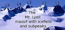
Ernest Peak - a.k.a. Lyell 3, L3 or Mt. Lyell (on maps, etc.) - is the central and highest peak of five distinct subpeaks on Mount Lyell (Canada) and is located on the border of Alberta and British Columbia. (There has been some dispute whether Lyell 2 or Lyell 3 is highest, but according to the recently released and corrected Climbers Guide to The Canadian Rocky Mountains - Rockies West book, the tallest is Ernest Peak).[1] It was named in 1972 by Sydney R. Vallance after Ernest Feuz Jr.[5]
| Ernest Peak | |
|---|---|
 Mt. Lyell 3 looking to Forbes, Lyell 4 & 5 | |
| Highest point | |
| Elevation | 3,498 m (11,476 ft)[1][2] |
| Prominence | 1,078 m (3,537 ft)[3] |
| Parent peak | Mount Forbes (3617 m)[3] |
| Listing | |
| Coordinates | 51°57′26″N 117°06′18″W[4] |
| Geography | |
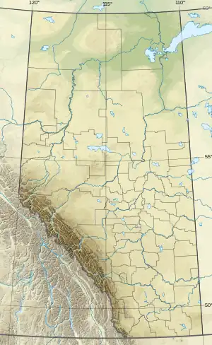
 Ernest Peak Location in Alberta and British Columbia  Ernest Peak Ernest Peak (British Columbia) | |
| Country | Canada |
| Provinces | Alberta and British Columbia |
| Protected area | Banff National Park |
| Parent range | Park Ranges |
| Topo map | NTS 82N14 Rostrum Peak[4] |
| Climbing | |
| First ascent | 1926 by A.J. Ostheimer, M.M. Strumia, J.M. Thorington, E. Feuz[5][3] |
Geology and climate
Due to this peak being the central and tallest subpeak - and thus is "Mount Lyell" - see the Mount Lyell article for geology and climate.
References
- Jones, David J. (2018). The Climbers Guide to the Rocky Mountains of Canada, Vol. Three: Rockies West. Golden, B.C.: Thin Gruel Press. p. 208. ISBN 978-1-7753241-0-2.
- "Topographic map of Mount Lyell–Ernest Peak". opentopomap.org. Retrieved 2021-08-26.
- "Mount Lyell (Lyell 3, Ernest Peak)". Bivouac.com. Retrieved 2021-08-26.
- "Ernest Peak (Alberta)". Geographical Names Data Base. Natural Resources Canada. Retrieved 2021-08-26.
- "Ernest Peak". cdnrockiesdatabases.ca. Retrieved 2019-08-11.
This article is issued from Wikipedia. The text is licensed under Creative Commons - Attribution - Sharealike. Additional terms may apply for the media files.
