Malá Vrbka
Malá Vrbka (German: Klein Wrbka) is a municipality and village in Hodonín District in the South Moravian Region of the Czech Republic. It has about 200 inhabitants.
Malá Vrbka | |
|---|---|
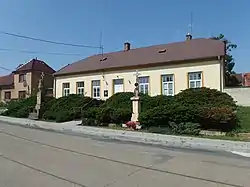 Former school | |
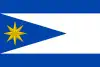 Flag 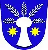 Coat of arms | |
 Malá Vrbka Location in the Czech Republic | |
| Coordinates: 48°52′10″N 17°27′33″E | |
| Country | |
| Region | South Moravian |
| District | Hodonín |
| First mentioned | 1401 |
| Area | |
| • Total | 4.45 km2 (1.72 sq mi) |
| Elevation | 266 m (873 ft) |
| Population (2023-01-01)[1] | |
| • Total | 161 |
| • Density | 36/km2 (94/sq mi) |
| Time zone | UTC+1 (CET) |
| • Summer (DST) | UTC+2 (CEST) |
| Postal code | 696 73 |
| Website | www |
Malá Vrbka, a part of traditional ethnographic region Horňácko, lies approximately 24 kilometres (15 mi) east of Hodonín, 72 km (45 mi) south-east of Brno, and 258 km (160 mi) south-east of Prague.
This article is issued from Wikipedia. The text is licensed under Creative Commons - Attribution - Sharealike. Additional terms may apply for the media files.