Morang District
Morang District (Nepali: मोरङ जिल्ला ⓘ) is located in Koshi Province in eastern Nepal. It is an Outer Terai district. It borders Jhapa to the east, Dhankuta and Panchthar to the north, Sunsari to the west, and Bihar, India, to the south. Morang has one metropolitan city (Biratnagar), eight municipalities and eight rural municipalities. The total area of Morang is 1,855 km2 (716 sq mi). The lowest elevation point is 60 meters and the highest is 2410 meters above sea level. The headquarters of Morang is connected by the Koshi National Highway to the east–west Mahendra National Highway at Itahari, Sunsari, and Morang is also connected to the Hill parts of the eastern region of Nepal. Morang is the core industrial sector for the eastern region of Nepal.
Morang District
मोरङ जिल्ला | |
|---|---|
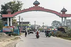 Entrance to Biratnagar | |
 | |
| Country | |
| Province | Koshi Province |
| Established | 7th century circa |
| Admin HQ. | Biratnagar |
| Government | |
| • Type | Coordination committee |
| • Body | DCC, Morang |
| • Head | Mr. Naresh Prasad Pokhrel |
| • Deputy-Head | Mr. Prakash Kumar Shah |
| • Parliamentary constituencies | 6 |
| • Provincial constituencies | 12 |
| Area | |
| • Total | 1,855 km2 (716 sq mi) |
| Population (2021)[1] | |
| • Total | 1,147,187 |
| • Rank | 1st (in Province) |
| • Density | 620/km2 (1,600/sq mi) |
| Time zone | UTC+05:45 (NPT) |
| Main Language(s) | Nepali, Maithili, Tharu, Rajbanshi, Limbu |
| Minor Language(s) | Newar , Angika , Urdu,Magar,Tamang |
| Website | www |
At the beginning of the 7th century, King Mung Mawrong Hang came to prominence in the terai lands of Limbuwan (present-day Sunsari, Morang and Jhapa area). He cleared much of the forest area in present-day Rangeli, east of Biratnagar, and built a town there. He named his Kingdom Morang after his name and rose to power.[2][3]
The lowlands of Limbuwan (present-day terai lands of Sunsari, Morang and Jhapa) was collectively known as Morang since the time of King Mawrong. In the beginning of 1400 AD, Morang Kingdom patriated from Kingdom of Ilam and Kingdom of Mikluk Bodhey (Choubise) and started ruling on its own. Morang Kingdom’s borders were set at Kankai river in the east, Koshi river in the west, Shanguri fort in the north and Jalal garh in India in the south. King Sangla Ing became the first king of Lowland Limbuwan kingdom of Morang after 900 years since it last had its own king. He built alliances with the other Kings of Limbuwan and remained in good terms. He built his kingdom at Varatappa and ruled from there. King Sangla Ing was succeeded by his son Pungla Ing, who later converted into Hinduism and changes his name to Amar Raya Ing.[4]
Geography and climate
| Climate Zone[5] | Elevation Range | % of Area |
|---|---|---|
| Lower Tropical | below 300 meters (1,000 ft) | 80.9% |
| Upper Tropical | 300 to 1,000 meters 1,000 to 3,300 ft. |
11.5% |
| Subtropical | 1,000 to 2,000 meters 3,300 to 6,600 ft. |
7.4% |
| Temperate | 2,000 to 3,000 meters 6,400 to 9,800 ft. |
0.2% |
Morang lies in the Outer Terai, or plains, of Eastern Nepal. Most of the land is taken up by rice and jute cultivation, though areas of sal forest remain along the northern part of the district where the plains meet the hills.
Demographics
At the time of the 2011 Nepal census, Morang District had a population of 965,370.
As their first language, 37.5% spoke Nepali, 23.7% Maithili, 6.0% Tharu, 3.8% Rajbanshi, 3.7% Limbu, 3.2% Urdu, 2.0% Rai, 2.0% Santali, 1.9% Angika, 1.9% Magar, 1.9% Tamang, 1.5% Newar, 1.3% Bhujel, 1.1% Dhimal, 0.9% Bantawa, 0.8% Bhojpuri, 0.7% Tajpuriya, 0.6% Hindi, 0.6% Rajasthani, 0.6% Uranw/Urau, 0.5% Chamling, 0.5% Gurung, 0.4% Bengali, 0.3% Magahi, 0.2% Ganagai, 0.2% Majhi, 0.2% Sampang, 0.2% Sunuwar, 0.1% Awadhi, 0.1% Danuwar, 0.1% Dumi, 0.1% Kulung, 0.1% Thulung, 0.1% Yakkha, 0.1% Yamphu and 0.3% other languages.[6]
Caste/ethnicity: 13.1% were Hill Brahmin, 12.0% Chhetri, 6.3% Tharu, 5.0% Rai, 4.7% Musalman, 4.2% Limbu, 3.9% Rajbanshi, 3.2% Newar, 3.0% Musahar, 2.8% Gangai, 2.7% Kewat, 2.6% Magar, 2.4% Tamang, 2.3% Bantar/Sardar, 2.2% Yadav, 2.0% Kami, 2.0% Satar/Santal, 1.6% Teli, 1.3% Damai/Dholi, 1.3% Khawas, 1.3% Mallaha, 1.2% Dhanuk, 1.2% Dhimal, 1.0% Marwadi, 1.0% other Terai, 0.9% Gurung, 0.8% Dusadh/Paswan/Pasi, 0.8% Halwai, 0.8% Nuniya, 0.7% Jhangad/Dhagar, 0.7% Majhi, 0.7% Sanyasi/Dasnami, 0.7% Sudhi, 0.7% Tajpuriya, 0.6% Hajam/Thakur, 0.6% Kathabaniyan, 0.5% Koiri/Kushwaha, 0.5% Sarki, 0.4% Bengali, 0.4% Chamar/Harijan/Ram, 0.4% Gharti/Bhujel, 0.4% Kayastha, 0.3% Kalwar, 0.3% Rajput, 0.3% Sonar, 0.2% Badhaee, 0.2% Bin, 0.2% Terai Brahmin, 0.2% Danuwar, 0.2% Khatwe, 0.2% Kurmi, 0.2% Sarbaria, 0.2% Sunuwar, 0.2% Tatma/Tatwa, 0.2% Thakuri, 0.1% Amat, 0.1% Badi, 0.1% Bantawa, 0.1% Baraee, 0.1% other Dalit, 0.1% Dhobi, 0.1% Dom, 0.1% Kahar, 0.1% Kulung, 0.1% Kumal, 0.1% Kumhar, 0.1% Lohar, 0.1% Munda, 0.1% Punjabi/Sikh, 0.1% Rajbhar, 0.1% Sherpa, 0.1% Yakkha, 0.1% Yamphu and 0.4% others.[7]
Religion: 80.3% were Hindu, 6.5% Kirati, 4.7% Muslim, 4.1% Buddhist, 2.3% Prakriti, 1.6% Christian, 0.1% Jain and 0.3% others.[8]
Literacy Rate: 70.5% could read and write, 2.0% could only read and 27.5% could neither read nor write.[9]
| Year | Pop. | ±% p.a. |
|---|---|---|
| 1981 | 534,692 | — |
| 1991 | 674,823 | +2.35% |
| 2001 | 843,220 | +2.25% |
| 2011 | 965,370 | +1.36% |
| 2021 | 1,147,186 | +1.74% |
| Sources:[10] | ||
Economy
Most of the district is rural, though it is also home to Biratnagar, the sixth largest city of Nepal. It is the industrial capital of Nepal. Morang has the highest numbers of industries and factories, multinational brands. Other emerging towns include Urlabari, Biratchowk, Belbari, Khorsane, Pathari and Rangeli. It has the largest industrial area in the whole country, expanding from Rani Mills Area to Duhabi River. Biratnagar Jute Mills, Arihant and Dhanawat Matches are among the nation's oldest industries.
Education
Morang district is home to the historic Morang Campus (Mahendra Morang Adarsh Multiple Campus, Biratnagar), Sukuna Multiple Campus (Sundar Haraicha Municipality), Urlabari Multiple Campus, Pathari Multiple Campus, and several other institutions of higher learning. Sukuna Multiple Campus has around 5000 students situated at Sunderharaincha of Morang district. Purbanchal University in Biratnagar offers graduate level courses in many disciplines of Science, Arts and Liberal Sciences. At present, the university has broadly identified Industry-Technology, Agriculture-Forestry, Environment- Rural-Cultural Subsistence and Sustainable Development as specific areas of “Academic Excellence”. It has affiliated private in all the parts of Nepal.
Politics
Morang has been a hotbed of political activity throughout Nepal's recent history producing political stalwarts such as Matrika Prasad Koirala, BP Koirala, Madan Bhandari, Girija Prasad Koirala, Man Mohan Adhikari, Sushil Koirala, Bharat Mohan Adhikari as well as the present time leaders like Shekhar Koirala, Upendra Yadav, etc.
The district currently sends 6 members to the national legislature.
Administrative divisions
The district consists of one Metropolitan Cities, eight urban municipalities and eight rural municipalities. These are as follows:

Municipalities
Notable people
- Rekha Thapa, Actress
- Madan Bhandari, Political Leader
- Ghanashyam Khatiwada, Member of House of Representative, Morang 1
- Nikita Chandak, Miss Nepal 2017
- Yama Buddha, Rapper
- Shekhar Koirala, Member of Legislature Parliament of Nepal
- Shiva Maya Tumbahamphe, Member of House of Representative,
- [Shiv Kumar Mandal] leader and House of Representative, Morang 5 (cpn maouist)
- Chhatraman Shrestha CTO of Need technosoft Pvt. Ltd.
Proportionate (CPN-UML)
- Lal Babu Pandit, Member of House of Representative, Morang 6
References
- Household and population by districts, Central Bureau of Statistics (CBS) Nepal Archived 2013-07-31 at the Wayback Machine
- Chemjong, Iman Sing. History and Culture of Kirant People.
- "Yakthung Phedap Limbuwan Royal Order". Yakthung Phedap Limbuwan Royal Order- 2019. Phedap. 8 December 2019.
- Chemjong, Iman Singh. History and Culture of Kirat People (4th ed.).
- The Map of Potential Vegetation of Nepal - a forestry/agroecological/biodiversity classification system (PDF), Forest & Landscape Development and Environment Series 2-2005 and CFC-TIS Document Series No.110., 2005, ISBN 87-7903-210-9, retrieved Nov 22, 2013
- NepalMap Language
- NepalMap Caste
- NepalMap Religion
- NepalMap Literacy
- "Nepal: Provinces and Districts". www.citypopulation.de.
- "NepalMap profile: Morang". NepalMap. Retrieved 14 July 2022.
- Ebert, Karen (1986), "Reported speech in some languages of Nepal", Direct and Indirect Speech, Berlin, New York: DE GRUYTER MOUTON, doi:10.1515/9783110871968.145, ISBN 9783110871968, retrieved 2023-05-12
- "NepalMap profile: Morang". NepalMap. Retrieved 14 July 2022.
Further reading
- Shaha, Rishikesh (1992). Ancient and Medieval Nepal. Manohar Publications, New Delhi. ISBN 978-81-85425-69-6.
- Shreshta, S.H (2005). Nepal in Maps. Kathmandu: Educational Publishing House. p. 129.
- Shreshta, Vinod Prasad (2007). A Concise Geography of Nepal. Kathmandu: Mandal Publications. p. 126. ISBN 978-99946-55-04-5.
- Woodhatch, Tom (1999). Nepal handbook. p. 194. ISBN 978-1-900949-44-6. Retrieved 2009-12-17.
{{cite book}}:|work=ignored (help)
External links
- "Districts of Nepal". Statoids.