Mount Aylmer
Mount Aylmer is a mountain in Banff National Park, Canada. At 3,162 m (10,374 ft), it is the highest point of the Palliser Range and the entire East Banff Ranges of the Canadian Rockies.[6] The mountain was named in 1890 by J.J. McArthur after his hometown of Aylmer, Quebec.[1][7]
| Mount Aylmer | |
|---|---|
 Mount Aylmer, August 1994 | |
| Highest point | |
| Elevation | 3,162 m (10,374 ft)[1][2] |
| Prominence | 1,142 m (3,747 ft)[3] |
| Listing | Mountains of Alberta |
| Coordinates | 51°19′26″N 115°26′00″W[4] |
| Geography | |
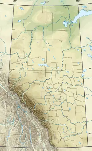
 Mount Aylmer | |
| Country | Canada |
| Province | Alberta |
| Protected area | Banff National Park |
| Parent range | Palliser Range |
| Topo map | NTS 82O6 Lake Minnewanka[4] |
| Climbing | |
| First ascent | 1889 by J.J. McArthur[1] |
| Easiest route | moderate scramble on SW[5] |
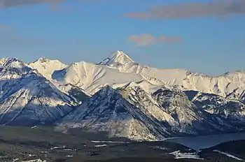
The summit can be climbed via scrambling.[5] Anyone who reaches the summit is rewarded with not only a great view of Lake Minnewanka but also a summit registry box. Names collected in this box are entered into the archives of the Whyte Museum in Banff.[8]
References
- "Mount Aylmer". cdnrockiesdatabases.ca. Retrieved 2005-11-10.
- "Topographic map of Mount Aylmer". opentopomap.org. Retrieved 2021-09-22.
- "Mount Aylmer". Bivouac.com. Retrieved 2005-11-10.
- "Mount Aylmer". Geographical Names Data Base. Natural Resources Canada. Retrieved 2021-09-22.
- Kane, Alan (2016). "Mount Aylmer". Scrambles in the Canadian Rockies (3rd ed.). Calgary: Rocky Mountain Books. Kindle Edition. ISBN 978-1-77160-098-9.
- "Mount Alymer". Peakbagger.com. Retrieved 2006-09-27.
- Place-names of Alberta. Ottawa: Geographic Board of Canada. 1928. p. 14.
- "Whyte Museum of the Canadian Rockies". Retrieved 2009-02-24.

Mount Aylmer (centered), Lake Minnewanka (lower right)
This article is issued from Wikipedia. The text is licensed under Creative Commons - Attribution - Sharealike. Additional terms may apply for the media files.