Rau Karna
Rau Karna is a village in Sikandarpur Sarausi block of Unnao district, Uttar Pradesh, India.[1][2] It is located 11 km north of the city of Unnao, on the road to Hardoi.[1] On the east side of the village is the Tinai, a small stream that dries up in hot weather.[3] The village holds a market twice per week.[3] Rau Karna is part of the nyaya panchayat circle of Banda Khera.[1]
Rau Karna | |
|---|---|
Village | |
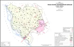 Map showing Rau Karna (#128) in Sikandarpur Sarausi CD block | |
 Rau Karna Location in Uttar Pradesh, India | |
| Coordinates: 26°38′N 80°28′E[1] | |
| Country India | |
| State | Uttar Pradesh |
| District | Unnao |
| Area | |
| • Total | 10.772 km2 (4.159 sq mi) |
| Population (2011)[2] | |
| • Total | 8,705 |
| • Density | 810/km2 (2,100/sq mi) |
| Languages | |
| • Official | Hindi |
| Time zone | UTC+5:30 (IST) |
| Vehicle registration | UP-35 |
As of 2011, Rau Karna's population is 8,705 people, in 1,688 households.[2] The main crops grown here are wheat, barley, gram, and jowar, and irrigation is provided by a canal as well as by tube wells.[1] There are also some mahua and mango groves.[3] The land around the village is level, and the soil is mostly fertile loam.[3] On the north side of the village, there is a large banyan tree underneath which is a lingam "of great antiquity" dedicated to Mahadeo.[1]
History
Rau Karna is said to have been founded around the year 1125 by Rawan Singh, who was the son of a Bisen thakur named Unwant Singh.[3] Rawan Singh cleared the land and founded the settlement, which is named after him ("Rau" being a modified version of "Rawan").[3] The modern village and nearby mounds mark the site of the fort built by Rawan Singh.[3] Much later, his descendants Bhawal Sah and Narbir Sah served as generals under the Mughal emperor Aurangzeb.[3]
At the turn of the 20th century, Rau Karna had a population of 2,532, almost entirely Hindus and mostly belonging to the Pasi and Lodh castes.[3] The village did not have a school, so children attended the one in nearby Thana instead.[3]
References
- Baghel, Amar Singh (1979). Uttar Pradesh District Gazetteers: Unnao. Rampur: Government Press. p. 270. Retrieved 5 July 2021.
- "Census of India 2011: Uttar Pradesh District Census Handbook - Unnao, Part A (Village and Town Directory)". Census 2011 India. pp. 262–79. Retrieved 5 July 2021.
- Nevill, H.R. (1903). Unao: A Gazetteer, Being Volume XXXVIII Of The District Gazetteers Of The United Provinces Of Agra And Oudh. Allahabad: Government Press. p. 231. Retrieved 5 July 2021.