Safipur
Safipur is a town and nagar panchayat in Unnao district in the Indian state of Uttar Pradesh.[1] Located 27 km[1] northwest[2] of the city of Unnao, Safipur serves as a tehsil headquarters[1][2] and is well-connected by roads to nearby towns.[2] Founded in the 1300s and originally called Saipur, the town's present name of Safipur is in honour of the 16th-century Muslim saint Makhdum Shah Safi, whose dargah is located here.[2] Important commodities manufactured in Safipur today include steel boxes and almirahs, furniture, and incense sticks.[1] As of 2011, Safipur's population is 25,688, in 4,288 households.[1]
Safipur
Saipur | |
|---|---|
Town | |
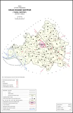 Map of Safipur CD block | |
 Safipur Location in Uttar Pradesh, India | |
| Coordinates: 26.73°N 80.35°E | |
| Country India | |
| State | Uttar Pradesh |
| District | Unnao |
| Founded by | Sai Sukul |
| Named for | Makhdum Shah Safi |
| Area | |
| • Total | 8.5 km2 (3.3 sq mi) |
| Elevation | 129 m (423 ft) |
| Population (2011)[1] | |
| • Total | 25,688 |
| • Density | 3,000/km2 (7,800/sq mi) |
| Languages | |
| • Official | Hindi + Dehati |
| Time zone | UTC+5:30 (IST) |
| PIN | 209871 |
| Vehicle registration | UP-35 |
History
Safipur was originally founded in the 1300s by a Brahmin named Sai Sukul, who was a subject of the Raja of Ugu.[2] The town was formerly called Saipur in Sai Sukul's honour; the name Saipur was still the more common name in general use as late as the early 1900s.[2] Sai Sukul supposedly died in battle in 1389 when Ibrahim Sharqi of the Jaunpur Sultanate conquered the town.[2] Ibrahim then put his own lieutenants in charge of Saipur: Maulvi Akram, the ancestor of Makhdum Shah Safi; the paymaster Rao Mahesh Rao, whose descendants held the office of qanungo; the risaldar Sayyid Mir, whose descendants were zamindars; and Sayyid Hasan Reza, whose descendants were taluqdars and zamindars.[2]
Maulvi Akram's great-grandson, Makhdum Shah Safi, was a religious mendicant who lived at Saipur during the 1500s.[2] When he died, he was buried here, and the town's name was changed to Safipur in his honour.[2] The mausoleum of Makhdum Shah Safi, as well as the surrounding dargah complex, was built by a follower of his named Chaudhri Khaslat Husain, who was the taluqdar of Sandila.[2] A large mosque was added to the complex in the early 1900s by Chaudhri Muhammad Azim, who was also taluqdar of Sandila.[2] Makhdum Shah Safi's dargah is the most important in Safipur, although there are several others, including those of Ifhamullah, Kudratullah, Hafizullah, and Abdullah.[2]
Safipur was mentioned as the capital of a pargana in the Ain-i-Akbari; it maintained this status into the 20th century.[2]
Two high-ranking officials under the Nawabs of Awadh, Diwan Umed Rai and Maulvi Fazl Azim, were natives of Safipur.[2] They both had various buildings constructed in the town: Diwan Umed Rai built a bazaar and a sarai, and Maulvi Fazl Azim built many wells, mosques, and an imambara.[2]
At the turn of the 20th century, Safipur was described as "a flourishing, well-built town" with a daily standing market and bazaars held twice weekly in four muhallas.[2] It contained the tehsil headquarters, a police station, a munsif's court, a dispensary, and a middle school attended by 146 students.[2]
Demographics
| Year | Pop. | ±% |
|---|---|---|
| 1901 | 7,949 | — |
| 1911 | 7,365 | −7.3% |
| 1921 | 6,051 | −17.8% |
| 1931 | 6,283 | +3.8% |
| 1941 | 6,920 | +10.1% |
| 1951 | 6,792 | −1.8% |
| 1961 | Not given | — |
| 1971 | Not given | — |
| 1981 | 13,728 | — |
| 1991 | 16,951 | +23.5% |
| 2001 | 22,378 | +32.0% |
| 2011 | 25,688 | +14.8% |
| Source: 2011 Census of India[1] | ||
According to the Indian census of 2001,[3] Safipur had a population of 22,378. Males constitute 52% of the population and females 48%. In Safipur, 17% of the population is under 6 years of age.
According to the 2011 census, Safipur has a population of 25,688 people, in 4,288 households.[1] The town's sex ratio is 932 females to every 1000 males; 13,299 of Safipur's residents are male and 12,389 are female.[1] Among the 0-6 age group, the sex ratio is 940, which is higher than the district urban average.[1] Members of Scheduled Castes make up 13.77% of the town's population, while no members of scheduled tribes were recorded.[1] The town's literacy rate was 60.9% (counting only people age 7 and up); literacy was higher among men and boys (66.8%) than among women and girls (54.5%).[1]
In terms of employment, 21.8% of Safipur residents were classified as main workers (i.e. people employed for at least 6 months per year) in 2011.[1] Marginal workers (i.e. people employed for less than 6 months per year) made up 10.8%, and the remaining 67.4% were non-workers.[1] Employment status varied heavily according to gender, with 51.2% of men being either main or marginal workers, compared to only 12.6% of women.[1]
Villages
Safipur CD block has the following 116 villages:[1]
| Village name | Total land area (hectares) | Population (in 2011) |
|---|---|---|
| Palhe Pur | 172.1 | 1,061 |
| Khusru Pur | 112.5 | 1,892 |
| Rania Mao | 209.2 | 993 |
| Mahapara Pur | 219.8 | 1,195 |
| Murha | 108.6 | 536 |
| Chhuhi | 293.1 | 1,668 |
| Ray Pur | 162.3 | 1,188 |
| Jamuniha Kachchh | 432.2 | 2,137 |
| Katri Aorangabad Istmurari | 790 | 0 |
| Katri Aorangabad Gair Istmurari | 69.2 | 0 |
| Rooppur Chandela Gair Ahatmali | 387.9 | 1,267 |
| Rooppur Chandela Ahatmali | 151.9 | 438 |
| Ram Pur | 256 | 543 |
| Daolatyar Pur | 203.7 | 985 |
| Katia Mao | 295.4 | 697 |
| Atwar Pur | 157.6 | 501 |
| Khairi Chandela | 122.2 | 740 |
| Dadlaha | 840 | 3,608 |
| Katri Alli Pur | 359.6 | 276 |
| Devria | 99.7 | 599 |
| Ram Pur Newada | 247.3 | 810 |
| Jujhar Pur | 292.1 | 692 |
| Papeer | 71.3 | 504 |
| Kisan Pur Tandawa | 66.9 | 312 |
| Andheliya | 72 | 445 |
| Sahapur | 347.3 | 1,042 |
| Devra Mao | 110.4 | 590 |
| Mao Mansur Pur | 374.2 | 2,885 |
| Kakraora | 119.2 | 1,189 |
| Safia Pur | 79.3 | 914 |
| Mahamud Pur | 114 | 1,479 |
| Gole Mao | 197.7 | 204 |
| Roshan Nagar | 72.3 | 465 |
| Safi Pur Rural | 1,545.8 | 5,741 |
| Munda | 399.2 | 2,308 |
| Tikara | 94.5 | 108 |
| Dayal Garhi | 71.2 | 287 |
| Gurdhari | 288.1 | 1,238 |
| Dakoli | 155.1 | 638 |
| Daroli | 388.5 | 4,407 |
| Pikhi | 341.4 | 4,389 |
| Atwa Mohal Osia | 208.8 | 1,216 |
| Osia | 530.8 | 4,624 |
| Habeeb Nagar | 195.5 | 92 |
| Raheema Bad | 270.2 | 1,914 |
| Raiya Mao | 173.6 | 1,276 |
| Mawae Lal | 230.6 | 1,238 |
| Birjpapl Pur | 224.9 | 1,127 |
| Lachhiman Ganj | 31.1 | 376 |
| Meer Nagar | 112.1 | 680 |
| Bhaishara | 113.7 | 659 |
| Nihal Pur | 113.2 | 659 |
| Mawe Man | 264.8 | 1,818 |
| Khijrabad | 19.2 | 0 |
| Dugaora | 68.5 | 508 |
| Abdulla Pur | 78.1 | 702 |
| Saleed | 159.2 | 1,351 |
| Gaori | 120.2 | 1,021 |
| Darab Nagar | 78.8 | 1,032 |
| Dev Gaon | 706 | 4,386 |
| Jahangeerabad | 36.5 | 0 |
| Khargaora | 523.7 | 2,736 |
| Lahber Pur | 523.7 | 1,584 |
| Najir Pur | 104.1 | 317 |
| Naobat Pur | 113.3 | 1,532 |
| Chakrasool Pur | 14.8 | 0 |
| Babhana | 361.8 | 1,856 |
| Makhdoom Nagar | 158.6 | 1,449 |
| Gopal Pur | 108.1 | 751 |
| Salhenagar Karaondi | 240.4 | 2,668 |
| Fateh Pur | 105.2 | 1,077 |
| Jat Purwa | 202.8 | 1,869 |
| Sahadat Nagar | 119.9 | 816 |
| Fajil Pur | 103.9 | 1,472 |
| Kusela | 325.4 | 1,817 |
| Sherpur Khurd | 95.7 | 1,022 |
| Loniahar | 42.1 | 0 |
| Sakhan Musalmanan | 65.1 | 1,539 |
| Sakhan Rajputan | 744.4 | 2,889 |
| Nibee Garha | 106.4 | 257 |
| Hamjapur | 148.6 | 302 |
| Gaholi | 83.3 | 735 |
| Sarai Sakhan | 291.2 | 2,025 |
| Devgan Mao | 167 | 1,114 |
| Mirja Pur | 277.7 | 2,168 |
| Niyamat Pur | 40.7 | 973 |
| Murad Pur | 145.9 | 1,229 |
| Ibraheema Bad | 255.6 | 1,358 |
| Khanpur | 40.8 | 484 |
| Jamalnagar Ahatmali | 242.7 | 1,438 |
| Jamalnagar Gair Ahatmali | 756.8 | 4,425 |
| Bahauddeen Pur | 117.7 | 1,185 |
| Narhar Pur | 122.9 | 868 |
| Bellawan | 108.6 | 764 |
| Aojhar Pur | 97.2 | 515 |
| Rukana Pur | 59.8 | 471 |
| Khokha Pur | 75.6 | 764 |
| Atha | 281.2 | 2,671 |
| Mustfa Bad | 186.7 | 2,174 |
| Salepur Khaeel Nagar | 144.5 | 1,002 |
| Hasana Pur | 60 | 900 |
| Pawa | 413.8 | 2,447 |
| Ray Pur | 154.6 | 910 |
| Jagdeesh Pur | 120 | 457 |
| Ambahara | 74.3 | 458 |
| Juned Pur | 63.9 | 337 |
| Ram Pur | 82.5 | 398 |
| Methi Tikur | 799.8 | 6,848 |
| Umer | 171.9 | 1,147 |
| Jamaluddeen Pur | 167.4 | 1,786 |
| Unwan | 552.9 | 6,530 |
| Atwa | 202.1 | 1,804 |
| Chakal Wanshi | 72.3 | 0 |
| Barbhaola | 227.8 | 606 |
| Firoj Pur Kala | 379.7 | 2,147 |
| Bhadni | 185.6 | 895 |
See also
References
- "Census of India 2011: Uttar Pradesh District Census Handbook - Unnao, Part A (Village and Town Directory)". Census 2011 India. pp. 36–55, 135–59, 525–39. Retrieved 30 June 2021.
- Nevill, H.R. (1903). Unao: A Gazetteer, Being Volume XXXVIII Of The District Gazetteers Of The United Provinces Of Agra And Oudh. Allahabad: Government Press. pp. 231–7. Retrieved 30 June 2021.
- "Census of India 2011: Data from the 2001 Census, including cities, villages and towns (Provisional)". Census Commission of India. Archived from the original on 16 June 2004. Retrieved 1 November 2008.