Saint-Sornin, Charente
Saint-Sornin (French pronunciation: [sɛ̃ sɔʁnɛ̃]; Occitan: Sent Sòrnin) is a commune in the Charente department in southwestern France.
Saint-Sornin | |
|---|---|
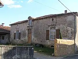 Old house | |
Location of Saint-Sornin | |
 Saint-Sornin  Saint-Sornin | |
| Coordinates: 45°41′41″N 0°26′11″E | |
| Country | France |
| Region | Nouvelle-Aquitaine |
| Department | Charente |
| Arrondissement | Angoulême |
| Canton | Val de Tardoire |
| Intercommunality | La Rochefoucauld - Porte du Périgord |
| Government | |
| • Mayor (2020–2026) | Michaël Canit[1] |
| Area 1 | 11.27 km2 (4.35 sq mi) |
| Population | 802 |
| • Density | 71/km2 (180/sq mi) |
| Time zone | UTC+01:00 (CET) |
| • Summer (DST) | UTC+02:00 (CEST) |
| INSEE/Postal code | 16353 /16220 |
| Elevation | 89–242 m (292–794 ft) (avg. 185 m or 607 ft) |
| 1 French Land Register data, which excludes lakes, ponds, glaciers > 1 km2 (0.386 sq mi or 247 acres) and river estuaries. | |
Population
|
|
See also
References
- "Répertoire national des élus: les maires". data.gouv.fr, Plateforme ouverte des données publiques françaises (in French). 9 August 2021.
- "Populations légales 2020". The National Institute of Statistics and Economic Studies. 29 December 2022.
Wikimedia Commons has media related to Saint-Sornin (Charente).
This article is issued from Wikipedia. The text is licensed under Creative Commons - Attribution - Sharealike. Additional terms may apply for the media files.