Samson Peak
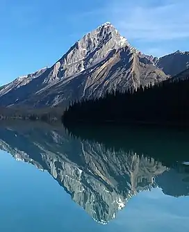
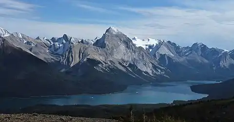
Samson Peak is a 3,081-metre (10,108 ft) mountain summit located on the eastern shore of Maligne Lake in Jasper National Park, in the Canadian Rockies of Alberta, Canada. The nearest higher peak is Mount Charlton, 7.26 km (4.51 mi) to the east.[4] Samson Peak is situated 1.72 km south of Leah Peak in the Queen Elizabeth Ranges.
| Samson Peak | |
|---|---|
 Samson Peak reflected in Maligne Lake | |
| Highest point | |
| Elevation | 3,081 m (10,108 ft)[1] |
| Prominence | 456 m (1,496 ft)[1] |
| Parent peak | Maligne Mountain (3200 m)[1] |
| Listing | Mountains of Alberta |
| Coordinates | 52°40′49″N 117°30′38″W[2] |
| Geography | |
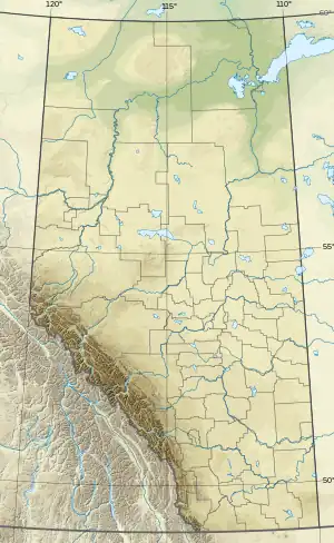
 Samson Peak Location of Samson Peak in Alberta  Samson Peak Samson Peak (Canada) | |
| Location | Alberta, Canada |
| Parent range | Queen Elizabeth Ranges Canadian Rockies |
| Topo map | NTS 83C12 Athabasca Falls[2] |
| Geology | |
| Age of rock | Devonian |
| Type of rock | Palliser Limestone |
| Climbing | |
| First ascent | 1928 by W.R. Hainsworth and M.M. Strumia[3] |
History
Samson Peak was named by Mary Schäffer in her expedition through the area in 1908 to find Maligne Lake. She also named nearby Leah Peak for Leah Beaver, the wife of Samson Beaver. Samson was a Stoney Indian who befriended Mary and provided her with a hand drawn map to assist her with finding the way to the elusive lake. Samson visited the lake with his father at the age of 14, and 16 years later he drew the map from memory when he met Mary at Elliott Barnes' cabin on the Kootenay Plains in the Saskatchewan Valley.[3]
The first ascent of Samson Peak was made in 1928 by W.R. Hainsworth and M.M. Strumia[3] The mountain's name was officially adopted in 1947 by the Geographical Names Board of Canada.[2]
Climate
Based on the Köppen climate classification, Samson Peak is located in a subarctic climate zone with cold, snowy winters, and mild summers.[5] Winter temperatures can drop below −20 °C with wind chill factors below −30 °C. Precipitation runoff from Samson Peak drains west into Maligne Lake, thence into the Maligne River which is a tributary of the Athabasca River.
References
- "Samson Peak". Bivouac.com. Retrieved 2018-10-22.
- "Samson Peak". Geographical Names Data Base. Natural Resources Canada. Retrieved 2018-10-22.
- "Samson Peak". cdnrockiesdatabases.ca. Retrieved 2021-03-21.
- "Samson Peak, Alberta". Peakbagger.com. Retrieved 2021-03-21.
- Peel, M. C.; Finlayson, B. L.; McMahon, T. A. (2007). "Updated world map of the Köppen−Geiger climate classification". Hydrol. Earth Syst. Sci. 11: 1633–1644. ISSN 1027-5606.
External links
- Weather forecast: Samson Peak
- Parks Canada web site: Jasper National Park
