Sikka Regency
Sikka is a regency within East Nusa Tenggara province, Indonesia, on the island of Flores.[2] It is bordered to the west by Ende Regency and to the east by East Flores Regency. It covers an area of 1,731.91 km2 and had a population of 300,301 at the 2010 census[3] and 321,953 at the 2020 Census;[4] the official estimate as at mid 2022 was 326,999.[1] The capital is the town of Maumere, which comprises the districts of Alok Barat, Alok and Alok Timur (although the last two also include a number of notable islands to the north of Flores).
Sikka Regency
Kabupaten Sikka | |
|---|---|
 Beach of Maumere | |
 Coat of arms | |
 Location within East Nusa Tenggara | |
 Sikka Regency 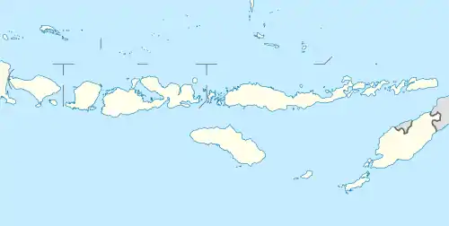 Sikka Regency Sikka Regency (Lesser Sunda Islands)  Sikka Regency Sikka Regency (Indonesia) | |
| Coordinates: 8.48833°S 122.974°E | |
| Country | |
| Region | Lesser Sunda Islands |
| Province | |
| Capital | Maumere |
| Government | |
| • Regent | Ansar Rera |
| • Vice Regent | Paolus Nong Susar |
| Area | |
| • Total | 668.69 sq mi (1,731.91 km2) |
| Population (mid 2022 estimate) | |
| • Total | 326,999 |
| • Density | 490/sq mi (190/km2) |
| [1] | |
| Area code | (+62) 382 |
| Website | sikkakab |
Politics
Paulus Moa was Regent of Sikka for a few years between 2002 and 2006.
The regency is divided into twenty-one districts (kecamatan), tabulated below with their areas and their populations at the 2010 census[3] and the 2020 census,[4] together with the official estimates as at mid 2022.[1] The table also includes the locations of the district administrative centres, the number of villages in each district (totaling 147 rural desa and 13 urban kelurahan - the latter all in the three "Alok" districts which comprise Maumere), and its post code.
| Name of District (kecamatan) | Area in km2 | Pop'n census 2010 | Pop'n census 2020 | Pop'n estimate mid 2022 | Admin centre | No. of villages | Post codes |
|---|---|---|---|---|---|---|---|
| Paga | 82.85 | 15,598 | 16,399 | 16,580 | Paga | 8 | 86153 |
| Mego | 111.26 | 11,873 | 12,939 | 13,170 | Lekebai | 10 | 86113 |
| Tana Wawo | 79.78 | 8,695 | 8,926 | 8,980 | Wolofeo | 6 | 86154 |
| Lela | 31.33 | 11,645 | 11,596 | 11,610 | Lela | 9 | 86161 |
| Bola | 56.83 | 10,785 | 10,797 | 10,810 | Bola | 6 | 86171 |
| Doreng | 30.41 | 11,191 | 12,002 | 12,180 | Waihawa | 7 | 86170 |
| Mapitara | 81.02 | 6,304 | 6,672 | 6,750 | Hebing | 4 | 86172 |
| Talibura | 260.11 | 20,454 | 22,424 | 22,850 | Talibura | 12 | 86183 |
| Waigete | 217.65 | 22,181 | 24,931 | 25,530 | Waigete | 6 | 86184 |
| Waiblama | 144.36 | 7,042 | 8,074 | 8,300 | Tanarawa | 9 | 86185 |
| Kewapante | 24.14 | 13,453 | 14,775 | 15,060 | Kewapante | 8 | 86182 |
| Hewokloang | 17.58 | 8,243 | 8,998 | 9,160 | Baowunut | 7 | 86181 |
| Kangae | 38.43 | 16,389 | 18,055 | 18,420 | Waippare | 9 | 86180 |
| Palu'e (a) | 41.00 | 9,553 | 9,497 | 9,510 | Uwa | 8 | 86110 |
| Koting | 23.56 | 6,360 | 6,526 | 6,570 | Koting D | 6 | 86116 |
| Nelle | 14.65 | 5,792 | 6,147 | 6,230 | Nelle Urung | 5 | 86119 |
| Nita | 141.07 | 21,223 | 22,748 | 23,080 | Nita | 12 | 86151 |
| Magepanda | 166.15 | 11,508 | 12,727 | 12,990 | Magepanda | 5 | 86152 |
| Alok (b) (Central Alok) | 14.64 | 33,064 | 32,629 | 32,670 | Kota Uneng | 7 | 86112 -86118 |
| Alok Barat (West Alok) | 62.75 | 16,808 | 22,294 | 23,580 | Wailiti | 4 | 86114 -86115 |
| Alok Timur (c) (East Alok) | 92.34 | 32,167 | 32,797 | 32,960 | Waioti | 10 | 86111 -86115 |
| Totals | 1,731.91 | 300,328 | 321,953 | 326,999 | Maumere | 160 |
Note: (a) Palu'e is an island district, situated off the north coast of Flores. (b) includes the offshore islands of Pulau Pemana Besar and Pulau Pemana Kecil (with a combined population of 4,268 in mid 2021) and, further north, Pulau Sukun or Samparong (with a population of 1,532 in mid 2021). (c) includes the offshore islands of Pulau Koja or Pulau Besar (with 2,960 inhabitants in mid 2021), Pulau Parumaan (with 1,816 inhabitants in mid 2021 - including Pulau Pangabatan, Pulau Mermaan and Pulau Damhila), and nearby Pulau Babi.
References
- Badan Pusat Statistik, Jakarta, 2023, Kabupaten Sikka Dalam Angka 2023 (Katalog-BPS 1102001.5307)
- Sikka Regency — Indonesia Regions
- Biro Pusat Statistik, Jakarta, 2011.
- Badan Pusat Statistik, Jakarta, 2021.
Regencies and cities of East Nusa Tenggara | ||
|---|---|---|
Capital: Kupang | ||
| Regencies |  | |
| Cities | ||