Southwest Sumba Regency
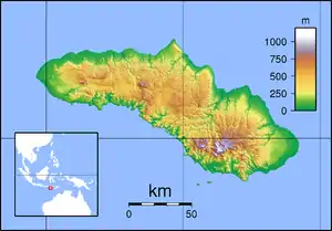
Southwest Sumba Regency (Indonesian: Kabupaten Sumba Barat Daya) is a regency on Sumba Island in East Nusa Tenggara province of Indonesia. Established in 2007 out of parts of West Sumba Regency, the regency has its seat (capital) in Tambolaka. Its population was 283,818 in the 2010 decennial census[2] and had risen to 303,650 at the 2020 census, comprising 155,716 male and 147,934 female;[3] the official estimate as at mid 2022 was 308,106.[1]
Southwest Sumba Regency
Kabupaten Sumba Barat Daya | |
|---|---|
 Coat of arms | |
 Location within East Nusa Tenggara | |
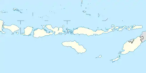
 Southwest Sumba Regency  Southwest Sumba Regency Southwest Sumba Regency (Lesser Sunda Islands)  Southwest Sumba Regency Southwest Sumba Regency (Indonesia) | |
| Coordinates: 9.5622°S 119.0891°E | |
| Country | |
| Region | Lesser Sunda Islands |
| Province | |
| Capital | Tambolaka |
| Government | |
| • Regent | Markus Dairo Tallu |
| • Vice Regent | Ndara Tanggu Kaha |
| Area | |
| • Total | 558.04 sq mi (1,445.32 km2) |
| Population (mid 2022 estimate)[1] | |
| • Total | 308,106 |
| • Density | 550/sq mi (210/km2) |
| Area code | (+62) 387 |
| Website | sbdkab |
Administrative districts
The Southwest Sumba Regency when created was composed of eight districts (kecamatan), but since 2010, three additional districts have been created within the Regency, by the splitting of existing districts. The areas (in km2) and the populations of the districts at the 2010 census[2] and the 2020 census[3] are listed below, together with the official estimates as at mid 2022.[1] The table also includes the locations of the district administrative centres, and the number of villages in each district (totaling 173 rural desa and 2 urban kelurahan - the latter both in Kota Tambolaka District).
| Name of District (kecamatan) | Area in km2 | Pop'n census 2010 | Pop'n census 2020 | Pop'n estimate mid 2022 | Admin centre | No. of villages |
|---|---|---|---|---|---|---|
| Kodi Bangedo | 73.22 | 36,057 | 17,220 | 17,239 | Walla Ndimu | 15 |
| Kodi Balaghar | 144.67 | (a) | 17,980 | 18,000 | Panenggo Ede | 14 |
| Kodi | 111.86 | 31,223 | 30,010 | 30,061 | Bondo Kodi | 19 |
| Kodi Utara (North Kodi) | 243.82 | 50,864 | 48,860 | 49,006 | Kori | 21 |
| Totals western (Kodi) part | 573.57 | 118,149 | 114,070 | 114,306 | 69 | |
| Wewewa Selatan (South Wewewa) | 174.14 | 21,691 | 22,800 | 22,919 | Tena Teke | 14 |
| Wewewa Barat (West Wewewa) | 147.34 | 45,482 | 42,270 | 43,501 | Waimangura | 20 |
| Wewewa Timur (East Wewewa) | 139.88 | 53,911 | 26,410 | 26,465 | Elopada | 19 |
| Wewewa Tengah (Central Wewewa) | 109.67 | (b) | 31,160 | 31,593 | Ndapa Taka | 20 |
| Wewewa Utara (North Wewewa) | 63.26 | 11,638 | 12,640 | 12,782 | Palla | 12 |
| Loura | 138.51 | 34,037 | 18,540 | 19,613 | Karuni | 11 |
| Kota Tambolaka (Tambolaka town) | 98.95 | (b) | 35,790 | 36,927 | Tambolaka | 10 |
| Totals eastern (Wewewa) part | 871.75 | 166,759 | 191,762 | 193,800 | 106 |
Notes: (a) The 2010 census populations of Kodi Balaghar is included with the figures for Kodi Bangedo, from which it was split.
(b) The 2010 census populations of Kota Tambolaka and Wewewa Tengah Districts are included with the figures for the districts from which they were split.
Tourism
Several tourist attractions in this district have been widely explored and visited by a variety of local and foreign tourists, but there are only a few who have access to roads and adequate facilities and infrastructure available, namely Mananga Aba Beach, Mbawana beach, Oro Beach, Kawona Beach, Newa Beach, Pantai Waikelo, Sumba Cultural Home, Lake Saltwater Weekuri, and Pabeti Waterfall.
References
- Badan Pusat Statistik, Jakarta, 2023, Kabupaten Sumba Barat Daya Dalam Angka 2023 (Katalog-BPS 1102001.5318)
- Biro Pusat Statistik, Jakarta, 2011.
- Badan Pusat Statistik, Jakarta, 2021.
