The Whistlers (Alberta)
The Whistlers is a 2,470-metre (8,100-foot) mountain summit located in Jasper National Park, in the Trident Range of the Canadian Rockies of Alberta, Canada. The municipality of Jasper is situated 7 kilometres to the northeast. Its nearest higher peak is Indian Peak, 2.5 km (1.6 mi) to the southwest.[1] The highest and longest aerial tramway in Canada ascends to a lookout at 2,277 meters elevation, still 193 meters below the summit, but a hiking trail continues to the summit. Some of the mountains that can be seen (weather permitting) from the top include Mount Robson, Mount Bridgland, Monarch Mountain, Cairngorm, Pyramid Mountain, Hawk Mountain, Mount Colin, Grisette Mountain, Mount Tekarra, Mount Hardisty, Mount Kerkeslin, Marmot Mountain, Terminal Mountain, and Manx Peak.
| The Whistlers | |
|---|---|
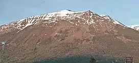 The Whistlers seen from Jasper | |
| Highest point | |
| Elevation | 2,470 m (8,100 ft)[1] |
| Prominence | 160 m (520 ft)[1] |
| Parent peak | Indian Peak (2820 m)[1] |
| Listing | Mountains of Alberta |
| Coordinates | 52°49′37″N 118°07′58″W[2] |
| Geography | |
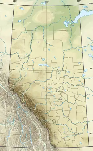 The Whistlers Location of The Whistlers in Alberta  The Whistlers The Whistlers (Canada) | |
| Location | Jasper National Park Alberta, Canada |
| Parent range | Trident Range Canadian Rockies[1] |
| Topo map | NTS 83D16 Jasper[2] |
| Climbing | |
| Easiest route | Tram, hiking |
History
The descriptive name The Whistlers was applied in 1916 by Édouard-Gaston Deville of the Geological Survey of Canada for the whistling inhabitants of the mountain, the hoary marmot.[3][4] The mountain's name was officially adopted in 1951 by the Geographical Names Board of Canada.[2]
Climate
Based on the Köppen climate classification, The Whistlers is located in a subarctic climate zone with cold, snowy winters, and mild summers.[5] Temperatures can drop below -20 °C with wind chill factors below -30 °C. Precipitation runoff from The Whistlers drains into tributaries of the Athabasca River.
In popular culture
On 9 April 2022, TikTok user Andrew Dawson posted a video what appears to be a massive giant standing near the top of Whistlers Peak Mountain.[6] The video went viral, garnishing more than 2.8 million views.
Following the initial video, Andrew continued to post a series of videos over the next few months detailing an alleged ongoing experience of being followed and observed by individuals whom he deemed were CIA operatives. [7]
On 6 May 2022, Andrew admitted the series of videos to be a hoax, however 10 days later on 16 May 2022 he posted a video with the captions reading "I'm scared" and "To much has happened and i can't be forced to be silent." in which he recanted his previous statement stating his videos were in fact real. By 17 May 2022, Andrew had posted his final video related to the events in which he recorded Whistlers Peak one last time with what appeared to be some sort of military unit on top. On 1 July 2022, an obituary was published for Andrew. No information can be found surrounding his death or his surviving family members. [8][9]
References
- "Whistlers Peak (The Whistlers)". Bivouac.com. Retrieved 2019-03-08.
- "The Whistlers". Geographical Names Data Base. Natural Resources Canada. Retrieved 2019-03-10.
- "The Whistlers". cdnrockiesdatabases.ca. Retrieved 2021-03-22.
- Place-names of Alberta. Ottawa: Geographic Board of Canada. 1928. p. 134.
- Peel, M. C.; Finlayson, B. L. & McMahon, T. A. (2007). "Updated world map of the Köppen−Geiger climate classification". Hydrol. Earth Syst. Sci. 11 (5): 1633–1644. Bibcode:2007HESS...11.1633P. doi:10.5194/hess-11-1633-2007. ISSN 1027-5606. S2CID 9654551.
- "Andrew Dawson on TikTok". TikTok. Retrieved 2022-10-05.
- "NEWS: TikToker Who Posted Video of a Giant on Whistlers Peak Mountain and Said CIA Was Stalking Him Dies 3 Months Later". The Confessionals. Retrieved 2022-10-05.
- Obituaries (2022-07-01). "Andrew Ryan Watchorn Dawson – Obituary". Campbell River Mirror. Retrieved 2022-10-05.
- "Andrew Dawson on TikTok".
Gallery
Views from the top
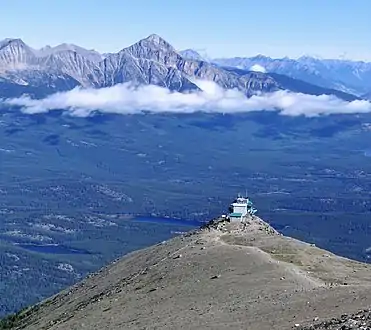 Summit view of the lookout and Pyramid Mountain
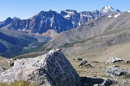 View of Terminal Mountain and Manx Peak
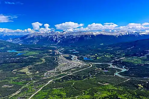 View of Jasper and the Colin Range
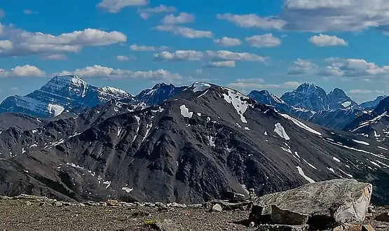 View south L→R Mount Edith Cavell, Lectern Peak, Marmot Mountain, Chak Peak, Throne Mountain, Blackhorn Peak.
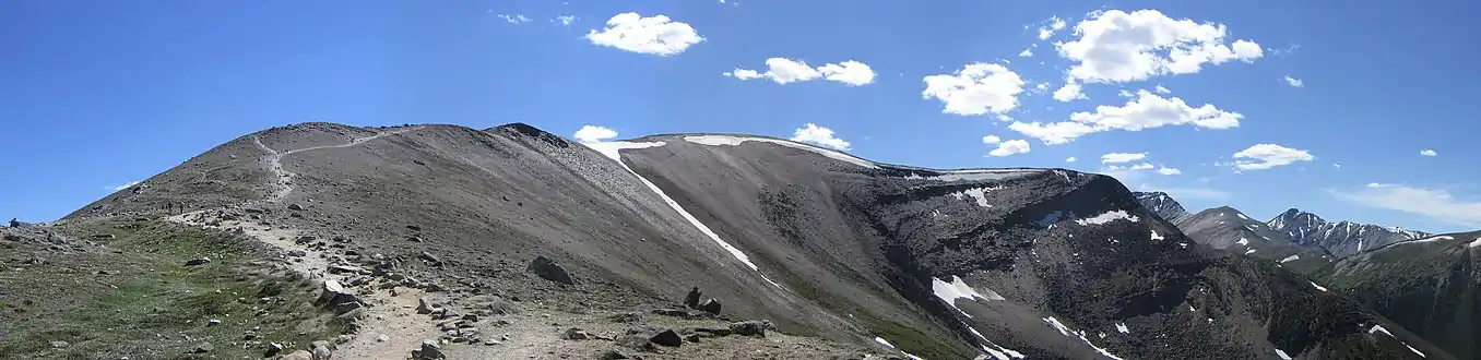 Walking to the top of The Whistlers
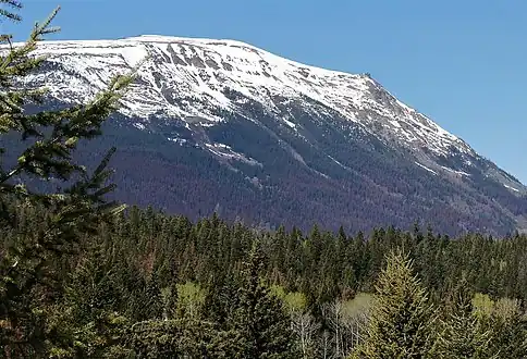 East aspect
External links
- Parks Canada web site: Jasper National Park
- Webcam and weather: Jasper Skytram