Yellowhead Mountain
Yellowhead Mountain is located on the border of Alberta and British Columbia. It was named for Pierre Bostonais aka Tête Jaune.[1][2] The mountain has four officially named summits: Bingley Peak, Leather Peak, Lucerne Peak, and Tête Roche.
| Yellowhead Mountain | |
|---|---|
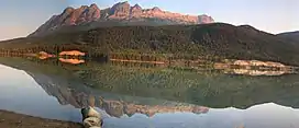 Yellowhead Mountain from Yellowhead Lake | |
| Highest point | |
| Elevation | 2,458 m (8,064 ft)[1] |
| Prominence | 343 m (1,125 ft) |
| Coordinates | 52°52′54″N 118°37′24″W |
| Geography | |
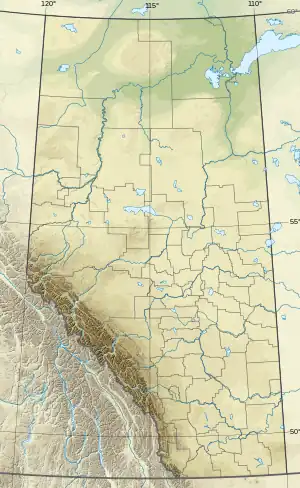 Yellowhead Mountain Location on Alberta/B.C. boundary  Yellowhead Mountain Yellowhead Mountain (Canada) | |
| Country | Canada |
| Provinces | Alberta and British Columbia |
| Parent range | Victoria Cross Ranges |
| Topo map | NTS 83D15 Lucerne |
Climate
Based on the Köppen climate classification, Yellowhead Mountain is located in a subarctic climate zone with cold, snowy winters, and mild summers.[3] Temperatures can drop below −20 °C with wind chill factors below −30 °C. In terms of favorable weather, July through September are the best months to climb.
See also
References
- "Yellowhead Mountain". cdnrockiesdatabases.ca. Retrieved 2019-06-09.
- "Yellowhead Mountain". Bivouac.com. Retrieved 2019-06-09.
- Peel, M. C.; Finlayson, B. L.; McMahon, T. A. (2007). "Updated world map of the Köppen−Geiger climate classification". Hydrol. Earth Syst. Sci. 11: 1633–1644. ISSN 1027-5606.
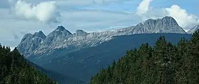
Yellowhead Mountain with Leather Peak, Lucerne Peak, and Tete Roche (right) seen from westbound Highway 16
This article is issued from Wikipedia. The text is licensed under Creative Commons - Attribution - Sharealike. Additional terms may apply for the media files.