X
wikiHow is a “wiki,” similar to Wikipedia, which means that many of our articles are co-written by multiple authors. To create this article, volunteer authors worked to edit and improve it over time.
Learn more...
Although New York's I-684 is only 28.51 miles long[1] , it ties together several important spots and exits, tying most of the Hudson Valley to White Plains, the Lower Hudson Valley, and even some of the boroughs of Bronx and Manhattan (when coupled with its connector routes). You can learn all about its travel in this article.
Steps
Part 1
Part 1 of 5:
Preparing to Travel
-
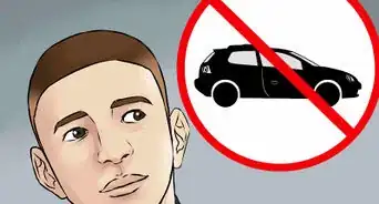
1Gas up the car - enough to travel the 29-mile highway. At moderate traffic, expect to stay in traffic for 35 minutes end-to-end.
-
2Learn how this route travels. Although this route serves many smaller sizes of the bigger cities (including White Plains at the start of the route), it doesn't cover New York City all that much, nor does it cover Albany - New York's state capital. It services parts of Westchester and Putnam County, with some less-noticeable signage for Connecticut.
- As it's portrayed on the map up north close to the northern terminus (at I-84), this route is east of the Taconic State Parkway's two exits off I-84.
Advertisement
Part 2
Part 2 of 5:
Starting the Route: Southern Westchester County
-
1Start the route when possible. Although the Wikipedia article goes in-depth how I-684 runs off of two exits of the Cross-Westchester Expressway and then talks a little about the other exits on the Cross-Westchester Expressway, if you follow along on Google Maps for PC, you'll see how it begins technically around exit 9N of the expressway which is unsigned as the end of Hutchinson River Parkway (official designation New York 984J[2] ) before the Expressway terminates and becomes the north-south highway called I-684 on a northbound-soundbound journey.
-
2Notice how at exit 1, this Interstate forms an additional Express lane, which will later merge into the interstate, or if traveling I-684 southbound exits onto a separate highway taking you to I-287. It is written in the Wikipedia article as being a connector route back to the Hutchinson River Parkway heading south - yet the Parkway can take you to New York City and Manhattanville Rd.
-
3Travel the route up to exit 2. Exit 2 serves the Westchester County Airport, among the places via NY-135/Airport Rd. It also services SUNY Purchase off Anderson Hill Rd (off NY-120/Purchase St) as it wanders the edge of the state border.
- Westchester County Airport (HPN), services - among other airlines - just American and Delta airlines, and a wealth of private flights for private services - via MillionAir - yet its main terminal only has one door to check-in.
Advertisement
Part 4
Part 4 of 5:
Bringing Yourself Back into Westchester County
-
1Travel through North Castle, NY, and up into Armonk - at exit 3. Heading northbound, you'll see two signed exits - 3N and 3S on NY-22/Bedford Rd & Armonk Bedford Rd. Armonk's commercial district is close to the exit, and if you take the exit north, you end up in Bedford.
-
2Watch out for exit 4. Exit 4 - NY-172 brings you towards the city of Mount Kisco and its CareMount Medical building for Mount Kisco (the former corporate location of Mount Kisco Medical Group which became CareMount when it merged with Mid-Hudson Medical Group in 2012) as well as the Northern Westchester Hospital - a little further off of NY-172 South Bedford Rd.
- NY-22 is also accessible from NY-172 east - just in case you passed the last exit and need to head on NY-22.
-
3Watch out to your left - as the Bedford Hills Correctional Facility appears among the trees. No direct access is provided, though there's its connection via either of the two exits (previous or next exit). It might not be easy to spot among the trees of the highway, but it's present.
-
4Watch out for exit 5. Exit 5 - signed as the Saw Mill River Parkway. The Saw Mill River Parkway has its northern terminus at this location and is a little bit tricky on the northbound travelers. I-684 only exits onto the parkway via the southbound lanes, and the parkway enters I-684 from over the northbound lanes where it becomes a pair of Express lanes that runs into the interstate a few miles north at the next exit.
- The Wikipedia page mentions it travels to NY-117 and New York City, but that's referencing routes at the southern terminus of the parkway.
-
5Travel wise, if you need to travel with exit 6 of I-684. Exit 6's exit - NY-35 travels to the Katonah Metro-North Railroad (Harlem Line/blue signed) station.
-
6Let the Metro-North Line follow I-684 to exit 6A at Golden's Bridge. At this exit, you'll spot the station right underneath the overpass to NY-138/Waccabuc Rd. You can't access the station right from the interstate, but if you travel off the interstate at this exit, you can travel to the station off the side street - NY-138.
- According to Google Maps for PC (website), you'll notice how it's accessible only from NY-22 from the northbound strip of highway, yet the cross-street enters the highway from NY-138.
- You might not notice the station right from the exit if you've taken the exit traveling northbound. Exit off the highway and head to NY-22. Take that north and as it travels parallel to the highway, you'll encounter the cross-street NY-138 and the one nearest the railroad station.
-
7Follow the interstate past exit 7 - serving Purdy's-Somers exit. The exit services Purdy's Metro-North (Harlem Line railroad station), yet is shielded from view via a line of trees. The exit is from the northbound side of the highway, yet when entering the highway, you need to take I-684 southbound.
-
8Follow the interstate past exit 8 for Croton Falls - and the last exit for this highway in Westchester County. Croton Falls' Metro-North Station is further west than running along the highway, but this station is accessible from this location. Exit 8 services Croton Falls and Hardscrabble Rd.
- Again, northbound exits with southbound entrances onto the highway.
Advertisement
Part 5
Part 5 of 5:
Traveling in Putnam County
-
1Travel past exit 9 - the exit for I-84's Brewster exit - in Putnam County. Although not the official northern terminus, many people will think it's the end because Interstate 84 is the last big cross-highway for I-684. Here there are ample exits and entrances from either highway as it is a cloverleaf at |I-84's exit 68.
-
2Follow the route north. There's only one exit left at exit 10 - bringing travelers onto US-202/NY-6 towards Brewster.
-
3Follow the route onto its final connector. It drops one lane each direction and becomes the bi-directional (one lane per direction) route NY-22 as it heads towards Pawling (Dutchess County), and points north such as towards Patterson, Wingdale, and Dover among the cities within an additional forty-five-minute drive.
Advertisement
References
About This Article
Advertisement
