Águas Claras, Federal District
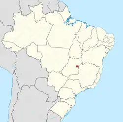
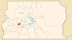
Águas Claras (Portuguese pronunciation: [ˈa.ɡuɐs ˈkla.ɾɐs]) is an administrative region in the Federal District in Brazil. It is bordered by Vicente Pires to the north, Guará and Park Way to the east, Arniqueira to the south, and Taguatinga to the west. It was founded in 8 April 2003 by District Law n.º 3153, which separated it from Taguatinga. It is the twentieth administrative region of the Federal District. Águas Claras has a total area of 2.496 hectars (24.96 square kilometers).[3]
Águas Claras | |
|---|---|
| Região Administrativa de Águas Claras Administrative Region of Águas Claras | |
 Location in the Federal District | |
| Coordinates: 15°50′25″S 48°01′40″W | |
| Country | |
| Region | Central-West |
| State | |
| Founded | April 8, 2003 |
| Government | |
| • Regional administrator | Manoel Valdeci Machado Elias[1] |
| Area | |
| • Total | 31.5 km2 (12.2 sq mi) |
| Population (2010) | |
| • Total | 135,685[2] |
| • Density | 4,307/km2 (11,160/sq mi) |
| Time zone | UTC−3 (BRT) |
| Area code | +55 61 |
| Website | www.aguasclaras.df.gov.br |


Etymology
The region's name, Portuguese for clear waters, is a reference to the stream within the region which flows into the Paranoá Lake.[4][5]
History
Early history
In December 1992, District Law No. 385 authorized the implementation of Águas Claras, then part of Taguatinga; its occupation plan was approved later that same year. Designed by architect and urbanist Paulo Zimbres, Águas Claras began construction shortly afterwards. It was separated from Taguatinga as the Federal District's twentieth administrative region on May 6 2003, through District Law No. 3153.
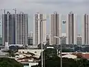
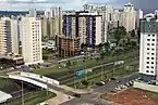
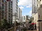
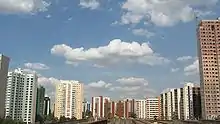
The neighborhood was notable for its accelerated growth, with large and diversified real estate developments.
Águas Claras has an area of approximately 31.5 km² and a population of just over 135 thousand.[2]
Geography
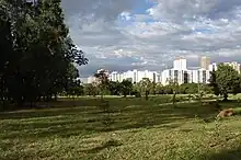
Águas Claras is located in the Brazilian highlands, in the Central-West region of Brazil.
Subdivisions
Águas Claras is divided into the areas of Águas Claras Vertical (with buildings with up to 32 floors), Areal, Setor Habitacional Arniqueiras (comprising the Arniqueiras, Vereda da Cruz and Vereda Grande housing developments) and Área de Desenvolvimento Econômico (ADE) (Economic Development Area), being formed by residential and commercial blocks.
Economy
The administrative region was the 6th region with the most expensive launches in Brazil in 2012, according to Lopes' "Anuário do Mercado Imobiliário Brasileiro da Lopes", with nine developments, totaling 1,607 units and 619 million reais in "General Sales Value." Comparatively, the Federal District was the fourth largest national market in 2012, with launches totaling a 3.3 billion reais GVS.[6]
Infrastructure
Metro
Águas Claras is split into two areas by the Federal District Metro lines and has four stations: Arniqueiras, Águas Claras, Concessionárias, and Estrada Parque.[7] The city is served by regular bus lines to Plano Piloto, Taguatinga and Ceilândia. With the inauguration of a set of four viaducts on January 24, 2009, the Araucárias and Castanheiras Avenues and the Boulervards bordering the subway line became one-way streets, thus promoting the fluidity of the local traffic.
Roads
The renovation of the Taguatinga Park Road (EPTG), partially delivered to the population in November 2010, reduced the travel time between Águas Claras and the central region of Brasília. With more lanes and marginal roads to help the flow of vehicles, the EPTG is now part of the "Green Line", part of the Integrated Brasília project. Planned in the initial project, the EPTG bike lane was only partially delivered in 2019. The project also foresees the implementation of an exclusive bus lane, the BRT-Oeste.
Another project planned for the region is the construction of the Estrada Parque Interbairros (EPIB), which will connect the central region of Brasília to Samambaia, passing next to Águas Claras.[8]
Public transportation is still insufficient, repeating a chronic problem present throughout the Federal District. Many bus stops in Águas Claras still have no shelters, causing inconvenience to users. Due to the expansion of the line and the inauguration of new subway stations in Ceilândia, in 2008, the subway system began to show signs of exhaustion, with delays and overcrowding of trains, jeopardizing one of the main means of connection between Águas Claras and other locations in the Federal District.
Health, education and safety
Águas Claras still lacks a hospital and public schools. In vertical Águas Claras there is a public daycare center. The 21st Police Station, which serves the region, is located in Areal. Since 2008, Military Police stations have been opened near Avenida Araucárias and Avenida Castanheiras. The lack of infrastructure for public services makes the population resort to existing services in Taguatinga or in the central region of Brasília.[9][10]
References
- "Perfil do administrador" (in Portuguese). Administração Regional de Águas Claras, DF. Retrieved 2015-01-01.
- "Pesquisa Distrital por Amostra de Domicílios - 2010/2011" (PDF) (in Portuguese). Codeplan. Retrieved 2013-04-09.
- "ATLAS DO DISTRITO FEDERAL 2017" (PDF). Codeplan. 2017. Retrieved 2023-06-16.
- "Águas Claras completa 17 anos". Administração Regional de Águas Claras. 2020-05-06. Retrieved 2023-06-09.
- "Águas Claras: histórias de trabalhadores na região de arranha-céus e que não para de crescer". Agência de Notícias CEUB. 2020-08-13. Retrieved 2023-06-09.
- "As 20 regiões com lançamentos mais caros do Brasil em 2012 - Página 7 - EXAME.com". 2013-09-22. Archived from the original on 2013-09-21. Retrieved 2023-06-11.
- "Linhas | Companhia do Metropolitano do Distrito Federal". metro.df.gov.br. Retrieved 2023-05-21.
- "Obras da Avenida das Cidades começam em 2022 | Metrópoles". Metrópoles | O seu portal de notícias (in Portuguese). 2020-02-19. Retrieved 2023-06-09.
- "National Geographic Brasil - Ficção urbana". Viaje Aqui. 2011-10-15. Archived from the original on 2011-10-15. Retrieved 2023-06-11.
- Mader', 'Helena (2011-07-24). "População de Águas Claras triplica em seis anos e saturação é iminente". Acervo (in Brazilian Portuguese). Retrieved 2023-06-11.