Vicente Pires
Vicente Pires (Portuguese pronunciation: [visentʃi piɾis]) is an administrative region in the Federal District in Brazil. It is bordered by Taguatinga to the west, Águas Claras to the south, Guará to the southeast, Brasília to the north, and Brazlândia to the northwest. According to a 2016 report, Vicente Pires has a population of 72,879.[3] Vicente Pires is the 16th largest administrative region by population.[4] The administrative region was created in 2009 after being separated from Taguatinga via law nº 814/2008, but the area has been occupied since the 1960s. It has a total area of 4.403,6 hectares (44.03 km²).[5]
Vicente Pires | |
|---|---|
| Região Administrativa de Vicente Pires Administrative Region of Vicente Pires | |
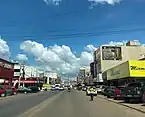
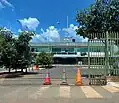
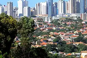
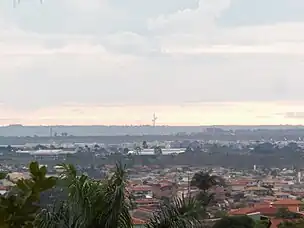
Clockwise from top: City skyline, I love VP sign, 38th Police Station, commercial road, Bridge | |
 Flag  Coat of arms | |
| Nickname(s): Buraco Pires, Vicentão | |
| Motto: Eu Amo Vicente Pires | |
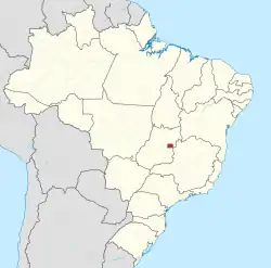
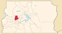 Location of Vicente Pires within Federal District | |
| Coordinates: 15°48′12″S 48°01′48″W | |
| Country | |
| Region | Central-West |
| State | |
| Separation from Taguatinga | 26 May 2009 |
| Government | |
| • Regional administrator | Gilvando Galdino Fernandes[1] |
| Area | |
| • Total | 25.74 km2 (9.94 sq mi) |
| Population (2016)[2] | |
| • Total | 72,879 |
| Time zone | UTC−3 (BRT) |
| Area code | +55 61 |
| Website | www |
Etymology
The name for Vicente Pires is largely believed to have originated from Vicente Pires da Mota, who owned the Vicente Pires Agricultural Colony.[6] The official origin for the name of the colony is from a stream in the region.[7]
History
Early history
In the 60s Vicente Pires was inhabited by Indians, and in the 70s by farmers. In 1989, the then Governor José Aparecido, decided to centralize the process of expanding the rural production area of the Águas Claras Agricultural Colony to the Agricultural Colonies of Vicente Pires, Samambaia and São José. Through an agreement intermediated by the GDF and carried out by means of the Zoobotanic Foundation, a land use contract for agricultural production was made with about 360 farmers, with a term of use stipulated in 30 years.[8]
As an administrative region
Vicente Pires was created on 26 May 2009, by the approval of law nº 814/2008. Vicente Pires was dismembered from Taguatinga and started to have its own administration, subsequently becoming its own administrative region. This occurred 20 years after the first farms in the former agricultural colony were established.[9] Vicente Pires then comes to comprise the Vicente Pires Housing Sector, Samambaia Housing Sector, São José Housing Sector and Cana-do-Reino Housing Sector.[10]
Some streets were restored, but the population still suffers with the lack of proper road infrastructure and potholes.[11] More recently, there have been investments to the administrative region's road infrastructure.[12][13]
In May 2010, the Regional Administration of Vicente Pires held a contest among the public and private schools of the administrative region with students from 1st to 9th grade of elementary school to choose their civic symbols (flag, anthem and coat of arms). The name of the winners and their respective symbols can be found in the Diário Oficial do Distrito Federal (section 01-171 3 September 2010).[14]
The regions of the Colonias Agrícolas Vicente Pires are part of the Urban Qualification and Expansion Zone, these are areas initially intended for rural use that have undergone urban occupation through the implementation of informal settlements, which have been slowly fought against.[15]
Geography
Vicente Pires is located in the Brazilian Highlands, in the Central-West region of Brazil. The Administrative Region is bordered by Taguatinga, Águas Claras, Guará, SCIA, SAI, Brazlândia and Brasília.[16] Vicente Pires comprises 25.74 km2 (9.94 sq mi) of land area.[4]
Climate
Vicente Pires has a Tropical Savanna climate (Köppen: Aw).[17] The climate has two distinct seasons, the rainy season, from October to April, and the dry season, from May to September. During the dry season, the city can have very low relative humidity levels, often below 30%.[18] The average temperature is 21.4 °C (70.5 °F).
| Climate data for Vicente Pires | |||||||||||||
|---|---|---|---|---|---|---|---|---|---|---|---|---|---|
| Month | Jan | Feb | Mar | Apr | May | Jun | Jul | Aug | Sep | Oct | Nov | Dec | Year |
| Record high °C (°F) | 32.6 (90.7) |
32.0 (89.6) |
32.1 (89.8) |
31.6 (88.9) |
31.6 (88.9) |
31.6 (88.9) |
30.8 (87.4) |
33.0 (91.4) |
35.7 (96.3) |
36.4 (97.5) |
34.5 (94.1) |
33.7 (92.7) |
36.4 (97.5) |
| Average high °C (°F) | 26.9 (80.4) |
27.2 (81.0) |
27.0 (80.6) |
26.8 (80.2) |
26.0 (78.8) |
25.3 (77.5) |
25.6 (78.1) |
27.4 (81.3) |
29.1 (84.4) |
29.0 (84.2) |
27.0 (80.6) |
26.8 (80.2) |
27.0 (80.6) |
| Daily mean °C (°F) | 21.9 (71.4) |
21.9 (71.4) |
21.8 (71.2) |
21.6 (70.9) |
20.3 (68.5) |
19.3 (66.7) |
19.3 (66.7) |
21.0 (69.8) |
22.8 (73.0) |
23.1 (73.6) |
21.7 (71.1) |
21.7 (71.1) |
21.4 (70.5) |
| Average low °C (°F) | 18.3 (64.9) |
18.2 (64.8) |
18.2 (64.8) |
17.7 (63.9) |
15.6 (60.1) |
14.2 (57.6) |
13.9 (57.0) |
15.3 (59.5) |
17.6 (63.7) |
18.5 (65.3) |
18.1 (64.6) |
18.3 (64.9) |
17.0 (62.6) |
| Record low °C (°F) | 12.2 (54.0) |
11.0 (51.8) |
14.5 (58.1) |
10.7 (51.3) |
1.4 (34.5) |
3.3 (37.9) |
1.6 (34.9) |
5.0 (41.0) |
9.0 (48.2) |
10.2 (50.4) |
11.4 (52.5) |
11.4 (52.5) |
1.4 (34.5) |
| Average precipitation mm (inches) | 206.0 (8.11) |
179.5 (7.07) |
226.0 (8.90) |
145.2 (5.72) |
26.9 (1.06) |
3.3 (0.13) |
1.5 (0.06) |
16.3 (0.64) |
38.1 (1.50) |
141.8 (5.58) |
253.1 (9.96) |
241.1 (9.49) |
1,478.8 (58.22) |
| Average precipitation days (≥ 1.0 mm) | 16 | 14 | 15 | 9 | 3 | 1 | 0 | 2 | 4 | 10 | 17 | 18 | 109 |
| Average relative humidity (%) | 74.7 | 74.2 | 76.1 | 72.2 | 65.4 | 58.8 | 51.0 | 43.5 | 46.4 | 58.8 | 74.5 | 76.0 | 64.3 |
| Mean monthly sunshine hours | 159.6 | 158.9 | 168.7 | 200.8 | 237.9 | 247.6 | 268.3 | 273.5 | 225.7 | 191.3 | 138.3 | 145.0 | 2,415.6 |
| Average ultraviolet index | 14 | 14 | 14 | 12 | 9 | 7 | 8 | 10 | 12 | 13 | 14 | 14 | 12 |
| Source 1: Instituto Nacional de Meteorologia[19][20][21][22][23][24][25] | |||||||||||||
| Source 2: Meteo Climat (record highs and lows)[26] | |||||||||||||
Government
The government of Vicente Pires is the Regional Administration. In a different fashion to municipalities, the Administrative Regions are administered by Regional Administrations, which are led by an administrator.[27] Each administration is responsible for providing services to their respective regions, such as power, water, sanitation, and road infrastructure. The current administrator for Vicente Pires is Gilvando Galdino Fernandes.
Infrastructure
Vicente Pires is served by a power grid, public lighting and asphalt paving, with projects for a water supply and sanitation system in the implementation phase.[28][29] The region presents recurring problems regarding the maintenance of roads, being sensitive to flooding and easily deteriorating in periods with heavy rainfall.[30] The lack of properly maintained roads has led to several craters being formed during rainy periods,[31] which gave it the nickname "Buraco Pires".[32][33] Vicente Pires is also an area with the possibility of natural disasters according to Brazil's Civil Police.[34]
Transport
The main highways that give access to the administrative region are Estrada Parque Ceilândia – EPCL (DF-095), Estrada Parque Taguatinga – EPTG (DF-085) and Estrada Parque Vicente Pires – EPVP (DF-079). Vicente Pires does not have any rail transportation, instead its public transportation is based on bus lines, which are provided by the company Expresso São José.[35]
References
- Izel, Adriana (31 December 2022). "Conheça os 33 administradores regionais que vão compor o governo". Agência Brasília (in Brazilian Portuguese). Retrieved 1 April 2023.
- "Pesquisa Distrital por Amostra de Domicílios – PDAD" (PDF). Vicente Pires Regional Administration. Retrieved 8 April 2023.
- "Pesquisa Distrital por Amostra de Domicílios PDAD 2015-2016.pdf" (PDF). Administração Regional de Vicente Pires (in Brazilian Portuguese). Retrieved 8 April 2023.
- "COMPATIBILIZAÇÃO ENTRE AS PROJEÇÕES POPULACIONAIS, A PDAD 2018 E A NOVA DELIMITAÇÃO (OFICIAL) DAS REGIÕES ADMINISTRATIVAS DO DISTRITO FEDERAL (PDF)" (PDF) (in Brazilian Portuguese). 22 August 2021.
- "ATLAS DO DISTRITO FEDERAL 2017" (PDF). Codeplan. 2017. Retrieved 16 June 2023.
- "Alguém sabe quem é ou quem foi Vicente Pires?". 27 January 2020. Retrieved 27 May 2023.
- "Vicente-Pires.pdf" (PDF). IPEDF. 2019. Retrieved 27 May 2023.
- "Conheça a RA – Administração Regional de Vicente Pires" (in Brazilian Portuguese). Retrieved 11 April 2023.
- "Vicente Pires completa 6 anos". Agência Brasília (in Brazilian Portuguese). 20 May 2015. Retrieved 19 December 2022.
- "Vicente Pires é a nova Região Administrativa do DF". Câmara Legislativa Distrito Federal (in Brazilian Portuguese). 23 April 2009. Retrieved 19 December 2022.
- "Historia de Vicente Pires DF – Ache Tudo e Região". www.achetudoeregiao.com.br. Retrieved 19 December 2022.
- Brasília, Redação Jornal de (2 January 2023). "Vicente Pires já não tem medo da chuva". Jornal de Brasília (in Brazilian Portuguese). Retrieved 30 January 2023.
- "Serviços de infraestrutura são finalizados temporariamente na Rua 7; confira o andamento das obras na Rua 5". VP Agora (in Brazilian Portuguese). Retrieved 11 April 2023.
- "Historia de Vicente Pires DF – Ache Tudo e Região". www.achetudoeregiao.com.br. Retrieved 11 April 2023.
- "DF Legal combate ocupação irregular de terras em duas regiões do DF | Metrópoles". www.metropoles.com (in Brazilian Portuguese). 31 August 2022. Retrieved 11 April 2023.
- "Administrações Regionais – Secretaria de Estado de Governo do Distrito Federal" (in Brazilian Portuguese). Retrieved 30 January 2023.
- A cidade das duas estações Archived 4 May 2012 at the Wayback Machine (in Brazilian Portuguese).
- "DF entra em estado de atenção por causa da baixa umidade do ar". Agência Brasil (in Brazilian Portuguese). 6 August 2014. Retrieved 8 June 2023.
- "Temperatura Máxima Mensal e Anual (°C)". Normais Climatológicas do Brasil 1991–2020 (in Portuguese). Instituto Nacional de Meteorologia. Archived from the original on 24 March 2022. Retrieved 24 March 2022.
- "Temperatura Média Compensada Mensal e Anual (°C)". Normais Climatológicas do Brasil 1991–2020 (in Portuguese). Instituto Nacional de Meteorologia. Archived from the original on 24 March 2022. Retrieved 24 March 2022.
- "Temperatura Mínima Mensal e Anual (°C)". Normais Climatológicas do Brasil 1991–2020 (in Portuguese). Instituto Nacional de Meteorologia. Archived from the original on 24 March 2022. Retrieved 24 March 2022.
- "Precipitação Acumulada Mensal e Anual (mm)". Normais Climatológicas do Brasil 1991–2020 (in Portuguese). Instituto Nacional de Meteorologia. Archived from the original on 24 March 2022. Retrieved 24 March 2022.
- "Número de dias no mês ou no ano com precipitação maior ou igual a (1 mm) (dias)". Normais Climatológicas do Brasil 1991–2020 (in Portuguese). Instituto Nacional de Meteorologia. Archived from the original on 24 March 2022. Retrieved 24 March 2022.
- "Umidade Relativa do Ar Compensada Mensal e Anual (%)". Normais Climatológicas do Brasil 1991–2020 (in Portuguese). Instituto Nacional de Meteorologia. Archived from the original on 24 March 2022. Retrieved 24 March 2022.
- "Insolação Total (horas)". Normais Climatológicas do Brasil 1991–2020 (in Portuguese). Instituto Nacional de Meteorologia. Archived from the original on 24 March 2022. Retrieved 24 March 2022.
- "Station Brasília" (in French). Meteo Climat. Retrieved 24 March 2022.
- "Administrações Regionais – GOVERNO DO DISTRITO FEDERAL" (in Brazilian Portuguese). Retrieved 8 April 2023.
- "PDOT" (PDF).
- Brasília, Redação Jornal de (2 January 2023). "Vicente Pires já não tem medo da chuva". Jornal de Brasília (in Brazilian Portuguese). Retrieved 30 January 2023.
- "Bastou a primeira chuva para Vicente Pires enfrentar transtornos | Metrópoles". www.metropoles.com (in Brazilian Portuguese). 10 August 2018. Retrieved 10 April 2023.
- "Vídeo: cratera em Vicente Pires faz casas e obra serem interditadas | Metrópoles". Metrópoles | O seu portal de notícias (in Portuguese). 14 May 2023. Retrieved 8 June 2023.
- "Comerciantes reclamam de falta de infraestrutura em Vicente Pires". G1 (in Brazilian Portuguese). Retrieved 30 January 2023.
- "GRANDE MANIFESTAÇÃO COM O FECHAMENTO DA EPTG | JBN" (in Brazilian Portuguese). Retrieved 30 January 2023.
- "Vicente Pires possui áreas com possibilidades de desastres naturais, diz Defesa Civil". VP Agora (in Brazilian Portuguese). Retrieved 11 April 2023.
- MOBILIDADE, SECRETARIA DE TRANSPORTE E. "Dados do STPC/DF". SECRETARIA DE TRANSPORTE E MOBILIDADE (in Brazilian Portuguese). Retrieved 27 May 2023.
