Želetava
Želetava (German: Schelletau) is a market town in Třebíč District in the Vysočina Region of the Czech Republic. It has about 1,500 inhabitants.
Želetava | |
|---|---|
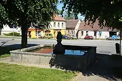
 Centre of Želetava | |
 Flag  Coat of arms | |
 Želetava Location in the Czech Republic | |
| Coordinates: 49°8′30″N 15°40′22″E | |
| Country | |
| Region | Vysočina |
| District | Třebíč |
| First mentioned | 1303 |
| Government | |
| • Mayor | Radek Malý |
| Area | |
| • Total | 27.59 km2 (10.65 sq mi) |
| Elevation | 578 m (1,896 ft) |
| Population (2023-01-01)[1] | |
| • Total | 1,508 |
| • Density | 55/km2 (140/sq mi) |
| Time zone | UTC+1 (CET) |
| • Summer (DST) | UTC+2 (CEST) |
| Postal code | 675 26 |
| Website | www |
Administrative parts
Villages of Bítovánky, Horky and Šašovice are administrative parts of Želetava.
Geography
Želetava is located about 17 kilometres (11 mi) southwest of Třebíč and 29 km (18 mi) south of Jihlava. It lies in the Křižanov Highlands. The highest point is at 680 metres (2,230 ft) above sea level. The Želetavka River springs here and flows through the municipal territory. There are several ponds fed by the Želetavka.
History
The first written mention of Želetava is from 1303. In 1370, it was promoted to a market town.[2]
Economy
Želetava is known for a cheese factory, which has been operating since 1902. Since 2000, the factory has been owned by Bel Group.[3]
Sights
The landmark of Želetava is the Church of Saint Michael the Archangel with a tall prismatic tower. It has a Gothic core with Baroque modifications. In front of the church are two valuable statues of Saints John the Baptist and John of Nepomuk.[4]
Other sights include the Chapel of Saint Catherine, and the Chapel of Saint Anthony of Padua in Horky.[2]
References
- "Population of Municipalities – 1 January 2023". Czech Statistical Office. 2023-05-23.
- "Základní informace" (in Czech). Městys Želetava. Retrieved 2022-09-07.
- "BEL Sýry Česko, a.s." (in Czech). Průmysl Dnes. Retrieved 2020-10-02.
- "Kostel sv. Michala s křížem a sochami" (in Czech). National Heritage Institute. Retrieved 2022-09-07.