Agarakadzor
Agarakadzor
Ագարակաձոր | |
|---|---|
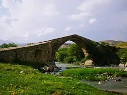 13th-century bridge near Agarakadzor | |
 Agarakadzor 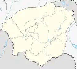 Agarakadzor | |
| Coordinates: 39°44′11″N 45°20′44″E | |
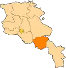
| Country | Armenia |
| Province | Vayots Dzor |
| Municipality | Areni |
| Population | |
| • Total | 1,301 |
| Time zone | UTC+4 (AMT) |
| Agarakadzor at GEOnet Names Server | |
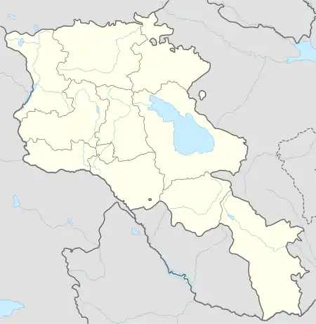
Agarakadzor (Armenian: Ագարակաձոր) is a village in the Areni Municipality of the Vayots Dzor Province in Armenia.[2] It is located 3 km southeast of the Province center, on the left bank of the Arpa River, near the confluence of the Agarakadzor tributary.
History
The village was founded at the beginning of the 19th century, although some historical records also reference the 12th and 13th centuries. Originally known as Ayar, the village was previously part of the Sharur-Daralayaz uezd within the Erivan Governorate.[3]
Historically, this was the estate of the Orbelians and this particular period is widely regarded as the most prosperous in the history of Vayots Dzor. Paying great attention to road construction to foster economic growth and facilitate trade, Tarsayich Orbelyan (12th century) built several caravanserais and bridges, including the Agarakadzor bridge, which is still standing and functioning today. Now many villages on the left bank of the Arpa River are connected to the city of Yeghegnadzor via this bridge.
Between 1828 and 1829, a wave of immigration occurred, with the population relocating from Khoy, Salmast gavars, and Maku to this area.
Climate
The climate of the region is characterized as subtropical with arid conditions. Summers are hot, while winters can be cold. The average annual precipitation ranges from 300 to 350 mm.
Population
The population dynamics of Agarakadzor over the years:[4]
| Year | 1831 | 1897 | 1914 | 1926 | 1959 | 1970 | 1979 | 1989 | 2001 | 2011 |
|---|---|---|---|---|---|---|---|---|---|---|
| Population | 216[4] | 346[4] | 382[4] | 277[4] | 480[4] | 283[4] | 930[4] | 1200[5] | 1283[4] | 1301[1] |
Occupation
The community has 340 households.
The main branch of the community's economy is agriculture, which thrives due to the favorable climate for gardening and viticulture. Cultivation of grain, forage crops, and vegetables is common. Additionally, the community is involved in animal husbandry, breeding both large and small livestock.
The pastures cover a total area of 912 hectares. Reserve lands are appropriated and used as arable land. The natural landscapes in the area consist of semi-deserts and dry steppes, which have been modified and converted into cultivated and irrigated landscapes.
The primary industry in the village is the food industry. Within the village, there is a mineral water factory "Jermuk", two stone processing workshops, which use the raw materials brought from Gnishik and Sisian.
Minerals
A tuff mine is found in the territory of the community, but it has a reserve value and is not exploited.
Historical and cultural sites
Near the village, on Arpa River, there is the Agarakadzor bridge (13th century), khachkars (cross-stones) of the 12-17th centuries, St. Hovhannes chapel (19th century). Located approximately 1.5 kilometers east of the village, there is a 17th century church and a castle that dates back to the 9th century.
Public facilities
There is a secondary school, a kindergarten, a house of culture, a medical station and coominication unit in the village.
Gallery
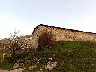 Church in nearby abandoned village of Gandzak
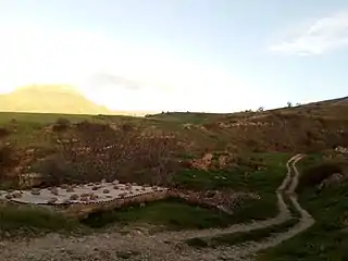 Nearby abandoned village of Gandzak
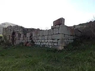 Tukh Manuk Church in nearby abandoned village of Boloraberd
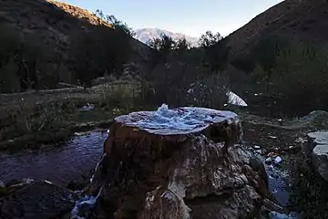 Grav spring in Agarakadzor
References
- Statistical Committee of Armenia. "The results of the 2011 Population Census of Armenia" (PDF).
- "RA Vayots Dzor Marz" (PDF). Marzes of the Republic of Armenia in Figures. 2009. pp. 264–270. Retrieved 27 June 2023.
- H. Barseghyan, S. Melik-Bakhshyan, E. Aghayan (1986). Dictionary of the toponymy of Armenia and adjacent territories, vol. 1. Yerevan: YSU Publishing House. p. 910.
{{cite book}}: CS1 maint: multiple names: authors list (link) - "Centre of Geodesy and Cartography" SNCO under Cadastre Committee of the Republic of Armenia (2008). Dictionary of settlements of the Republic of Armenia (PDF). Yerevan. p. 184. Archived from the original (PDF) on 2020-02-09. Retrieved 2023-06-30.
{{cite book}}: CS1 maint: location missing publisher (link) - H. Barseghyan, S. Melik-Bakhshyan, E. Aghayan (1986). Dictionary of the toponymy of Armenia and adjacent territories, vol. 5. Yerevan: YSU Publishing House. p. 540.
{{cite book}}: CS1 maint: multiple names: authors list (link)
External links
- Report of the results of the 2001 Armenian Census, Statistical Committee of Armenia
- Kiesling, Brady (2005), Rediscovering Armenia: Guide, Yerevan, Armenia: Matit Graphic Design Studio
- Kiesling, Brady (June 2000). Rediscovering Armenia: An Archaeological/Touristic Gazetteer and Map Set for the Historical Monuments of Armenia (PDF). Archived (PDF) from the original on 6 November 2021.