Hermon, Armenia
Hermon
Հերմոն | |
|---|---|
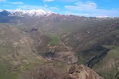 Hermon (foreground) and Goghtanik (background) | |
 Hermon 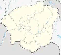 Hermon | |
| Coordinates: 39°52′46″N 45°25′35″E | |
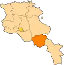
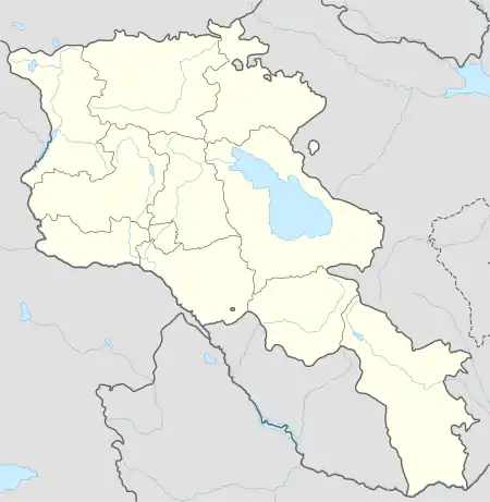
| Country | Armenia |
| Province | Vayots Dzor |
| Municipality | Yeghegis |
| Population | |
| • Total | 180 |
| Time zone | UTC+4 (AMT) |
| Hermon, Armenia at GEOnet Names Server | |
Hermon (Armenian: Հերմոն) is a village in the Yeghegis Municipality of the Vayots Dzor Province in Armenia.[2] It is located 26 km northeast of the Province center, in the upper reaches of the Yeghegis River, a right-hand tributary of the Arpa River.
On April 3, 1991, for unknown reasons, it was renamed Hermon.
History
The historical Armenian name of the village is Grkiq, and in 1991 for an unknown reason it was renamed after Hermon - a mountain in the border between Syria and Lebanon. Until 1988, Azerbaijanis lived in the village of Ghavushugh (Hermon), and then it was resettled by Armenians displaced from Azerbaijan and Artsakh. During the Soviet era, the Azerbaijani-populated Kalasar was merged with Ghavushugh, now known as Hermon. Currently, Kalasar is not inhabited, but the ruins of the church and many Armenian tombstones can still be seen.
Geography
Yeghegnadzor-Vardahovit, Yeghegnadzor-Goghtanik roads pass through Hermon. The village has a beautiful nature, with the Aretes River flowing alongside it. Kalasar (Kalaser) village is included in the administrative territory of Hermon community. It is located on the southern slope of the Ardenis mountain range, in the valley of the Yeghegis River, a right-hand tributary of Arpa, 1 km northwest of Hermon village and about 17 km northeast of the Province center. Previously, Kalasar was part of the Sharur-Daralayaz administrative district within the Erivan Governorate.
Population
The population dynamics of Hermon over the years:[3]
| Year | 1831 | 1873 | 1897 | 1926 | 1939 | 1959 | 1970 | 1979 | 1989 | 2001 | 2011 |
|---|---|---|---|---|---|---|---|---|---|---|---|
| Population | 96 | 158[4] | 233 | 262 | 391 | 455 | 671 | 636 | 181[5] | 203 | 180[6] |
Occupation
The population is engaged in animal husbandry, arable farming, cultivation of fruit trees.
Historical and cultural sites
Located to the northwest of Hermon village, the Arates monastery holds historical significance as part of the Vayots Dzor gavar within the Syunik Province of Greater Armenia. The monastery complex comprises four large and five small interconnected buildings. According to ancient inscriptions, the churches within the complex are referred to as Saint Sion, Saint Karapet, and Holy Mother of God. While the monastery is believed to have been founded in the 7th century, the earliest written records date back to the 9th century. Saint Karapet, founded in the 11th to 12th centuries, features a notable gavit designed by the architect Siranes in the 13th century. In the 13th century, the ishkhan of Vayots Dzor, Tarsayich Orbelyan, donated several villages to the Arates monastery, after which the monastery became the summer residence of Noravank. From the 10th to the 14th centuries, the monastery served as a significant center for manuscript writing.
Situated 3 kilometers southwest of Hermon village, on the mountainside, lies the Hermon Monastery (Knevank) that dates back to the 11th to 15th centuries. It was a prominent religious and cultural center of the Syunik Province of Greater Armenia. It was established in 936 by Smbat, the throne ishkhan of the Syunik historical province, and bishop Hakob. In 1338, Master Tiratur, an apprentice of Yesai Nchetsi, settled at the monastery and founded a new school known as the School of the Hermon Monastery, which operated until the late 15th century. For around a century, the monastery was home to a manuscript writing school, resulting in the preservation of over twelve manuscripts and exegesis that have come down to us.
Located 3 kilometers southwest of the village is the St. Gregory Church, constructed in the 16th century.
Public facilities
There is a nine-year primary school, a house of culture, a hotel complex and a village hall in the village.
Notable people
References
- Statistical Committee of Armenia. "The results of the 2011 Population Census of Armenia" (PDF).
- "RA Vayots Dzor Marz" (PDF). Marzes of the Republic of Armenia in Figures. 2009. pp. 264–270. Retrieved 27 June 2023.
- "Centre of Geodesy and Cartography" SNCO under Cadastre Committee of the Republic of Armenia (2008). Dictionary of settlements of the Republic of Armenia (PDF). Yerevan. p. 121. Archived from the original (PDF) on 2020-02-09.
{{cite book}}: CS1 maint: location missing publisher (link) - Zaven Korkotyan (1932). The population of Soviet Armenia in the last century (1831-1931) (PDF). Yerevan: Publication of the Melkonian Fund.
- H. Barseghyan, S. Melik-Bakhshyan, E. Aghayan (2001). Dictionary of the toponymy of Armenia and adjacent territories, vol. 5. Yerevan: YSU Publishing House. p. 916.
{{cite book}}: CS1 maint: multiple names: authors list (link) - "Distribution of the current and permanent population of the Republic of Armenia by administrative-territorial divisions and gender" (PDF). 2011. pp. 93–121. Retrieved 27 June 2023.