Artabuynk
Artabuynk
Արտաբույնք | |
|---|---|
 | |
 Artabuynk 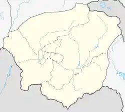 Artabuynk | |
| Coordinates: 39°51′54″N 45°19′32″E | |
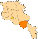
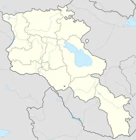
| Country | Armenia |
| Province | Vayots Dzor |
| Municipality | Yeghegis |
| Population | |
| • Total | 984 |
| Time zone | UTC+4 (AMT) |
| Artabuynk at GEOnet Names Server | |
Artabuynk (Armenian: Արտաբույնք) is a village in the Yeghegis Municipality of the Vayots Dzor Province of Armenia.[2] It is situated 17 km north of the Province center, on the right bank of one of the tributaries of the Yeghegis River.
Etymology
The village was previously known as Yeghegis, Yekhegis, Alagyaz and Erdapin.
History
Records related to the name of the village have been mentioned in Armenian historiography since the 5th century. In 1828, 38 families from Khoy gavar resettled in Erdapin village.
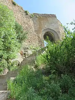
Elegis tributary of Yeghegis river flows through the village. On the eastern side of the village, there is an imposing mountain barrier, atop which stands the Smbataberd fortress. Constructed in the 12th century, the fortress served as the residence of the Orbelians and was named after Smbat, the ishkhan of Syunik.
Situated northwest of Smbataberd is the Tsaghats Kar church complex, built during the reign of Abas I in the 10th century.
Geography
Situated in the northeastern part of the Yeghegnadzor-Selim highway, the village is approximately 17 km away from Yeghegnadzor, the center of the Province, and 6 km from the road of the republican significance. It shares its borders with Horbategh to the north, Shatin to the south, Yeghegis to the east, and Salli to the west.
Situated at an elevation of 1700 m above sea level, the village often experiences dry and drought-prone years. Towering mountains with lofty peaks surround the village, and the springs originating from the slopes provide the village with essential drinking and irrigation water.
Climate
The climate is cold in winter and cool in summer.
Population
Based on the 2011 RA census, Artabuynk had a permanent population of 984, and the current population stands at 970 individuals. The residents are Armenians, whose ancestors migrated from Khoyunts village of the Khoy region during the years 1829-1830.
The population dynamics of Artabuynk over the years:
| Year | 1831 | 1897 | 1926 | 1939 | 1959 | 1970 | 1979 | 1989 | 2001 | 2011 |
|---|---|---|---|---|---|---|---|---|---|---|
| Population | 172 | 530 | 780 | 1055 | 941 | 1107 | 1023 | 1042[3] | 1077 | 984[1] |
Occupation
The village has 438 households.
Agriculture is the primary economic activity in the village, with a focus on arable farming and animal husbandry. The community's pastures span 1136.8 hectares, arable lands cover 6.9 hectares, and grasslands extend over 197 hectares.
Historical and cultural sites
Artabuynk is home to a collection of historical landmarks, including the Tsaghats Kar monastery complex (11th century), Smbataberd fortress (10th century), Holy Mother of God Church (1321), Chri chapel (13th century), a 13th-century fortress, a Cyclopean fortress dating back to the 2nd-1st millennium BC and khachkars (cross-stones) from the 10th to the 16th centuries.
In the vicinity of the village, there are more khachkars dating from the 9th to the 13th centuries.
Gallery
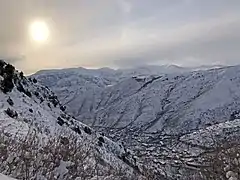 Smbatasar mountain
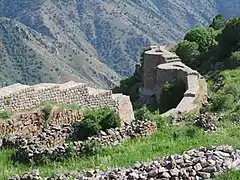 Smbataberd
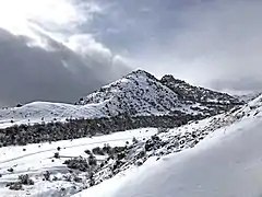 Smbatasar mountain
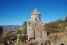 Tsaghats Kar Monastery, St. Karapet
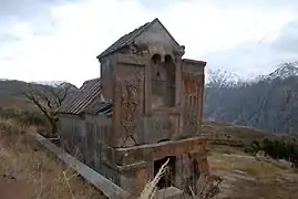 Tsaghats Kar Monastery, St. Surp Nshan
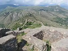 Smbataberd
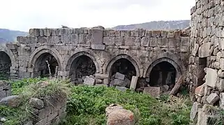 Tsaghats Kar monastic complex
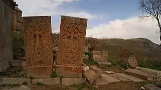 Khachkars in Tsaghats Kar
References
- Statistical Committee of Armenia. "The results of the 2011 Population Census of Armenia" (PDF).
- "RA Vayots Dzor Marz" (PDF). Marzes of the Republic of Armenia in Figures. 2009. pp. 264–270. Retrieved 27 June 2023.
- H. Barseghyan, S. Melik-Bakhshyan, E. Aghayan (2001). Dictionary of the toponymy of Armenia and adjacent territories, vol. 5. Yerevan: YSU Publishing House. p. 916.
{{cite book}}: CS1 maint: multiple names: authors list (link)