Nor Aznaberd
Nor Aznaberd
Նոր Ազնաբերդ | |
|---|---|
 Nor Aznaberd 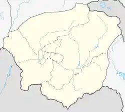 Nor Aznaberd | |
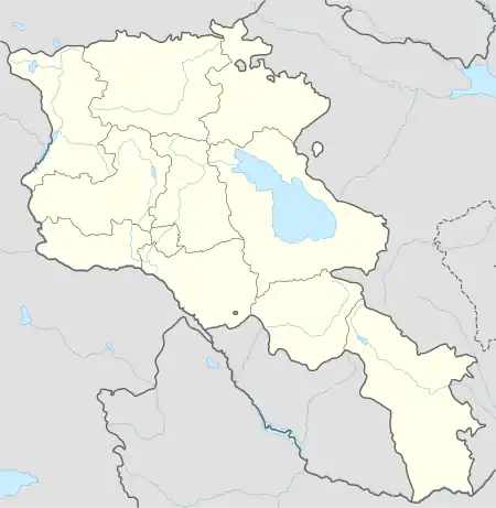
| Coordinates: 39°32′39″N 45°25′00″E | |
| Country | Armenia |
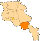
| Province | Vayots Dzor |
| Municipality | Vayk |
| Population | |
| • Total | 126 |
| Time zone | UTC+4 (AMT) |
| Nor Aznaberd at GEOnet Names Server | |
Nor Aznaberd (Armenian: Նոր Ազնաբերդ, former names: Gyulstan, Itrghan) is a village in the Vayk Municipality of the Vayots Dzor Province of the Republic of Armenia.[2] It is located 42 km southeast of the Province center, on the bank of the upper left tributary of the Chahuk River, on the steep southern slope of the Vayots Dzor mountains.
In January 1935, the name of Itrghan was changed to Gyulstan.[3] Then, on April 3, 1991, it was renamed once again to Nor Aznaberd.
Geography
The village is traversed by two rivers known as Chahuk and Lvis. It shares a border of approximately 5 km with the Bzkov village of Nakhichevan and also borders the Khndzorut and Sers communities within the Province. Situated at an elevation of 1630 m above sea level, it is located 46 km away from the Province center.
The village spans a total area of 1191 ha.
Population
According to the results of the RA 2011 census, Nor Aznaberd had a recorded permanent population of 126 individuals, with a current population of 122 people.[4] Until 1989, the village was predominantly inhabited by Azerbaijanis.[5][3]
The population dynamics of Nor Aznaberd over the years:
| Year | Population |
|---|---|
| 1831 | 157[6] |
| 1873 | 257[5] |
| 1897 | 235[6] |
| 1926 | 96[6] |
| 1939 | 202[6] |
| 1959 | 148[6] |
| 1979 | 253[6] |
| 2001 | 182[6] |
| 2011 | 126[4] |
Occupation
The population is engaged in animal husbandry and arable farming.
Historical and cultural sites
In 1991, a memorial monument and khachkar commemorating the victims of the Karabakh movement were installed near the village entrance in an area known as Taq jur (Hot water).
The ruins of Verin Shenik village can be found alongside the Chahuk River.
Public facilities
The village does not have an educational institution. The children attend the school in the nearby Khndzorut village. The village has a house of culture which is not functioning.
References
- Statistical Committee of Armenia. "The results of the 2011 Population Census of Armenia" (PDF).
- "RA Vayots Dzor Marz" (PDF). Marzes of the Republic of Armenia in Figures. 2009. pp. 264–270. Retrieved 27 June 2023.
- H. Barseghyan, S. Melik-Bakhshyan, E. Aghayan (1986). Dictionary of the toponymy of Armenia and adjacent territories, vol. 1. Yerevan: YSU Publishing House. p. 910.
{{cite book}}: CS1 maint: multiple names: authors list (link) - "Distribution of the current and permanent population of the Republic of Armenia by administrative-territorial divisions and gender" (PDF). 2011. pp. 93–121. Retrieved 27 June 2023.
- Zaven Korkotyan (1932). The population of Soviet Armenia in the last century (1831-1931) (PDF). Yerevan: Publication of the Melkonian Fund.
- "Centre of Geodesy and Cartography" SNCO under Cadastre Committee of the Republic of Armenia (2008). Dictionary of settlements of the Republic of Armenia (PDF). Yerevan. p. 184. Archived from the original (PDF) on 2020-02-09.
{{cite book}}: CS1 maint: location missing publisher (link)
External links
- Report of the results of the 2001 Armenian Census, Statistical Committee of Armenia
- Nor Aznaberd at GEOnet Names Server
- Kiesling, Brady (2005), Rediscovering Armenia: Guide, Yerevan, Armenia: Matit Graphic Design Studio
- Kiesling, Brady (June 2000). Rediscovering Armenia: An Archaeological/Touristic Gazetteer and Map Set for the Historical Monuments of Armenia (PDF). Archived (PDF) from the original on 6 November 2021.