Beaupont
Beaupont (French pronunciation: [bopɔ̃]) is a commune in the Ain department in eastern France.
Beaupont | |
|---|---|
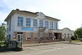 Town hall | |
Location of Beaupont | |
 Beaupont  Beaupont | |
| Coordinates: 46°24′41″N 5°16′01″E | |
| Country | France |
| Region | Auvergne-Rhône-Alpes |
| Department | Ain |
| Arrondissement | Bourg-en-Bresse |
| Canton | Saint-Étienne-du-Bois |
| Intercommunality | Bassin de Bourg-en-Bresse |
| Government | |
| • Mayor (2020–2026) | Gérard Janodet[1] |
| Area 1 | 14.07 km2 (5.43 sq mi) |
| Population | 683 |
| • Density | 49/km2 (130/sq mi) |
| Time zone | UTC+01:00 (CET) |
| • Summer (DST) | UTC+02:00 (CEST) |
| INSEE/Postal code | 01029 /01270 |
| Elevation | 187–228 m (614–748 ft) (avg. 199 m or 653 ft) |
| 1 French Land Register data, which excludes lakes, ponds, glaciers > 1 km2 (0.386 sq mi or 247 acres) and river estuaries. | |
Geography
Beaupont is 28 km north of Bourg-en-Bresse and about 100 km from Lyon. The Solnan forms most of the commune's eastern border. The Sevron forms the commune's western border.
Population
| Year | Pop. | ±% p.a. |
|---|---|---|
| 1968 | 575 | — |
| 1975 | 515 | −1.56% |
| 1982 | 415 | −3.04% |
| 1990 | 422 | +0.21% |
| 1999 | 492 | +1.72% |
| 2007 | 560 | +1.63% |
| 2012 | 675 | +3.81% |
| 2017 | 689 | +0.41% |
| Source: INSEE[3] | ||
See also
References
- "Répertoire national des élus: les maires". data.gouv.fr, Plateforme ouverte des données publiques françaises (in French). 9 August 2021.
- "Populations légales 2020". The National Institute of Statistics and Economic Studies. 29 December 2022.
- Population en historique depuis 1968, INSEE
Wikimedia Commons has media related to Beaupont.
This article is issued from Wikipedia. The text is licensed under Creative Commons - Attribution - Sharealike. Additional terms may apply for the media files.