Birieux
Birieux (French pronunciation: [biʁjø]; Arpitan: Beriô) is a commune in the Ain department in eastern France.
Birieux | |
|---|---|
Commune | |
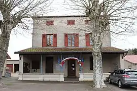 Town hall | |
 Coat of arms | |
Location of Birieux | |
 Birieux  Birieux | |
| Coordinates: 45°57′12″N 5°02′23″E | |
| Country | France |
| Region | Auvergne-Rhône-Alpes |
| Department | Ain |
| Arrondissement | Bourg-en-Bresse |
| Canton | Villars-les-Dombes |
| Intercommunality | Dombes |
| Government | |
| • Mayor (2022–2026) | Cyril Baillet[1] |
| Area 1 | 15.83 km2 (6.11 sq mi) |
| Population | 285 |
| • Density | 18/km2 (47/sq mi) |
| Time zone | UTC+01:00 (CET) |
| • Summer (DST) | UTC+02:00 (CEST) |
| INSEE/Postal code | 01045 /01330 |
| Elevation | 277–295 m (909–968 ft) (avg. 285 m or 935 ft) |
| 1 French Land Register data, which excludes lakes, ponds, glaciers > 1 km2 (0.386 sq mi or 247 acres) and river estuaries. | |
Geography
The Chalaronne forms part of the commune's northwestern border.
History
Birieux is first mentioned in the 12th century as a priory dependent on the abbey of l'Île Barbe à Lyon.
In the Middle Ages, Birieux was a possession of the lords of Thoire-Villars.
In 1789, the commune was included in the canton of Meximieux.
Population
| Year | Pop. | ±% p.a. |
|---|---|---|
| 1968 | 110 | — |
| 1975 | 97 | −1.78% |
| 1982 | 102 | +0.72% |
| 1990 | 125 | +2.57% |
| 1999 | 145 | +1.66% |
| 2007 | 220 | +5.35% |
| 2012 | 265 | +3.79% |
| 2017 | 283 | +1.32% |
| Source: INSEE[3] | ||
Economy
The region is primarily agricultural, producing grain and cattle.
See also
References
- "Répertoire national des élus: les maires" (in French). data.gouv.fr, Plateforme ouverte des données publiques françaises. 13 September 2022.
- "Populations légales 2020". The National Institute of Statistics and Economic Studies. 29 December 2022.
- Population en historique depuis 1968, INSEE
External links
Wikimedia Commons has media related to Birieux.
This article is issued from Wikipedia. The text is licensed under Creative Commons - Attribution - Sharealike. Additional terms may apply for the media files.