Belleydoux
Belleydoux (French pronunciation: [bəlɛdu][3]) is a commune in the Ain department in eastern France.
Belleydoux | |
|---|---|
Commune | |
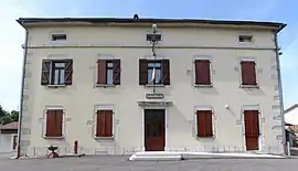 Town hall | |
Location of Belleydoux | |
 Belleydoux  Belleydoux | |
| Coordinates: 46°15′09″N 5°46′39″E | |
| Country | France |
| Region | Auvergne-Rhône-Alpes |
| Department | Ain |
| Arrondissement | Nantua |
| Canton | Nantua |
| Intercommunality | Haut-Bugey Agglomération |
| Government | |
| • Mayor (2020–2026) | Pascal Courtois[1] |
| Area 1 | 17.63 km2 (6.81 sq mi) |
| Population | 308 |
| • Density | 17/km2 (45/sq mi) |
| Time zone | UTC+01:00 (CET) |
| • Summer (DST) | UTC+02:00 (CEST) |
| INSEE/Postal code | 01035 /01130 |
| Elevation | 616–1,281 m (2,021–4,203 ft) (avg. 834 m or 2,736 ft) |
| 1 French Land Register data, which excludes lakes, ponds, glaciers > 1 km2 (0.386 sq mi or 247 acres) and river estuaries. | |
Geography
Belleydoux is situated at the southernmost end of the Hautes-Combes in the Jura mountains, and lies in the Semine valley, a tributary of the Rhône via the Valserine river. The village is overlooked by the Roche Fauconnière cliff.
Population
| Year | Pop. | ±% p.a. |
|---|---|---|
| 1968 | 250 | — |
| 1975 | 200 | −3.14% |
| 1982 | 222 | +1.50% |
| 1990 | 232 | +0.55% |
| 1999 | 277 | +1.99% |
| 2007 | 287 | +0.44% |
| 2012 | 332 | +2.96% |
| 2017 | 314 | −1.11% |
| Source: INSEE[4] | ||
Notable people
- Gabriel Taborin (1799–1864), religious Brother and founder
See also
References
- "Répertoire national des élus: les maires" (in French). data.gouv.fr, Plateforme ouverte des données publiques françaises. 13 September 2022.
- "Populations légales 2020". The National Institute of Statistics and Economic Studies. 29 December 2022.
- Panne de dameuse et l'avenir du ski en question à Belleydoux (Ain), archived from the original on 21 December 2021, retrieved 29 July 2021
- Population en historique depuis 1968, INSEE
Wikimedia Commons has media related to Belleydoux.
This article is issued from Wikipedia. The text is licensed under Creative Commons - Attribution - Sharealike. Additional terms may apply for the media files.