Chak Sunda
Chak Sunda is a village in Harchandpur block of Rae Bareli district, Uttar Pradesh, India.[2] As of 2011, its population is 1,223, in 204 households.[2] It has one primary school and no healthcare facilities.[2]
Chak Sunda | |
|---|---|
Village | |
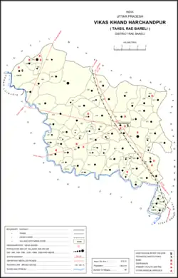 Map showing Chak Sunda (#239) in Harchandpur CD block | |
 Chak Sunda Location in Uttar Pradesh, India | |
| Coordinates: 26.30699°N 81.107779°E[1] | |
| Country India | |
| State | Uttar Pradesh |
| District | Raebareli |
| Area | |
| • Total | 1.115 km2 (0.431 sq mi) |
| Population (2011)[2] | |
| • Total | 1,223 |
| • Density | 1,100/km2 (2,800/sq mi) |
| Languages | |
| • Official | Hindi |
| Time zone | UTC+5:30 (IST) |
| PIN | 229308[2] |
| Vehicle registration | UP-35 |
The 1961 census recorded Chak Sunda as comprising 3 hamlets, with a total population of 594 people (306 male and 288 female), in 103 households and 103 physical houses.[3] The area of the village was given as 279 acres.[3]
The 1981 census recorded Chak Sunda as having a population of 838 people, in 123 households, and having an area of 105.63 hectares.[4]
References
- Search for "Chak Sunda" here https://geonames.nga.mil/namesgaz/.
{{cite web}}: Missing or empty|title=(help) - "Census of India 2011: Uttar Pradesh District Census Handbook - Rae Bareli, Part A (Village and Town Directory)" (PDF). Census 2011 India. pp. 168–84. Retrieved 1 August 2021.
- Census 1961: District Census Handbook, Uttar Pradesh (39 - Raebareli District) (PDF). Lucknow. 1965. pp. xxxviii-xxxix of section "Rae Bareli Tahsil". Retrieved 1 August 2021.
{{cite book}}: CS1 maint: location missing publisher (link) - Census 1981 Uttar Pradesh: District Census Handbook Part XIII-A: Village & Town Directory, District Rae Bareli (PDF). 1982. pp. 82–3. Retrieved 1 August 2021.
This article is issued from Wikipedia. The text is licensed under Creative Commons - Attribution - Sharealike. Additional terms may apply for the media files.