Ghurhat
Ghurhat is a village in Salon block of Rae Bareli district, Uttar Pradesh, India.[2] It is located 37 km from Raebareli, the district headquarters.[3] As of 2011, Ghurhat has a population of 693 people, in 115 households.[2] It has one primary school and no healthcare facilities.[2]
Ghurhat | |
|---|---|
Village | |
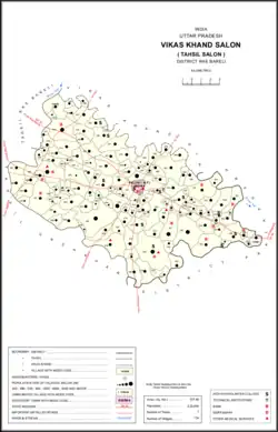 Map showing Ghurhat (#498) in Salon CD block | |
 Ghurhat Location in Uttar Pradesh, India | |
| Coordinates: 25.991894°N 81.364695°E[1] | |
| Country India | |
| State | Uttar Pradesh |
| District | Raebareli |
| Area | |
| • Total | 0.998 km2 (0.385 sq mi) |
| Population (2011)[2] | |
| • Total | 693 |
| • Density | 690/km2 (1,800/sq mi) |
| Languages | |
| • Official | Hindi |
| Time zone | UTC+5:30 (IST) |
| Vehicle registration | UP-35 |
The 1961 census recorded Ghurhat as comprising 3 hamlets, with a total population of 299 people (143 male and 156 female), in 66 households and 61 physical houses.[4] The area of the village was given as 250 acres.[4]
The 1981 census recorded Ghurhat as having a population of 424 people, in 102 households, and having an area of 90.96 hectares.[3] The main staple foods were given as wheat and rice.[3]
References
- ""Geonames Search"". Do a radial search using these coordinates here.
- "Census of India 2011: Uttar Pradesh District Census Handbook - Rae Bareli, Part A (Village and Town Directory)" (PDF). Census 2011 India. pp. 427–51. Retrieved 11 September 2021.
- Census 1981 Uttar Pradesh: District Census Handbook Part XIII-A: Village & Town Directory, District Rae Bareli (PDF). 1982. pp. 227–8. Retrieved 11 September 2021.
- Census 1961: District Census Handbook, Uttar Pradesh (39 - Raebareli District) (PDF). Lucknow. 1965. pp. cxii-cxiii of section "Salon Tahsil". Retrieved 11 September 2021.
{{cite book}}: CS1 maint: location missing publisher (link)
This article is issued from Wikipedia. The text is licensed under Creative Commons - Attribution - Sharealike. Additional terms may apply for the media files.