Shergarh, Raebareli
Shergarh is a village in Shivgarh block of Rae Bareli district, Uttar Pradesh, India.[2] As of 2011, its population is 548, in 111 households.[2] It has no schools and no healthcare facilities.[2] It is located 11 km from Maharajganj, the tehsil headquarters.[3] The main staple foods are wheat and rice.[3]
Shergarh | |
|---|---|
Village | |
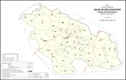 Map showing Shergarh (#877) in Shivgarh CD block | |
 Shergarh Location in Uttar Pradesh, India | |
| Coordinates: 26.50955°N 81.281958°E[1] | |
| Country India | |
| State | Uttar Pradesh |
| District | Raebareli |
| Area | |
| • Total | 0.774 km2 (0.299 sq mi) |
| Population (2011)[2] | |
| • Total | 548 |
| • Density | 710/km2 (1,800/sq mi) |
| Languages | |
| • Official | Hindi |
| Time zone | UTC+5:30 (IST) |
| Vehicle registration | UP-35 |
The 1961 census recorded Shergarh as comprising 3 hamlets, with a total population of 294 people (161 male and 133 female), in 58 households and 53 physical houses.[4] The area of the village was given as 203 acres.[4]
The 1981 census recorded Shergarh as having a population of 333 people, in 74 households, and having an area of 82.15 hectares.[3]
References
- "GeoNames Search". geonames.nga.mil. Archived from the original on 12 April 2014. Retrieved 23 June 2023.
- "Census of India 2011: Uttar Pradesh District Census Handbook - Rae Bareli, Part A (Village and Town Directory)" (PDF). Census 2011 India. pp. 91–107. Retrieved 31 July 2021.
- Census 1981 Uttar Pradesh: District Census Handbook Part XIII-A: Village & Town Directory, District Rae Bareli (PDF). 1982. pp. 34–5. Retrieved 31 July 2021.
- Census 1961: District Census Handbook, Uttar Pradesh (39 - Raebareli District) (PDF). Lucknow. 1965. pp. xvi-xvii of section "Maharajganj Tahsil". Retrieved 31 July 2021.
{{cite book}}: CS1 maint: location missing publisher (link)
This article is issued from Wikipedia. The text is licensed under Creative Commons - Attribution - Sharealike. Additional terms may apply for the media files.