MetroLink (St. Louis)
MetroLink (reporting mark BSDA) is a light rail system that serves the Greater St. Louis area. Operated by Metro Transit in a shared fare system with MetroBus,[7] the two-line, 38-station system runs from St. Louis Lambert International Airport and Shrewsbury in Missouri to Scott Air Force Base in Illinois. Intermediate destinations include downtown Clayton, Forest Park, and downtown St. Louis. It is the only U.S. light rail system to cross state lines.
In 2022, MetroLink had about 6,702,600 riders.[2] As of the third quarter of 2020, its ridership ranked 11th among the country's light rail systems, and second only to Minneapolis Metro Transit in the Midwestern United States.[8]
MetroLink shares many characteristics of a light metro or rapid transit service,[9][10] including a completely independent right-of-way, a higher top speed, and level boarding at all platforms.[10][11]
History
Construction on the initial MetroLink alignment from St. Louis Lambert International Airport to the 5th & Missouri station in East St. Louis began in 1990. The first 13.9-mile (22.4 km) segment with 16 stations opened on July 31, 1993. between the North Hanley and 5th & Missouri stations and initially operated with 31 high-floor vehicles.[3][12] The remainder of this initial 17-mile (27 km) alignment was completed on June 25, 1994, when the extension to Lambert Airport Main opened.[13] Three stations have been added to this original alignment: East Riverfront in 1994, Lambert Airport East in 1998, and Cortex in 2018.[14][15]
About 14 miles (22.5 km) of the original 17-mile (27 km) alignment reused existing railroad right-of-way. The capital cost to build the initial phase of MetroLink was $465 million, including $348 million from the Federal Transit Administration (FTA).[16]
Construction on the St. Clair County MetroLink extension from the 5th & Missouri station to the College station in Belleville began in 1998 and opened in May 2001. The extension added eight stations and seven park-ride lots. The total project cost was $339.2 million with $243.9 million paid by the FTA and $95.2 million paid by the St. Clair County Transit District (via a 1/2 cent sales tax passed in November 1993).[16]
In May 2003, a 3.5-mile (5.6 km) extension from Southwestern Illinois College to the Shiloh-Scott station opened. This $75 million project was funded by a $60 million grant from the Illinois FIRST (Fund for Infrastructure, Roads, Schools, and Transit) Program and $15 million from the St. Clair County Transit District.[16]
.jpg.webp)
The 8-mile (12.9 km) Cross County Extension opened on August 26, 2006 and added nine stations from Forest Park-DeBaliviere to Shrewsbury, Missouri. Intermediate stops include service to Washington University, Clayton, the Saint Louis Galleria and Maplewood.[17] The entire project was funded by a $430 million Metro bond issue. Citing repeated delays and cost overruns, Metro fired and then sued its general contractor, Cross County Collaborative, in the summer of 2004. Metro sought $81 million in damages for fraud and mismanagement while the Collaborative counter-sued for $17 million for work that Metro hadn't paid for. On December 1, 2007, a jury awarded the Collaborative $2.56 million.[18]
On October 27, 2008, Metro renamed the Lambert Airport branch the Red Line and the Shrewsbury branch the Blue Line. Blue Line service was also extended from its former terminus at Emerson Park to Fairview Heights. All trains have signs on the front and side that identify the train as a Red or Blue line train, and operators make live announcements identifying lines and stations.[12]
On September 9, 2014, the United States Department of Transportation announced $10.3 million in funding for a new Metrolink station between the Central West End and Grand stations in the Cortex research district. An additional $5 million in funding was provided by a public-private partnership including Washington University, BJC HealthCare, Great Rivers Greenway and the Cortex Innovation Community. The new Cortex station, located just east of Boyle Avenue, opened to the public on July 31, 2018.[19]
2022 flooding
On July 26, 2022, the Forest Park-DeBaliviere and Delmar Loop stations were flooded in a flash flood that shut down the system for nearly 72 hours and caused nearly $40 million in damage.[20][21] On September 5, 2022, Metro announced new schedules to accommodate repairs.[22] Damage included roughly 5 miles (8.0 km) of track bed, two elevators, two communications rooms and three signal houses. As of summer 2023, everything has been repaired except for one of the three signal houses, which controlled train movement at Forest Park-DeBaliviere where four tracks merge into two tracks and was a total loss. A replacement is being built on an elevated platform to reduce flood risk.[23]
On July 31, 2023, Metro received $27.7 million in federal emergency disaster relief funding to help cover the cost of flood damage.[24] Currently, both the Red and Blue Lines are operating at all stations along their routes. The Blue Line is operating on a single track between the Forest Park-DeBaliviere and University City-Big Bend stations to accommodate safe switching while the signal house is reconstructed. Metro expects to have trains operating on a full schedule by fall 2023.[23]
Chronology
Below is a list of dates on which parts of the MetroLink system opened for service.
| Date | Event | Stations | Length |
|---|---|---|---|
| July 31, 1993[25] | Line opens between North Hanley and 5th & Missouri | 16 | 13.9 mi (22.4 km) |
| May 14, 1994[25] | East Riverfront opens between existing stations | 1 | — |
| June 25, 1994[25] | Extension to Lambert Airport Main opens | 1 | 3.15 mi (5.1 km) |
| December 23, 1998[25] | Lambert Airport East opens between existing stations | 1 | — |
| May 5, 2001[25] | Extension to College opens | 8 | 17.4 mi (28 km) |
| June 23, 2003[25] | Extension to Shiloh-Scott opens | 1 | 3.5 mi (5.6 km) |
| August 26, 2006[26] | Extension to Shrewsbury-Lansdowne I-44 opens | 9 | 8 mi (13 km) |
| July 31, 2018[27] | Cortex opens between existing stations | 1 | — |
| Total | 38 | 46 mi (74 km) |
Current rail lines
.svg.png.webp)
Red Line

The 38-mile (61.2 km) Red Line alignment begins at Lambert St. Louis International Airport, making stops at the Terminal 1 and Terminal 2 stations. It proceeds through Kinloch before reaching the North Hanley station near Bel-Ridge. It stops twice at the University of Missouri St. Louis in Normandy: UMSL North and UMSL South. It heads south on the former Wabash/Norfolk & Western Railroad's Union Depot line that once brought passenger trains from Ferguson to Union Station. It travels into Pagedale, stopping at the Rock Road station and then at Wellston's namesake station on Plymouth Street. From here, the Red Line crosses the St. Louis City/County boundary at Skinker Boulevard, making a stop at the Delmar Loop station, which serves the Delmar Loop area and is located just below the Wabash Railroad's old Delmar Station building. At the following station, Forest Park-DeBaliviere, the Red Line meets the Blue Line. From this station, the two services share track until the Blue Line terminates at the Fairview Heights station in Illinois. From Fairview Heights, the Red Line continues south, serving Belleville, Illinois, and then terminating at the Shiloh-Scott station near Scott Air Force Base. For the rest of the Red Line, see the "Shared alignment" section.
Blue Line
The 24-mile (38.6 km) Blue Line alignment starts at the Shrewsbury-Lansdowne I-44 station in Shrewsbury, just west of the River des Peres. It crosses over Interstate 44 and continues north to two stations in Maplewood, Missouri (Sunnen and Maplewood/Manchester). The line continues north to the Brentwood I-64 station in Brentwood, Missouri, just south of Interstate 64. It then proceeds in a tunnel underneath Interstate 64, continuing to the Richmond Heights station, which serves the Saint Louis Galleria shopping mall. The line then proceeds through a sharp turn east to the Clayton station in the median of Forest Park Parkway in Clayton, Missouri, where it serves the Central Business District of St. Louis County. It heads east to the Forsyth station where it enters a tunnel to the University City-Big Bend subway station. After crossing the St. Louis City/County boundary, the Blue Line stops at the Skinker subway station, the last stop serving nearby Washington University. At the following station, Forest Park-DeBaliviere, the Blue Line meets the Red Line. From this station, the two services share track until the Blue Line terminates at the Fairview Heights station in Illinois.
Shared alignment
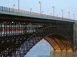
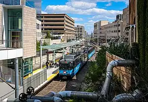
From the Forest Park-DeBaliviere station, the Red and Blue lines share tracks for 16 stations.[28] Continuing east, the Central West End station serves the Washington University Medical Center including Barnes-Jewish and St. Louis Children's hospitals. The next station, Cortex, was built to serve the Cortex Innovation Community. From here is the Grand station, located under the Grand Boulevard viaduct, which serves Saint Louis University and its namesake hospital. Trains then pass under the Jefferson Avenue viaduct before they enter the next stop at Union Station, located partially beneath the historic train shed at the popular St. Louis Union Station. A short distance later, trains stop at the Civic Center station and connect with the Gateway Transportation Center and Enterprise Center. Trains then continue east along Interstate 64 turning north toward the Stadium station. Stadium station serves Busch Stadium, Cupples Station, and the popular Ballpark Village district. Here, the line enters the historic St. Louis Freight Tunnel that was built in 1874 and converted to light rail usage beginning in 1991.[29] The next station is 8th & Pine, a subway station located under 8th Street serving the Central Business District. Following a curve eastward under Washington Avenue, the line then enters the Convention Center subway station serving the Dome and convention facilities at America's Center. It then exits the tunnel and makes stops on both sides of the historic Eads Bridge, first at the Laclede's Landing station and then the East Riverfront station in East St. Louis, Illinois. From there, it runs at-grade serving the 5th & Missouri, Emerson Park, Jackie Joyner-Kersee Center and Washington Park stations until the Blue Line terminates at the Fairview Heights station in Fairview Heights, Illinois. From here, Red Line trains continue to their terminus at the Shiloh-Scott station in Shiloh, Illinois.
Rolling stock
.jpg.webp)
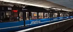
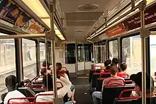
MetroLink operates 87 Siemens SD-400 and SD-460 light rail vehicles. Each 90-foot (27 m), single articulated vehicle has four high platform doors per side and can hold 72 seated and 106 standing passengers.[30][31] The cars are powered by an electric motor which gets its electricity from a catenary wire with a 750-volt supply.[32]
Each car has an enclosed operator cab at each end. This configuration is the most flexible for operations but prevents travel between cars. Each car has separate doors for boarding at station level and track level; in normal operations, the track-level doors (equipped with stairs) are unused.
In 2026, Metro plans to begin phasing out the original SD-400 cars and to refurbish the SD-460 cars for continued use.[33] In May 2023, Metro received a $196.2 million federal grant to purchase up to 48 Siemens S200 high-floor light rail vehicles to replace 25 of the oldest cars.[34]
Metro operates two storage and maintenance facilities. Ewing Yard sits between the Grand and Union Station stops just west of downtown St. Louis; 29th Street Yard is located between the JJK Center and Washington Park stops in East St. Louis.
Roster
| Unit Type | Year Built | Quantity | Numbers[35] |
|---|---|---|---|
| Siemens SD400 | 1991–1993 | 31[36] | 1001–1031 |
| Siemens SD460 | 1999 | 10 | 2001–2010 |
| 2000 | 24 | 3001–3024 | |
| 2004–2005 | 22 | 4001–4022 | |
| Siemens S200 | Deliveries to begin in 2026[34] | ||
Fares
MetroLink uses a proof-of-payment system. Tickets can be purchased at ticket-vending machines at the entrance to all stations and must be validated before boarding the train. Single-ride tickets are good for up to two hours in the direction that a passenger initially boards.[12] Some fares, such as monthly or weekly fares, do not need to be validated, but passengers must have the pass in their possession while riding and must show the pass to security personnel upon request. Reduced fares can be purchased by seniors ages 65+, people with disabilities, and children ages 5–12. Up to three children under 5 may ride free with a fare-paying rider. Proof of age may be requested of all people riding with reduced fares. Other types of passes include a Semester Pass for full-time students.[37]
In 2018, Metro introduced the Gateway Card, a multi-use smart card that was intended to eliminate most paper passes and tickets. In 2023, Metro announced that it would replace the Gateway Card—one Bi-State official called it a "failed system"—with a new fare collection system as part of the Secure Platform Plan.[38]
Secure Platform Plan
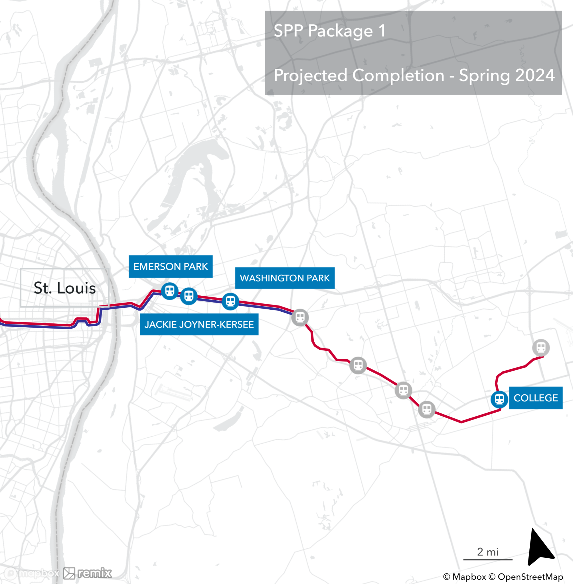
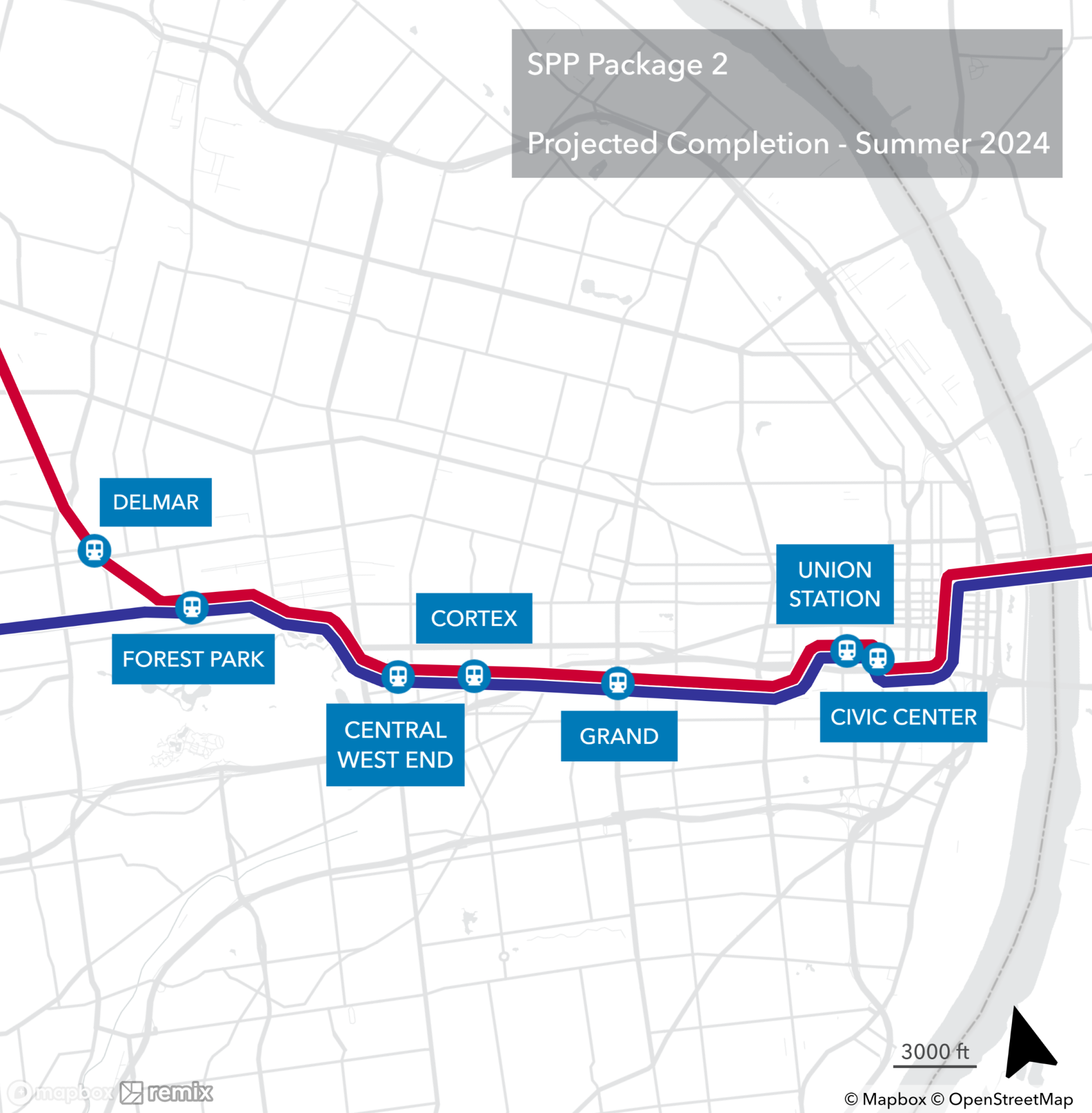
In 2024, Metro Transit will begin adding turnstiles at all MetroLink stations as part of its $52 million Secure Platform Plan (SPP). Stations will also receive a new fare collection system, additional fencing, passenger assist telephones, and cameras monitored from a new real-time camera center.[39]
The SPP will be implemented in six phases of four to eight stations apiece. The first two phases are slated for completion in 2024 and the rest in 2025. The first phase covers four Illinois stations; the second, seven Missouri stations.[39] On September 26, 2023, Millstone Weber LLC was awarded a $6.4 million contract for the first phase with completion expected in spring 2024.[40]
Projects in progress
MidAmerica Airport
In 2019, the St. Clair County Transit District was awarded $96 million in Illinois infrastructure funding to build a 5.2-mile (8.4 km) extension of the Red Line from Shiloh-Scott to MidAmerica St. Louis Airport in Mascoutah.[41] This extension will include a 2.6-mile (4.2 km) double-track segment, a single-track segment of the same length, and a passenger station at the airport.[42] Design work was completed in the summer of 2022; construction began in 2023. Metro expects to begin operations in 2025.[43][44]
Infrastructure Improvements
In 2023, Metro began a system-wide rehabilitation program that will last up to two years.[45] That spring, Metro began rehabilitating the downtown subway tunnels, including the Laclede's Landing, Convention Center and 8th & Pine subway stations.[46] Elsewhere, curve tracks, catenary wire, system conduit, staircases and retaining walls are to be upgraded or replaced.[47] Three stations are to receive platform rehabilitations: Jackie Joyner-Kersee Center, Rock Road and Wellston.[47]
Beginning in 2024, Metro will begin to rehabilitate the Union Station tunnel, the Cross County tunnels, and stations between Forsyth and Skinker. A storage siding will be added near the Richmond Heights station.[47] In 2024, Metro expects to complete upgrades to the Supervisory Control Automated Data Acquisition (SCADA) and Public Address/Customer Information (PA/CIS) systems. The upgraded SCADA/PA/CIS will operate as an integrated system that monitors and controls operations and will allow Metro to provide real-time arrival information to passengers, such as live displays at stations.[47]
Projects in planning
North-South MetroLink
Northside/Southside - St. Louis City
- This 5.6-mile (9.0 km) expansion would serve about 14 stations between Chippewa Street in South St. Louis and Grand Boulevard in North St. Louis running primarily on Jefferson Avenue. Proposed frequency is 10 to 20 minutes operating between 5 a.m. and 1 a.m., 7 days a week. It would provide a fixed rail upgrade to Metro's high-volume #11 (Chippewa) and #4 (Natural Bridge) bus routes.[48] On September 22nd, 2023, Bi-State Development's board recommended for approval a 4-year, $18.9 million contract with the joint venture Northside-Southside Transit Partners to provide consulting services for the design phase of the project.[49]
St. Louis County Connector
- This extension would be a Phase II to Northside/Southside and continue from the North Grand station along Natural Bridge Avenue toward North St. Louis County. Higher-volume bus stops further west along Metro's #4 bus route support further expansion into North County.[50] In February 2023, Metro announced four routes for consideration with an LPA expected to be selected in the fall of 2023.[51]
The North-South corridor will not feature the rapid transit like characteristics of the Red and Blue lines but will be similar to other on-street light rail lines in the US, such as Houston or Phoenix, and would be separate from the rest of the system.[52] Because of this, an infill station to facilitate transfers will be constructed on the Red and Blue Lines where they intersect with the new Jefferson Avenue alignment.[53]
Previous proposals
Many of these extensions were proposed in 2010 when Metro released its 30-year long range plan, Moving Transit Forward.[54] Most are defunct as regional leadership has said their priorities are the proposed MetroLink extensions in the city of St. Louis and North St. Louis County.[55]
North-South MetroLink Corridors
NorthSide - Downtown to Florissant Valley Community College
- This 12-mile (19 km) extension would have run north from downtown St. Louis to the Florissant Valley Community College. A study for this extension was completed in 2008 and a Locally Preferred Alternative (LPA) was selected. The LPA would have begun in downtown St. Louis, traveling west on Delmar Boulevard to Jefferson Avenue, north on Jefferson to Natural Bridge Avenue then west on Natural Bridge to Goodfellow Boulevard. It would then travel north on Goodfellow to West Florissant Avenue and follow West Florissant to Florissant Valley Community College.[56] See "Projects in planning" section for updated plans as of 2023.
SouthSide - Downtown to Bayless
- This 9 to 17-mile (14-27 km) extension would run south from downtown St. Louis to Bayless at Interstate 55. A study for this extension was completed in 2008 and an LPA selected. The LPA begins at the Gateway Transportation Center at 14th Street & Spruce Street, continues south on 14th to Chouteau Avenue, then traveling west on Chouteau to Jefferson Avenue. It would then travel south on Jefferson to Meramec Street, where it would follow the Interstate 55 right-of-way to a terminus at Bayless Ave.[57]
Cross County Corridors
Daniel Boone - Clayton to Maryland Heights/Westport & Chesterfield
- A study performed in 2000 recommended a new MetroLink line from Clayton, Missouri, to Westport Plaza in Maryland Heights, Missouri. The 8 to 10-mile (13-16 km) line would have run north from the Clayton station along the disused Terminal Railroad Association of St. Louis "Central Belt" right-of-way paralleling Interstate 170, then turn west to follow existing Union Pacific Railroad trackage operated by Central Midland Railway to Page Avenue where the line would have then followed Page to Westport Plaza.[58][59] This proposed alignment would have added up to six stations between Clayton and Maryland Heights in the Interstate 170 and Page corridors serving Ladue, Olivette, and Overland.[60]
- A 12-mile (19 km) extension to Chesterfield would have been a potential Phase II of the Daniel Boone Corridor. The alignment would have headed west from Westport Plaza and crossed over Interstate 270 in Maryland Heights. It would have then run along the Page Avenue Extension (Highway 364) until it turned towards Creve Coeur Lake Memorial Park. It then would have headed westward to Spirit of St. Louis Airport in the Chesterfield Valley.[60] This alignment has not been given serious consideration because of its perceived low ridership potential.
MetroNorth - Clayton to Florissant
- This 12-mile (19 km) extension would have extended the current Blue Line from Clayton towards North County and into Florissant, Missouri. Like the Daniel Boone line, some of it will follow along the old Terminal Railroad Association of St. Louis "Central Belt" right-of-way paralleling I-170.[60]
MetroSouth - Shrewsbury to Butler Hill
- This 12-mile (19 km) extension would have extended the current Blue Line from its terminus in Shrewsbury, Missouri, further into South County beyond Interstates 270/255 to Butler Hill Road. An environmental impact study was completed in 2004; however, selection of an LPA was deferred due to the lack of local funding sources as well as other factors.[61]
St. Charles County Corridor
- Lambert Airport to St. Charles County: Proposals to expand MetroLink 16 to 20 miles (26 to 32 km) from Lambert Airport northwestward to St. Charles County were abandoned after St. Charles County voters rejected a sales tax in 1996 to fund an extension; subsequently, all MetroBus service was ended. The proposed route would have used the Old St. Charles Bridge (now demolished) to cross the Missouri River and reach St. Charles, St. Peters, and O'Fallon.[62]
Madison County Corridors
- East St. Louis to Alton/Edwardsville: After a 2005 study looked at the potential costs, ridership, and effects, the East-West Gateway Council of Governments developed two recommended alignments for extending Metrolink into Madison County, Illinois. Both start from the 5th & Missouri station in East St Louis in St. Clair County and run 21 to 23 miles (34 to 37 km) to connect Granite City, Collinsville, Glen Carbon, Edwardsville, East Alton, Wood River, and Alton. The alignments would have split in Madison, Illinois. To plan any Madison County extensions, Metro will have to collaborate with Madison County Transit.[63]
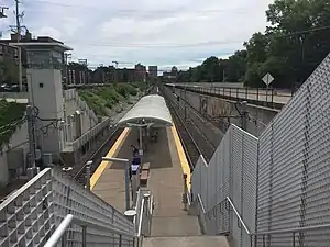
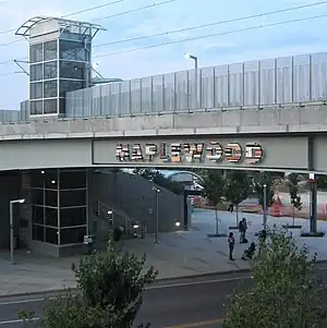
Station gallery

.jpg.webp)
.jpg.webp)
.jpg.webp)
.jpg.webp)

.jpg.webp)
.jpg.webp)

.jpg.webp)

.jpg.webp)
.jpg.webp)
.jpg.webp)
See also
- Bi-State Development Agency
- Loop Trolley
- Metro Call-A-Ride
- MetroBus
- MetroLink Blue Line
- MetroLink Red Line
- St. Clair County Transit District
- List of MetroLink (St. Louis) stations
- List of Metro Transit (St. Louis) yards and depots
- List of rail transit systems in the US
- List of rapid transit systems
- List of tram and light-rail transit systems
References
- "Transit Ridership Report Second Quarter 2023" (PDF). American Public Transportation Association. September 13, 2023. Retrieved September 21, 2023.
- "Transit Ridership Report Fourth Quarter 2022" (PDF). American Public Transportation Association. March 1, 2023. Retrieved March 29, 2023.
- "History – The 1990s – MetroLink". Bi-State Development Agency (Metro). 2010. Archived from the original on August 23, 2013. Retrieved August 11, 2013.
- "Procurement Information". Bi-State Development Agency (Metro). 2010. Archived from the original on August 18, 2013. Retrieved August 11, 2013.
- St.Louis Metro Link Project, Final Environmental Impact Statement. U.S. Department of Transportation Urban Mass Transportation Administration, East-West Gateway Coordinating Council. October 9, 1987. pp. 2–26. Retrieved December 10, 2018.
- "A Lesson for Jacksonville: The St. Louis Metrolink". Metro Jacksonville. April 9, 2009. Retrieved December 10, 2018.
- "Fare Increase 2014". Metrostlouis.org. Archived from the original on April 16, 2016. Retrieved April 10, 2016.
- "APTA Q3 2020 Light Rail Transit Ridership Report" (PDF). Archived from the original (PDF) on January 3, 2021. Retrieved January 28, 2020.
- Track Design Handbook for Light Rail Transit. Transportation Research Board. 2012. ISBN 978-0-309-25824-1.
- "Joint International Light Rail Conference" (PDF). Onlinepubs.trb.org. p. 671. Retrieved July 25, 2022.
- Henry, Lyndon (2006). Sharing of Rail Transit Infrastructure by Streetcars and Larger Light Rail Vehicles: Design and Operational Issues. ISBN 978-1-931594-23-3.
- "World.nycsubway.org: St. Louis, Missouri". Nycsubway.org. Retrieved April 10, 2016.
- Tipton, Virgil (June 22, 1994). "Takeoff: MetroLink Opens Lambert Stop Saturday". St. Louis Post-Dispatch.
- "UrbanRail.Net > North America > USA > Missouri > St. Louis Metrolink". www.urbanrail.net. Retrieved September 14, 2023.
- "Soon-to-open Cortex MetroLink Station is more than just another stop, say regional transit leaders". STLPR. Retrieved September 14, 2023.
- "Metro – Inside MetroLink". Metro. Archived from the original on September 11, 2008. Retrieved October 23, 2007.
- "Metro Announces August 26 Grand Opening Date for Cross County MetroLink Extension" (PDF) (Press release). Metro. August 7, 2006. Archived from the original (PDF) on October 9, 2007. Retrieved June 7, 2007.
- American, Jessica Bassett Of the St Louis (December 6, 2007). "Metro loses suit against Cross County Collaborative". St. Louis American. Retrieved September 26, 2023.
- "MetroLink gets creative in opening first new station in more than a decade". Ksdk.com. Retrieved July 25, 2022.
- Lindsey (August 16, 2022). "MetroLink Flood Damage Update". metrostlouis.org. Retrieved September 12, 2022.
- Schrappen, Colleen. "MetroLink to resume full service, but cost for flood repairs could double". STLtoday.com. Retrieved September 12, 2022.
- Lindsey (September 1, 2022). "MetroLink Changes Starting September 5: Blue Line Service to Operate Between Shrewsbury and Forest Park". metrostlouis.org. Retrieved September 12, 2022.
- Jerry (August 9, 2023). "Flood Update: Metro Transit Receives $27.7 Million in Disaster Relief Funding". Metro Transit – Saint Louis. Retrieved September 5, 2023.
- Schlinkmann, Mark (August 1, 2023). "Metro gets nearly $28 million in federal aid to cover repairs after 2022 flood". STLtoday.com. Retrieved September 5, 2023.
- "UrbanRail.Net > North America > USA > Missouri > St. Louis Metrolink". Urbanrail.net. Retrieved April 10, 2016.
- "St. Louis Metro to Launch MetroLink Extension August 26". Apta.com. Archived from the original on February 2, 2017. Retrieved April 10, 2016.
- Hemphill, Evie. "Soon-to-open Cortex MetroLink Station is more than just another stop, say regional transit leaders". news.stlpublicradio.org. Retrieved June 17, 2019.
- "MetroLink Schematic Map" (PDF). Metro St. Louis.
- "St. Louis Freight Tunnel". Bridgehunter.com. Retrieved September 26, 2022.
- "Siemens AG – Projects – Rolling Stock". Siemens. Archived from the original on February 7, 2007. Retrieved January 23, 2007.
- "SD460 High-Floor Light Rail Vehicle – St. Louis, Missouri" (PDF). Siemens. Archived from the original (PDF) on February 10, 2015. Retrieved February 10, 2015.
- "The St. Louis Streetcar and MetroLink: Compatibility Issues to Address Before Expansion – nextSTL". nextSTL. March 15, 2013. Retrieved April 10, 2016.
- "@MetroSTL". Twitter. July 26, 2021. Retrieved July 27, 2021.
- Schlinkmann, Mark (May 5, 2023). "Feds give Metro $196 million grant for new MetroLink cars". STLtoday.com. Retrieved May 17, 2023.
- "Modern Urban Rail Systems". Bi-State Transit Info & Roster. Archived from the original on August 19, 2012.
- Equipment Railway Age January 1990 page 8
- "Fare Chart". Metro. Retrieved June 1, 2014.
- Schlinkmann, Mark (February 7, 2023). "Metro Transit replacing 'failed' $10.3 million smart card system". STLtoday.com. Retrieved September 25, 2023.
- "Secure Platform Plan Project". Metro Transit – Saint Louis. Retrieved September 15, 2023.
- Jerry (September 26, 2023). "Contract Awarded for First Construction Package of MetroLink's Secure Platform Plan". Metro Transit – Saint Louis. Retrieved September 26, 2023.
- Schlinkmann, Mark. "Illinois to pay for long-sought MetroLink extension to MidAmerica Airport". STLtoday.com. Retrieved September 20, 2022.
- "Trajectory for Transit in 2022 Points to Need for Continued Collaboration". January 19, 2022. Retrieved February 2, 2022.
- "When will MetroLink extension to MidAmerica Airport be complete? How much will it cost? - MidAmerica St. Louis Airport (BLV) | Mascoutah, IL". flymidamerica.com. July 14, 2021. Retrieved September 20, 2022.
- Menn, Mackenzie (November 21, 2022). "MetroLink Expansion in Illinois is on Track". St. Clair County Transit District. Retrieved January 30, 2023.
- "MetroLink Improvements". Metro Transit – Saint Louis. Retrieved September 26, 2023.
- "Transit Infrastructure Improvements". Metro Transit – Saint Louis. Retrieved September 26, 2023.
- "MetroLink Improvement Projects". Metro Transit – Saint Louis. Retrieved September 26, 2023.
- "Northside-Southside TAA" (PDF). East-West Gateway Council of Governments. Aecom.
- "Board of Commissioners 9/22/23" (PDF). Bi-State Development Agency. pp. 196–197. Retrieved September 26, 2023.
- "Northside-Southside TAA" (PDF). East-West Gateway Council of Governments. Aecom.
- Schlinkmann, Mark (February 18, 2023). "Bi-State reveals possible North County MetroLink routes". STLtoday.com. Retrieved September 12, 2023.
- "Claiming It Would "Divide Us", Stenger Opposes North-South Rail Transit – NextSTL". June 20, 2016.
- "Northside-Southside TAA" (PDF). East-West Gateway Council of Governments. Aecom.
- "Moving Transit Forward" (PDF). Metro Transit.
- Schlinkmann, Mark. "St. Louis County back in picture for north-south MetroLink expansion". STLtoday.com. Retrieved September 11, 2022.
- "MetroLink Planning – Northside". East-West Gateway. Archived from the original on August 3, 2008. Retrieved October 30, 2008.
- "MetroLink Planning – Southside". East-West Gateway. Archived from the original on March 26, 2009. Retrieved October 30, 2008.
- "MetroLink Planning – Daniel Boone". East-West Gateway. Archived from the original on March 20, 2007. Retrieved June 1, 2007.
- "St. Louis RR Maps". Railsandtrails.com. Retrieved July 25, 2022.
- "LPAs for Daniel Boone, Northside and Southside Study Areas" (PDF). East-West Gateway Council of Governments.
- "East-West Gateway Board Defers Selection of MetroLink Alternative for Metro South Study Area" (PDF). East-West Gateway. November 3, 2004. Archived from the original (PDF) on May 15, 2013. Retrieved September 29, 2010.
- Uptergrove, Kate. "St. Louis County to explore MetroLink expansion; St. Charles County says no". MidRiversNewsMagazine.com. Retrieved September 25, 2022.
- "Madison County Light Rail Feasibility Study Final Report" (PDF). East-West Gateway Council of Governments.
External links
- Metro – Official website for Metro Transit
- Bi-State Development – Official website for Bi-State Development
- St. Clair County Transit District – Official website for the St. Clair County Transit District
- Citizens for Modern Transit – St. Louis transit advocacy group
- Arts in Transit Website
| Lines | ||
|---|---|---|
| Infrastructure |
| |
| Rolling Stock | ||
| Rail Yards | ||
| Major Transit Centers | ||
| Connecting services | ||
| Other Connections | ||
| Expansions | ||
| Operators | ||
Italics denote lines or service which are planned or not operating Bold denotes primary transfers or terminals | ||