Sang Sefid Rural District
Sang Sefid Rural District (Persian: دهستان سنگ سفيد) is in Qareh Chay District of Khondab County, Markazi province, Iran.
Sang Sefid Rural District
Persian: دهستان سنگ سفيد | |
|---|---|
 Sang Sefid Rural District | |
| Coordinates: 34°15′34″N 49°10′35″E[1] | |
| Country | |
| Province | Markazi |
| County | Khondab |
| District | Qareh Chay |
| Population (2016)[2] | |
| • Total | 7,825 |
| Time zone | UTC+3:30 (IRST) |
At the National Census of 2006, its population (as a part of the former Khondab District of Arak County) was 8,669 in 2,112 households.[3] There were 8,569 inhabitants in 2,435 households at the following census of 2011, by which time the district had been separated from the county in the establishment of Khondab County.[4] At the most recent census of 2016, the population of the rural district was 7,825 in 2,447 households. The largest of its 14 villages was Aqdash, with 2,763 people.[2]
References
- OpenStreetMap contributors (31 August 2023). "Sang Sefid Rural District (Khondab County)" (Map). OpenStreetMap. Retrieved 31 August 2023.
- "Census of the Islamic Republic of Iran, 1395 (2016)". AMAR (in Persian). The Statistical Center of Iran. p. 00. Archived from the original (Excel) on 17 October 2020. Retrieved 19 December 2022.
- "Census of the Islamic Republic of Iran, 1385 (2006)". AMAR (in Persian). The Statistical Center of Iran. p. 00. Archived from the original (Excel) on 20 September 2011. Retrieved 25 September 2022.
- "Census of the Islamic Republic of Iran, 1390 (2011)" (Excel). Iran Data Portal (in Persian). The Statistical Center of Iran. p. 00. Retrieved 19 December 2022.
| Capital | 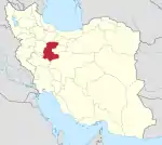 | ||||||||||||||||||||||||
|---|---|---|---|---|---|---|---|---|---|---|---|---|---|---|---|---|---|---|---|---|---|---|---|---|---|
| Counties and cities |
| ||||||||||||||||||||||||
| Sights |
| ||||||||||||||||||||||||
| populated places | |||||||||||||||||||||||||
| Capital | |||||||||||||||||||||||
|---|---|---|---|---|---|---|---|---|---|---|---|---|---|---|---|---|---|---|---|---|---|---|---|
| Districts |
| ||||||||||||||||||||||
This article is issued from Wikipedia. The text is licensed under Creative Commons - Attribution - Sharealike. Additional terms may apply for the media files.