Shazand County
Shazand County (Persian: شهرستان شازند) is in Markazi province, Iran. Its capital is the city of Shazand.
Shazand County
Persian: شهرستان شازند | |
|---|---|
County | |
 | |
 Location of Shazand County in Markazi province (bottom left, purple) | |
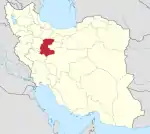
 Location of Markazi province in Iran | |
| Coordinates: 33°54′N 49°20′E[1] | |
| Country | |
| Province | Markazi |
| Capital | Shazand |
| Districts | Central, Qarah Kahriz, Sarband, Zalian |
| Population (2016)[2] | |
| • Total | 117,571 |
| Time zone | UTC+3:30 (IRST) |
| Shazand County can be found at GEOnet Names Server, at this link, by opening the Advanced Search box, entering "9207314" in the "Unique Feature Id" form, and clicking on "Search Database". | |
At the 2006 census, the county's population was 118,789 in 31,228 households.[3] The following census in 2011 counted 117,746 people in 35,084 households.[4] At the 2016 census, the county's population was 117,571 in 38,214 households.[2]
Administrative divisions
The population history and structural changes of Shazand County's administrative divisions over three consecutive censuses are shown in the following table. The latest census shows four districts, nine rural districts, and six cities.[2]
| Administrative Divisions | 2006[3] | 2011[4] | 2016[2] |
|---|---|---|---|
| Central District | 61,632 | 47,737 | 45,840 |
| Astaneh RD | 7,120 | 6,540 | 5,479 |
| Kazzaz RD | 13,161 | 12,014 | |
| Kuhsar RD | 3,150 | ||
| Qarah Kahriz RD | 25,040 | ||
| Astaneh (city) | 6,969 | 6,880 | 7,166 |
| Shazand (city) | 19,353 | 21,156 | 21,181 |
| Qarah Kahriz District | 19,120 | 18,119 | |
| Kuhsar RD | 2,611 | 2,088 | |
| Qarah Kahriz RD | 16,509 | 8,495 | |
| Shahbaz (city)1 | 7,536 | ||
| Sarband District | 14,492 | 12,076 | 10,214 |
| Hendudar RD | 8,608 | 6,784 | 5,665 |
| Malmir RD | 4,021 | 3,189 | 2,631 |
| Hendudar (city) | 1,863 | 2,103 | 1,918 |
| Zalian District | 42,665 | 38,813 | 43,398 |
| Nahr-e Mian RD | 9,741 | 8,945 | 8,245 |
| Pol-e Doab RD | 27,846 | 12,836 | 10,752 |
| Zalian RD | 2,911 | 2,408 | 1,753 |
| Mahajeran (city) | 12,293 | 20,346 | |
| Tureh (city) | 2,167 | 2,331 | 2,302 |
| Total | 118,789 | 117,746 | 117,571 |
| RD: Rural District 1Merger of the former villages of Bazneh and Hafteh[5] | |||
Wikimedia Commons has media related to Shazand County.
References
- OpenStreetMap contributors (1 September 2023). "Shazand County" (Map). OpenStreetMap. Retrieved 1 September 2023.
- "Census of the Islamic Republic of Iran, 1395 (2016)". AMAR (in Persian). The Statistical Center of Iran. p. 00. Archived from the original (Excel) on 17 October 2020. Retrieved 19 December 2022.
- "Census of the Islamic Republic of Iran, 1385 (2006)". AMAR (in Persian). The Statistical Center of Iran. p. 00. Archived from the original (Excel) on 20 September 2011. Retrieved 25 September 2022.
- "Census of the Islamic Republic of Iran, 1390 (2011)" (Excel). Iran Data Portal (in Persian). The Statistical Center of Iran. p. 00. Retrieved 19 December 2022.
- Rahimi, Mohammad Reza (17 July 2013). "Carrying out national divisions in Markazi province". Qavanin (in Persian). Ministry of Interior, Political and Defense Commission. Archived from the original on 1 September 2023. Retrieved 1 September 2023.
This article is issued from Wikipedia. The text is licensed under Creative Commons - Attribution - Sharealike. Additional terms may apply for the media files.
