Victoria Cross Ranges
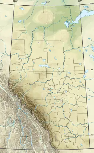
The Victoria Cross Ranges (52°55′N 118°18′W to 53°05′N 118°30′W) are a set of mountain ranges in the Canadian Rockies, located to the northwest of Jasper. Of the 19 peaks contained within this range, five are named after Canadian recipients of the Victoria Cross. The area of the ranges is 678 square kilometres (262 sq mi).[3]
| Victoria Cross Range | |
|---|---|
Victoria Cross Ranges | |
| Highest point | |
| Peak | Snaring Mountain |
| Elevation | 2,931 m (9,616 ft)[1] |
| Listing | Mountains of Alberta |
| Coordinates | 53°02′17″N 118°19′50″W[2] |
| Dimensions | |
| Area | 678 km2 (262 sq mi)[3] |
| Geography | |
 | |
| Country | Canada |
| Province | Alberta |
| Range coordinates | 53°00′N 118°18′W[4] |
| Parent range | Canadian Rockies |
| Topo map | NTS 83E2 Resplendent Creek[4] |
This range includes the following mountains and peaks:
| Mountain/Peak | Elevation (m/ft) | namesake | |
|---|---|---|---|
| Snaring Mountain | 2,931 | 9,616 | Named for local Indigenous tribe who used snares to trap small animals |
| Mount Bridgland | 2,930 | 9,610 | Morrison Bridgland (not VC recipient) |
| Mount Mahood | 2,896 | 9,501 | |
| Consort Mountain | 2,883 | 9,459 | Unknown |
| Mount Oliver | 2,865 | 9,400 | Frank Oliver |
| Mount Beaupré | 2,778 | 9,114 | |
| Monarch Mountain | 2,777 | 9,111 | |
| Pyramid Mountain | 2,766 | 9,075 | |
| Mount McKean | 2,743 | 8,999 | George Burdon McKean, VC |
| Buttress Mountain | 2,685 | 8,809 | |
| Mount Griesbach | 2,682 | 8,799 | William Antrobus Griesbach (not VC recipient) |
| Mount Kinross | 2,650 | 8,690 | Cecil John Kinross, VC |
| Mount Zengel | 2,630 | 8,630 | Raphael Louis Zengel, VC |
| Mount Henry | 2,629 | 8,625 | Henry A.F. MacLeod, CPR engineer[5] |
| Cairngorm | 2,610 | 8,560 | |
| Mount Kerr | 2,560 | 8,400 | John Chipman Kerr, VC |
| Emigrants Mountain | 2,553 | 8,376 | |
| Elysium Mountain | 2,446 | 8,025 | |
| Mount Pattison | 2,316 | 7,598 | John George Pattison, VC |
See also
Further reading
- Ferrigno, Jane G.; Williams, Richard S. (eds.). Glaciers of North America: Glaciers of Canada. U.S. Geological Survey Professional Paper 1386-J (Report). p. 269.
- Yorath, Chris; Gadd, Ben. Of Rocks, Mountains and Jasper: A Visitor's Guide To The Geology Of Jasper National Park. p. 133.
- Patton, Brian; Robinson, Bart. Canadian Rockies Trail Guide. p. 184.
References
- "Topographic map of Snaring Mountain". opentopomap.org. Retrieved 2023-04-02.
- "Snaring Mountain". Geographical Names Data Base. Natural Resources Canada. Retrieved 2023-04-06.
- "Victoria Cross Ranges". bivouac.com. Retrieved 2023-04-06.
- "Victoria Cross Ranges". Geographical Names Data Base. Natural Resources Canada. Retrieved 2023-04-06.
- Donovan and Monto, Alberta Place Names, p. 142
External links
This article is issued from Wikipedia. The text is licensed under Creative Commons - Attribution - Sharealike. Additional terms may apply for the media files.