This article was co-authored by wikiHow staff writer, Sophia Latorre. Sophia Latorre is a Content Manager on the wikiHow team. Before joining wikiHow, Sophia worked as a technical editor and was published in six International Energy Agency (IEA) Wind Annual Reports. Now, she writes, edits, and reviews articles for the wikiHow Content Team, working to make the content as helpful as possible for readers worldwide. Sophia holds a BA in English from Colorado State University.
There are 7 references cited in this article, which can be found at the bottom of the page.
wikiHow marks an article as reader-approved once it receives enough positive feedback. In this case, several readers have written to tell us that this article was helpful to them, earning it our reader-approved status.
This article has been viewed 200,959 times.
Learn more...
Observing clouds is a simple but efficient way to forecast short-term weather conditions. High, sparsely scattered clouds like cumulus and cirrus clouds generally don’t produce precipitation, while more ominous clouds like arcus clouds and funnel clouds indicate severe storms and rain, sleet, or snow. Track cloud changes over the course of a day for the most accurate picture of the weather forecast.
Steps
Recognizing Fair Weather Clouds
-
1Look high in the atmosphere for thin and feathery cirrus clouds. Cirrus clouds are made up of ice crystals falling through the atmosphere. They are wispy-looking and usually scattered sparsely across the sky. Cirrus clouds high in the atmosphere confirm good weather, as they rarely ever produce precipitation or storms.[1]
- Cirrus clouds are the most abundant of all high-level clouds.
-
2Check for puffy, scattered cumulus clouds low in the atmosphere. Cumulus clouds are the sort of clouds you'll see on a beautiful summer day. Look for bright, fluffy clouds spaced far enough apart to allow the blue sky to shine through clearly. Cumulus clouds usually indicate fair weather.[2]
- Stratocumulus clouds are denser and indicate light rain or snow.
Advertisement -
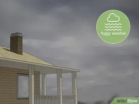
3Take note of low-hanging grey stratus clouds that stretch across the sky. Stratus clouds are typically seen on overcast days as they often block the entire sky with a dull grey color. Look for stratus clouds to confirm a foggy day with little to no precipitation.[3]
-
4Watch for dish-shaped lenticular clouds low in the atmosphere. Lenticular clouds occur mostly in mountainous or hilly areas where stable, moist air passes over elevated ground. Look for unique, UFO-shaped clouds that are especially striking right before sunset. Lenticular clouds are usually a sign of good weather as they are not associated with storms or strong precipitation.[4]
Spotting Precipitation and Storm Clouds
-
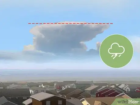
1Pay attention to tall, flat-topped cumulonimbus clouds that indicate storms. Cumulonimbus clouds a are larger, denser version of cumulus clouds that extend high into the atmosphere. Once they reach a part of the sky where the air is no longer buoyant, their shape flattens at the top. Look for these anvil-shaped clouds for a strong indication that a thunderstorm is coming.[5]
- Over the course of a day, fair weather cumulus clouds can turn into cumulonimbus clouds.
-
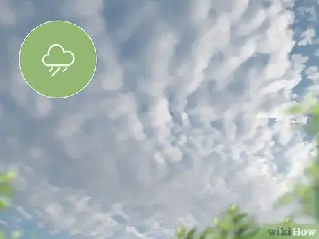
2Keep an eye out for cirrocumulus clouds high in the atmosphere, which produce precipitation. Cirrocumulus clouds develop from cirrus clouds. They have a ripple shape and are usually grainy in appearance. Look for cirrocumulus clouds to indicate an imminent rainfall or snowfall.[6]
- In tropical regions, cirrocumulus clouds may indicate an oncoming hurricane.
-
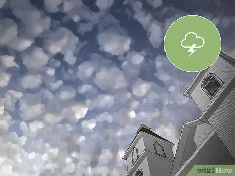
3Look for small patches of altocumulus clouds, which signify thunderstorms. Alto-cumulus clouds are mid-level clouds that are composed of water droplets and appear as grey, puffy, irregular objects. These clouds most often are seen in a layer of small clouds. Look for altocumulus clouds on days with warm, humid, temperatures to predict thunderstorms within a few hours.[7]
- For instance, if you see altocumulus clouds in the morning, it will likely storm in the afternoon.
-
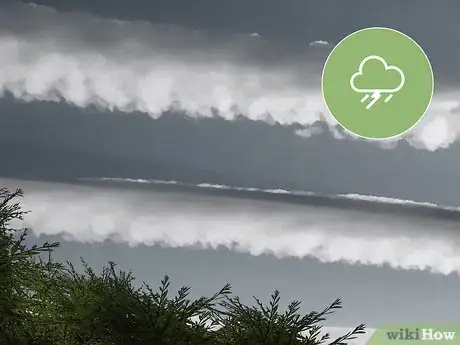
4Watch for low-hanging, shelf-like arcus clouds that indicate rain. Arcus clouds are horizontal clouds that hover ominously low. They are usually an indication that a storm is about to occur. Look for arcus clouds to predict rain, thunder, and lightening with near certainty.[8]
- Once you spot arcus clouds, seek shelter as soon as possible for protection from the storm.
-
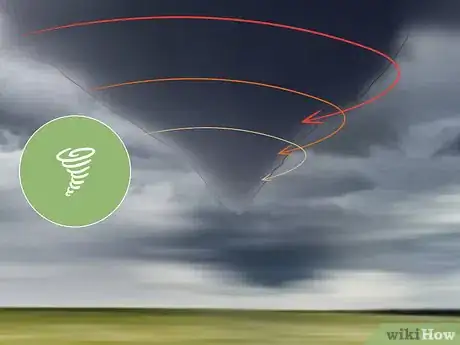
5Be aware of funnel clouds, which can form tornadoes. Funnel clouds have a tapered shape and appear to be coming from the base of a larger cloud. Tornadoes may occur if this type of cloud reaches the ground with a violent wind speed. Be on the lookout for funnel clouds which indicate that severe storm conditions are imminent.[9]
- Seek shelter right away if you spot a funnel cloud in the sky as heavy storms and tornadoes can be very dangerous.
Community Q&A
-
QuestionAre these all the types of clouds?
 Community AnswerNo. There are others depending on how specific you want to get. These are the major categories of clouds.
 -
QuestionDo thunderstorms always produce tornadoes?
 DonaganTop AnswererNo, many thunderstorms are not associated with tornadoes.
 -
QuestionHow to predict a thunderstorm?
 Community AnswerBasically thunderstorms are produced in hot and humid conditions. They are always found with cumulonimbus clouds, however forecasting them is much more complicated than that, so I suggest you check out some cloud books like 'Reading the Clouds', 'The Message of the Clouds' and 'The Pocket Weather Forecaster.'
References
- ↑ https://www.independent.co.uk/news/science/weather-how-to-predict-clouds-types-cumulus-cumulonimbus-cirrus-stratus-lenticular-kelvin-helmholtz-a8274006.html?
- ↑ https://www.theweathernetwork.com/news/articles/how-to-use-the-clouds-to-predict-the-weather/54385
- ↑ https://www.theweathernetwork.com/news/articles/how-to-use-the-clouds-to-predict-the-weather/54385
- ↑ https://www.theweathernetwork.com/news/articles/how-to-use-the-clouds-to-predict-the-weather/54385
- ↑ https://www.independent.co.uk/news/science/weather-how-to-predict-clouds-types-cumulus-cumulonimbus-cirrus-stratus-lenticular-kelvin-helmholtz-a8274006.html
- ↑ https://www.nasa.gov/centers/langley/pdf/245892main_MeteorologyTeacherRes-Ch16.r3.pdf
- ↑ https://www.weatheronline.co.uk/reports/wxfacts/Altocumulus.htm
- ↑ https://www.daytondailynews.com/news/local/what-arcus-cloud/HKscMxsDKUU5xilsU5VTeO/
- ↑ https://www.metoffice.gov.uk/learning/clouds/other-clouds/funnel-clouds


