National Register of Historic Places listings in Wilson County, Tennessee
This is a list of the National Register of Historic Places listings in Wilson County, Tennessee.
Location of Wilson County in Tennessee
This is intended to be a complete list of the properties and districts on the National Register of Historic Places in Wilson County, Tennessee, United States. Latitude and longitude coordinates are provided for many National Register properties and districts; these locations may be seen together in a map.[1]
There are 24 properties and districts listed on the National Register in the county.
| Anderson – Bedford – Benton – Bledsoe – Blount – Bradley – Campbell – Cannon – Carroll – Carter – Cheatham – Chester – Claiborne – Clay – Cocke – Coffee – Crockett – Cumberland – Davidson – Decatur – DeKalb – Dickson – Dyer – Fayette – Fentress – Franklin – Gibson – Giles – Grainger – Greene – Grundy – Hamblen – Hamilton – Hancock – Hardeman – Hardin – Hawkins – Haywood – Henderson – Henry – Hickman – Houston – Humphreys – Jackson – Jefferson – Johnson – Knox – Lake – Lauderdale – Lawrence – Lewis – Lincoln – Loudon – Macon – Madison – Marion – Marshall – Maury – McMinn – McNairy – Meigs – Monroe – Montgomery – Moore – Morgan – Obion – Overton – Perry – Pickett – Polk – Putnam – Rhea – Roane – Robertson – Rutherford – Scott – Sequatchie – Sevier – Shelby – Smith – Stewart – Sullivan – Sumner – Tipton – Trousdale – Unicoi – Union – Van Buren – Warren – Washington – Wayne – Weakley – White – Williamson – Wilson |
This National Park Service list is complete through NPS recent listings posted October 20, 2023.[2]
Current listings
| [3] | Name on the Register[4] | Image | Date listed[5] | Location | City or town | Description |
|---|---|---|---|---|---|---|
| 1 | Bailey Graveyard |  Bailey Graveyard |
March 28, 1996 (#96000338) |
654 N. McKee Rd. 36°10′04″N 86°07′36″W |
Watertown | |
| 2 | Harry Bailey House | 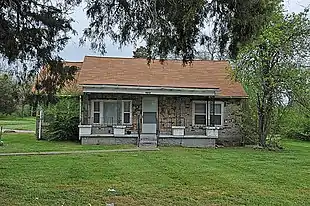 Harry Bailey House |
March 15, 2000 (#00000230) |
423 Trousdale Ferry Rd. 36°12′33″N 86°16′07″W |
Lebanon | |
| 3 | I.W.P. Buchanan House | 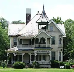 I.W.P. Buchanan House |
January 8, 1979 (#79002487) |
428 W. Main St. 36°12′31″N 86°18′02″W |
Lebanon | Designed by Knoxville architect George F. Barber |
| 4 | Camp Bell | 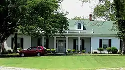 Camp Bell |
April 15, 1982 (#82004074) |
Coles Ferry Pike 36°13′30″N 86°18′23″W |
Lebanon | |
| 5 | Dr. John Owen Campbell House | 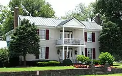 Dr. John Owen Campbell House |
December 8, 1980 (#80003884) |
2344 Lebanon Rd 36°13′39″N 86°21′43″W |
Lebanon | Built in 1842 |
| 6 | Castle Heights Academy Historic District | 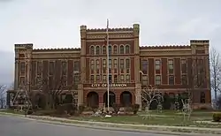 Castle Heights Academy Historic District |
January 11, 1996 (#95001507) |
Junction of Castle Heights Ave., N. and Cadet Ct. 36°12′45″N 86°18′26″W |
Lebanon | |
| 7 | Cedars of Lebanon State Park Historic District | 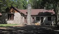 Cedars of Lebanon State Park Historic District |
November 7, 1995 (#95001274) |
Cedar Forest Rd. in Cedars of Lebanon State Park 36°05′08″N 86°18′48″W |
Lebanon | |
| 8 | Chandler Stone Wall | 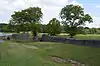 Chandler Stone Wall |
July 19, 2001 (#01000757) |
Old Lebanon Rd., 2 miles west of Mount Juliet Rd. 36°11′23″N 86°33′06″W |
Mt. Juliet | |
| 9 | John Cloyd House | 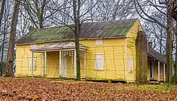 John Cloyd House |
October 1, 1974 (#74001931) |
13988 US-70 Old Hickory 36°13′16″N 86°33′35″W |
Mt. Juliet | |
| 10 | Fite-Fessenden House | 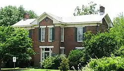 Fite-Fessenden House |
July 5, 1985 (#85001488) |
236 W. Main St. 36°12′30″N 86°17′42″W |
Lebanon | Actual street address is 236 W. Main; now houses the Wilson County Museum |
| 11 | Hale House-Patterson Hotel | 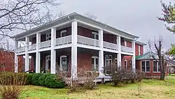 Hale House-Patterson Hotel |
March 14, 1997 (#97000245) |
116 Depot St. 36°06′00″N 86°21′25″W |
Watertown | |
| 12 | Lebanon Commercial Historic District |  Lebanon Commercial Historic District |
November 18, 1999 (#99001373) |
Roughly around the public square, and 104-124 N. College, 105-115 N. Cumberland, 102-203 E. Main, and 103-122 E. Market St 36°12′29″N 86°17′27″W |
Lebanon | |
| 13 | Lebanon Woolen Mills |  Lebanon Woolen Mills |
July 12, 2007 (#07000687) |
218 N. Maple St. 36°12′33″N 86°17′37″W |
Lebanon | Now known as the Mill at Lebanon; currently being renovated as a shopping center |
| 14 | Memorial Hall, Cumberland University |  Memorial Hall, Cumberland University |
April 29, 1977 (#77001301) |
Cumberland University campus 36°12′14″N 86°18′00″W |
Lebanon | |
| 15 | Mitchell House | 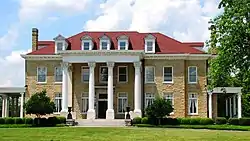 Mitchell House |
December 6, 1979 (#79003435) |
W. Main St. on the grounds of Castle Heights Military Academy 36°12′40″N 86°18′29″W |
Lebanon | Now serves as the international headquarters of the Sigma Pi fraternity |
| 16 | Pickett Chapel Methodist Church | 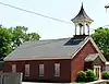 Pickett Chapel Methodist Church |
April 18, 1977 (#77001302) |
E. Market St. 36°12′32″N 86°17′19″W |
Lebanon | Built in 1827; currently being restored |
| 17 | Rest Hill Cemetery |  Rest Hill Cemetery |
March 25, 1993 (#93000212) |
State Route 141 east of its junction with the State Route 24 bypass 36°12′35″N 86°16′13″W |
Lebanon | |
| 18 | William Washington Seay House | 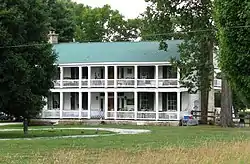 William Washington Seay House |
August 25, 1995 (#95001044) |
10575 Trousdale Ferry Pike 36°12′19″N 86°06′26″W |
Flat Rock | |
| 19 | Sellars Indian Mound | 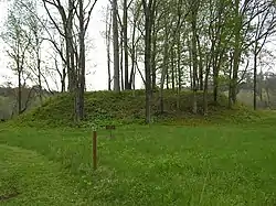 Sellars Indian Mound |
December 11, 1972 (#72001256) |
Address Restricted |
Lebanon | |
| 20 | Warner Price Mumford Smith House | 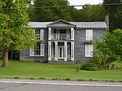 Warner Price Mumford Smith House |
July 22, 1993 (#93000647) |
10277 Lebanon Rd. 36°13′56″N 86°29′49″W |
Mt. Juliet | |
| 21 | Spring Creek Presbyterian Church | 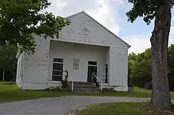 Spring Creek Presbyterian Church |
November 8, 2000 (#00001356) |
Cainsville 36°05′34″N 86°14′20″W |
Doaks Crossroads | |
| 22 | Ida New and William Madison Turner Farm | November 7, 1995 (#95001275) |
3964 Old Murfreesboro Rd. 36°09′02″N 86°19′36″W |
Lebanon | ||
| 23 | Watertown Commercial Historic District | 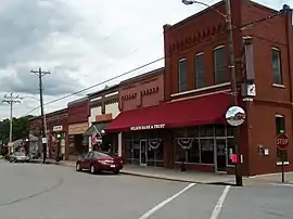 Watertown Commercial Historic District |
November 8, 2000 (#00001353) |
Roughly along Main St., Depot Ave., and Public Square 36°05′59″N 86°08′02″W |
Watertown | |
| 24 | Williamson Chapel CME Church Complex | 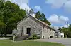 Williamson Chapel CME Church Complex |
November 15, 2006 (#06001039) |
1576 Needmore Rd. 36°14′39″N 86°33′44″W |
Greenlawn |
Former listings
| [3] | Name on the Register | Image | Date listed | Date removed | Location | City or town | Description |
|---|---|---|---|---|---|---|---|
| 1 | Belle Isle | May 22, 1980 (#80003883) | February 1, 1983 | NW of Lebanon on Cairo Bend Rd. |
Lebanon vicinity |
See also
Wikimedia Commons has media related to National Register of Historic Places in Wilson County, Tennessee.
References
- The latitude and longitude information provided in this table was derived originally from the National Register Information System, which has been found to be fairly accurate for about 99% of listings. Some locations in this table may have been corrected to current GPS standards.
- National Park Service, United States Department of the Interior, "National Register of Historic Places: Weekly List Actions", retrieved October 20, 2023.
- Numbers represent an alphabetical ordering by significant words. Various colorings, defined here, differentiate National Historic Landmarks and historic districts from other NRHP buildings, structures, sites or objects.
- "National Register Information System". National Register of Historic Places. National Park Service. April 24, 2008.
- The eight-digit number below each date is the number assigned to each location in the National Register Information System database, which can be viewed by clicking the number.
| Topics | |
|---|---|
| Lists by state |
|
| Lists by insular areas | |
| Lists by associated state | |
| Other areas | |
| Related | |
Municipalities and communities of Wilson County, Tennessee, United States | ||
|---|---|---|
| Cities | ||
| Town | ||
| CDPs | ||
| Other communities | ||
| Ghost towns | ||
This article is issued from Wikipedia. The text is licensed under Creative Commons - Attribution - Sharealike. Additional terms may apply for the media files.