National Register of Historic Places listings in Shelby County, Tennessee
This is a list of the National Register of Historic Places listings in Shelby County, Tennessee.
This is intended to be a complete list of the properties and districts on the National Register of Historic Places in Shelby County, Tennessee, United States. Latitude and longitude coordinates are provided for many National Register properties and districts; these locations may be seen together in a map.[1]
There are 200 properties and districts listed on the National Register in the county, including 4 National Historic Landmarks. There are 24 properties that have been removed from the register.
| Anderson – Bedford – Benton – Bledsoe – Blount – Bradley – Campbell – Cannon – Carroll – Carter – Cheatham – Chester – Claiborne – Clay – Cocke – Coffee – Crockett – Cumberland – Davidson – Decatur – DeKalb – Dickson – Dyer – Fayette – Fentress – Franklin – Gibson – Giles – Grainger – Greene – Grundy – Hamblen – Hamilton – Hancock – Hardeman – Hardin – Hawkins – Haywood – Henderson – Henry – Hickman – Houston – Humphreys – Jackson – Jefferson – Johnson – Knox – Lake – Lauderdale – Lawrence – Lewis – Lincoln – Loudon – Macon – Madison – Marion – Marshall – Maury – McMinn – McNairy – Meigs – Monroe – Montgomery – Moore – Morgan – Obion – Overton – Perry – Pickett – Polk – Putnam – Rhea – Roane – Robertson – Rutherford – Scott – Sequatchie – Sevier – Shelby – Smith – Stewart – Sullivan – Sumner – Tipton – Trousdale – Unicoi – Union – Van Buren – Warren – Washington – Wayne – Weakley – White – Williamson – Wilson |
This National Park Service list is complete through NPS recent listings posted October 20, 2023.[2]
Current listings
| [3] | Name on the Register[4] | Image | Date listed[5] | Location | City or town | Description |
|---|---|---|---|---|---|---|
| 1 | Adams Avenue Historic District | 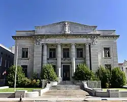 Adams Avenue Historic District |
November 25, 1980 (#80004481) |
Adams and Washington Aves. 35°08′54″N 90°02′59″W |
Memphis | |
| 2 | Walter Granville Allen House | February 23, 1990 (#90000320) |
8504 Macon Rd. 35°09′22″N 89°46′44″W |
Cordova | ||
| 3 | American Snuff Company Historic District | July 25, 2018 (#100002755) |
46 Keel Ave., 700 N Front & 701 N Main Sts. 35°09′50″N 90°02′48″W |
Memphis | ||
| 4 | Anderson-Coward House | 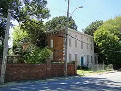 Anderson-Coward House |
March 13, 1986 (#86000404) |
919 Coward Pl. 35°07′50″N 90°01′53″W |
Memphis | |
| 5 | Annesdale | 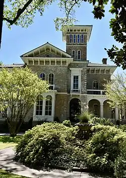 Annesdale |
November 25, 1980 (#80003856) |
1325 Lamar Ave. 35°07′30″N 90°01′03″W |
Memphis | |
| 6 | Annesdale Park Historic District | 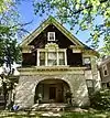 Annesdale Park Historic District |
December 22, 1978 (#78002630) |
Roughly bounded by Peabody and Goodbar Aves., Cleveland St. and Rosenstein Pl. 35°07′49″N 90°01′09″W |
Memphis | |
| 7 | Annesdale-Snowden Historic District | October 25, 1979 (#79002460) |
Roughly bounded by Interstate 240, Lamar Ave. and Heistan Pl 35°07′33″N 90°01′40″W |
Memphis | ||
| 8 | Anshei Sphard-Beth El Emeth Synagogue | 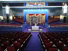 Anshei Sphard-Beth El Emeth Synagogue |
July 24, 2020 (#100005388) |
120 East Yates Road North 35°08′04″N 89°52′15″W |
Memphis | |
| 9 | Arlington Historic District | May 17, 1982 (#82004038) |
Brown, Campbell, Chester, Quintard, Greenlee, and Walker Sts. 35°17′37″N 89°39′44″W |
Arlington | ||
| 10 | Ashlar Hall | 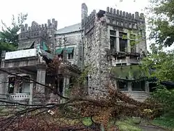 Ashlar Hall |
January 13, 1983 (#83003061) |
1397 Central Ave. 35°07′34″N 90°00′57″W |
Memphis | |
| 11 | Audubon Park Historic District | November 7, 2022 (#100008389) |
750 Cherry Rd. 35°06′46″N 89°55′03″W |
Memphis | ||
| 12 | John Alexander Austin House |  John Alexander Austin House |
July 12, 1984 (#84003684) |
290 S. Front St. 35°08′19″N 90°03′26″W |
Memphis | |
| 13 | Bank of Commerce and Trust Company Building | 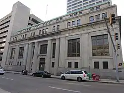 Bank of Commerce and Trust Company Building |
May 7, 1980 (#80003857) |
45 S. 2nd St. 35°08′36″N 90°03′08″W |
Memphis | |
| 14 | Barksdale Mounted Police Station | November 27, 2019 (#100004695) |
189 S. Barksdale St. 35°08′02″N 89°59′56″W |
Nashville | ||
| 15 | Barretville Bank and Trust Company Building | May 7, 2019 (#100003904) |
9043 Barret Rd. 35°22′24″N 89°45′50″W |
Millington | ||
| 16 | Pauline Cheek Barton House | 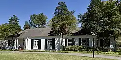 Pauline Cheek Barton House |
September 7, 1995 (#95001069) |
6562 Green Shadows Ln. 35°05′24″N 89°50′42″W |
Memphis | |
| 17 | Beale Street Historic District | 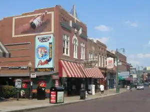 Beale Street Historic District |
October 15, 1966 (#66000731) |
Beale St. from 2nd to 4th Sts.; also the junction of Beale and 4th Sts. 35°08′23″N 90°03′05″W |
Memphis | Second location represents a boundary increase of July 29, 1993 |
| 18 | Gladys "MaDear" Bennett House | March 27, 2020 (#100005136) |
1039 Delmar Ave. 35°08′53″N 90°01′31″W |
Memphis | ||
| 19 | Boyce-Gregg House |  Boyce-Gregg House |
December 19, 1979 (#79002462) |
317 S. Highland St. 35°07′22″N 89°56′45″W |
Memphis | |
| 20 | Bradford-Maydwell House | 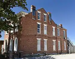 Bradford-Maydwell House |
December 26, 1979 (#79002463) |
648 Poplar Ave. 35°08′48″N 90°02′17″W |
Memphis | |
| 21 | John Willard Brister Library |  John Willard Brister Library |
July 11, 1980 (#80003858) |
University of Memphis campus 35°07′05″N 89°56′24″W |
Memphis | |
| 22 | Wilks Brooks House | 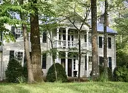 Wilks Brooks House |
May 16, 1980 (#80003859) |
2000 Old Oak Dr. 35°06′12″N 89°50′52″W |
Memphis | |
| 23 | Calvary Episcopal Church and Parish House | 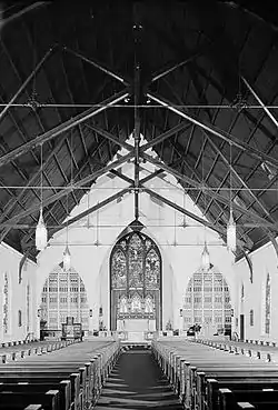 Calvary Episcopal Church and Parish House |
April 27, 1982 (#82004039) |
102 N. 2nd St. 35°08′50″N 90°03′00″W |
Memphis | |
| 24 | Joseph A. Campbell House | 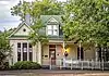 Joseph A. Campbell House |
March 29, 1991 (#91000314) |
215 South St. 35°02′21″N 89°39′58″W |
Collierville | part of the Collierville Multiple Property Submission (MPS) |
| 25 | Capleville Methodist Church | April 3, 1979 (#79002459) |
5053 Shelby Dr. 35°01′12″N 89°53′43″W |
Capleville | ||
| 26 | Capt. Harris House | 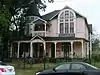 Capt. Harris House |
December 19, 1979 (#79002464) |
2106 Young St. 35°07′10″N 89°59′30″W |
Memphis | |
| 27 | Robert M. Carrier House | 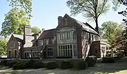 Robert M. Carrier House |
May 27, 1980 (#80003860) |
642 S. Willett St. 35°07′43″N 90°00′35″W |
Memphis | |
| 28 | Central Gardens Historic District | 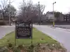 Central Gardens Historic District |
September 9, 1982 (#82004040) |
Roughly bounded by Rembert St., York, Cleveland, and Eastmoreland Aves. 35°07′47″N 90°00′24″W |
Memphis | |
| 29 | Central High School | 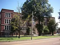 Central High School |
September 17, 1982 (#82004041) |
306 S. Bellevue Boulevard 35°08′01″N 90°01′11″W |
Memphis | part of the Public Schools of Memphis 1902-1915 Thematic Resource (TR) |
| 30 | Davis Charles House | May 8, 2017 (#100000980) |
1291 Winchester Rd. 35°02′20″N 89°42′45″W |
Collierville | ||
| 31 | Chickasaw Heritage Park | 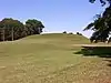 Chickasaw Heritage Park |
November 25, 1997 (#97001441) |
Junction of Riverside Boulevard and Ornamental Metal Museum Dr. 35°07′21″N 90°04′28″W |
Memphis | |
| 32 | Chucalissa Indian Village | 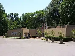 Chucalissa Indian Village |
May 7, 1973 (#73001830) |
Mitchell Rd. 35°03′45″N 90°07′44″W |
Memphis | |
| 33 | Cornelius Lawrence Clancy House | November 25, 1983 (#83004294) |
911 Kerr Ave. 35°06′23″N 90°01′57″W |
Memphis | ||
| 34 | Collierville Historic District | 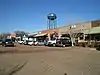 Collierville Historic District |
March 12, 1990 (#90000305) |
Roughly N. and S. Rowlett, Poplar, and Walnut Sts. 35°02′35″N 89°40′02″W |
Collierville | part of the Collierville MPS |
| 35 | Collins Chapel CME Church and Site |  Collins Chapel CME Church and Site |
March 29, 1991 (#91000307) |
678 Washington Ave. 35°08′44″N 90°02′17″W |
Memphis | |
| 36 | Columbian Mutual Tower | 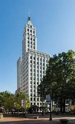 Columbian Mutual Tower |
July 24, 1978 (#78002631) |
60 N. Main St. 35°08′48″N 90°03′06″W |
Memphis | |
| 37 | Cooper-Young Historic District |  Cooper-Young Historic District |
June 22, 1989 (#89000508) |
Roughly bounded by the former L&N railroad tracks, E. Parkway S., Southern Ave., and S. McLean Boulevard 35°07′13″N 89°59′32″W |
Memphis | |
| 38 | Cordova School |  Cordova School |
July 28, 1995 (#95000932) |
1017 Sanga Rd. 35°09′11″N 89°46′18″W |
Memphis | |
| 39 | Cotton Row Historic District |  Cotton Row Historic District |
August 1, 1979 (#79002467) |
S. Front St. between Monroe and Gayoso Aves. 35°08′26″N 90°03′21″W |
Memphis | |
| 40 | Court Square Historic District | 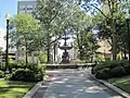 Court Square Historic District |
April 15, 1982 (#82004042) |
Roughly bounded by Riverside Dr., N. 2nd St., and Madison and Jefferson Aves. 35°08′46″N 90°03′09″W |
Memphis | |
| 41 | Crisscross Lodge | 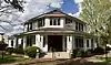 Crisscross Lodge |
April 6, 1989 (#88002627) |
10056 Poplar Ave. 35°03′02″N 89°43′41″W |
Collierville | |
| 42 | E.H. Crump House | 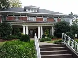 E.H. Crump House |
December 26, 1979 (#79002465) |
1962 Peabody Ave. 35°07′55″N 89°59′45″W |
Memphis | |
| 43 | Rowland J. Darnell House | 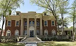 Rowland J. Darnell House |
March 26, 1979 (#79002466) |
1433 Union Ave. 35°08′10″N 90°00′49″W |
Memphis | |
| 44 | Davies Manor | 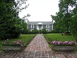 Davies Manor |
March 19, 1975 (#75001787) |
9336 Davies Plantation Rd. 35°13′13″N 89°45′04″W |
Memphis | |
| 45 | Delmar-Lema Historic District | 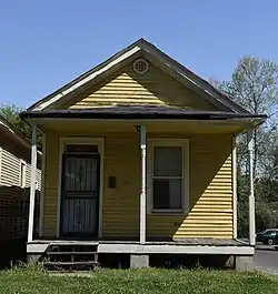 Delmar-Lema Historic District |
March 12, 1998 (#98000242) |
1044-1066 Delmar Ave; 1044–1060, 1041-1061 Lemar Pl. 35°08′54″N 90°01′31″W |
Memphis | |
| 46 | Dermon Building | 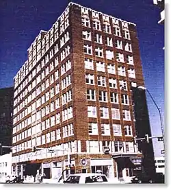 Dermon Building |
March 15, 1984 (#84003688) |
46 N. 3rd St. 35°08′44″N 90°02′58″W |
Memphis | |
| 47 | Dixie Greyhound Bus Lines Complex |  Dixie Greyhound Bus Lines Complex |
November 21, 2003 (#03001193) |
525 N. Main St. 35°09′31″N 90°02′53″W |
Memphis | |
| 48 | Jack Dudney House | Jack Dudney House |
March 29, 1991 (#91000315) |
90 W. Poplar Ave. 35°02′45″N 89°39′55″W |
Collierville | part of the Collierville MPS |
| 49 | East Buntyn Historic District | November 22, 1995 (#95001332) |
Roughly bounded by Central and Southern Aves. and Ellsworth and Greer Sts. 35°07′11″N 89°57′09″W |
Memphis | ||
| 50 | Elam Homestead | 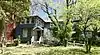 Elam Homestead |
September 18, 1980 (#80003861) |
1428 Fox St. 35°05′33″N 89°57′05″W |
Memphis | |
| 51 | William C. Ellis and Sons Ironworks and Machine Shop |  William C. Ellis and Sons Ironworks and Machine Shop |
August 25, 1983 (#83003062) |
231-245 S. Front St. 35°08′24″N 90°03′25″W |
Memphis | |
| 52 | Elmwood Cemetery |  Elmwood Cemetery |
March 20, 2002 (#02000233) |
824 Dudley St. 35°07′28″N 90°01′46″W |
Memphis | |
| 53 | Elmwood Cemetery Office and Entrance Bridge | 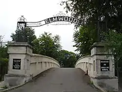 Elmwood Cemetery Office and Entrance Bridge |
May 22, 1978 (#78002632) |
824 S. Dudley St. 35°07′27″N 90°01′45″W |
Memphis | |
| 54 | Evergreen Historic District |  Evergreen Historic District |
January 11, 1985 (#85000080) |
Roughly bounded by N. Parkway, Kenilworth St., Watkins St., and Court Ave. 35°08′41″N 90°00′43″W |
Memphis | |
| 55 | Fairview Junior High School |  Fairview Junior High School |
October 25, 1990 (#90001571) |
750 E. Parkway South 35°07′30″N 89°58′55″W |
Memphis | |
| 56 | First Baptist Church |  First Baptist Church |
March 15, 2005 (#05000182) |
538 Linden Ave. 35°08′19″N 90°02′38″W |
Memphis | part of the Religious Resources of Memphis, Shelby County, TN MPS |
| 57 | First Baptist Church | 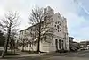 First Baptist Church |
February 11, 1971 (#71000833) |
379 Beale Ave. 35°08′19″N 90°02′54″W |
Memphis | Also known as Beale Street Baptist Church, historic church built for a congregation of newly freed slaves. |
| 58 | First Colored Baptist Church | 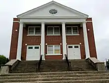 First Colored Baptist Church |
July 14, 2000 (#00000807) |
682 S. Lauderdale St. 35°07′43″N 90°02′37″W |
Memphis | |
| 59 | First Congregational Church and Parish House | 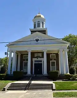 First Congregational Church and Parish House |
July 21, 1980 (#80003862) |
234 S. Watkins St. 35°08′07″N 90°00′54″W |
Memphis | |
| 60 | First Presbyterian Church | 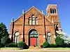 First Presbyterian Church |
March 15, 2005 (#05000183) |
166 Poplar Ave. 35°09′06″N 90°02′55″W |
Memphis | part of the Religious Resources of Memphis, Shelby County, TN MPS |
| 61 | John M. Fleming Home Place | 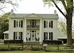 John M. Fleming Home Place |
December 6, 1990 (#90001763) |
1545 S. Byhalia Rd. 35°00′09″N 89°41′51″W |
Collierville | |
| 62 | Forrest Park Historic District |  Forrest Park Historic District |
March 4, 2009 (#09000118) |
S. Manassas St. and Union Ave. 35°08′22″N 90°02′05″W |
Memphis | |
| 63 | Fountain Court Historic District | 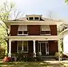 Fountain Court Historic District |
December 17, 1998 (#98001531) |
1155-1229 Fountain Court 35°06′59″N 90°02′02″W |
Memphis | part of the Memphis MPS |
| 64 | Fowlkes-Boyle House | 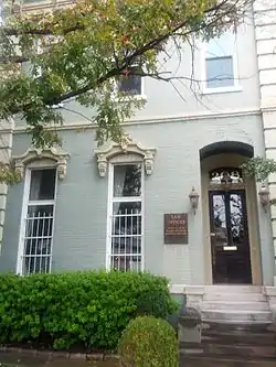 Fowlkes-Boyle House |
August 7, 1974 (#74001928) |
208 Adams Ave. 35°08′49″N 90°02′50″W |
Memphis | |
| 65 | Galloway-Speedway Historic District | July 28, 2004 (#04000766) |
N. Parkway, Faxon, Greenlaw, Galloway, and Forrest Aves. 35°09′25″N 90°01′37″W |
Memphis | part of the Memphis MPS | |
| 66 | Gaston Park Historic District | 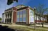 Gaston Park Historic District |
July 3, 1989 (#89000521) |
1046 S. 3rd St. 35°07′09″N 90°03′15″W |
Memphis | part of the Memphis Park and the Parkway System MPS |
| 67 | Gayoso-Peabody Historic District | May 7, 1980 (#80003863) |
Roughly along S. Main St. from McCall Pl. to Monroe Ave. 35°08′31″N 90°03′11″W |
Memphis | Boundaries modified on January 27, 2006 | |
| 68 | Germantown Baptist Church | 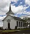 Germantown Baptist Church |
April 1, 1975 (#75001786) |
2216 Germantown Rd. 35°05′04″N 89°48′38″W |
Germantown | Not used by Germantown Baptist Church |
| 69 | Germantown Redoubt | 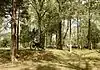 Germantown Redoubt |
June 6, 1991 (#91000623) |
Honey Tree Dr. south of its junction with Poplar Pike 35°04′25″N 89°47′37″W |
Germantown | |
| 70 | Glenview Historic District | 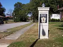 Glenview Historic District |
October 7, 1999 (#99001244) |
Bounded by the former Southern railroad line, Lamar Ave., S. Parkway East, and the former St. Louis – San Francisco railroad line 35°06′24″N 89°59′58″W |
Memphis | part of the Memphis MPS and the Residential Resources of Memphis MPS |
| 71 | Goodwinslow | December 6, 1979 (#79002482) |
4066 James Rd. 35°12′35″N 89°55′35″W |
Raleigh | ||
| 72 | Goodwyn Street Historic District | March 9, 1990 (#90000302) |
Goodwyn St. from Central to Southern Aves. 35°07′11″N 89°57′45″W |
Memphis | ||
| 73 | Nicholas Gotten House | 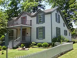 Nicholas Gotten House |
March 20, 2002 (#02000236) |
2969 Court St. 35°12′23″N 89°52′26″W |
Bartlett | |
| 74 | Grace Episcopal Church | Grace Episcopal Church |
March 15, 2005 (#05000184) |
555 Vance Ave. 35°08′10″N 90°02′38″W |
Memphis | part of the Religious Resources of Memphis, Shelby County, TN MPS |
| 75 | Graceland | 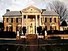 Graceland |
November 7, 1991 (#91001585) |
3764 Elvis Presley Boulevard 35°02′45″N 90°01′22″W |
Memphis | |
| 76 | Green Meadows-Poplar Glen Historic District | April 22, 2003 (#03000304) |
Roughly along Union Ave. Extension, Patricia Dr., Madison Ave., Ashlawn Rd., Ashlawn Cove, and Alicia Dr. 35°08′09″N 89°58′44″W |
Memphis | ||
| 77 | Greenlaw Addition Historic District | 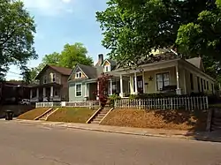 Greenlaw Addition Historic District |
August 16, 1984 (#84003704) |
Roughly bounded by Bethel, Thomas, 7th, Auction, and 2nd Sts. 35°09′34″N 90°02′30″W |
Memphis | |
| 78 | Greenlevel | 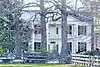 Greenlevel |
March 6, 1987 (#87000397) |
853 Collierville-Arlington Rd., S. 35°06′06″N 89°39′33″W |
Collierville | |
| 79 | Greenstone Apartments | May 14, 1980 (#80003864) |
1116-1118 Poplar Ave. and 200 Waldran Boulevard 35°08′41″N 90°01′23″W |
Memphis | ||
| 80 | Greenwood | 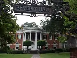 Greenwood |
July 9, 1979 (#79002468) |
1560 Central Ave. 35°07′36″N 90°00′36″W |
Memphis | |
| 81 | Griggs Business and Practical Arts College | March 21, 2023 (#100008765) |
492 Vance Ave. 35°08′06″N 90°02′45″W |
Memphis | ||
| 82 | Daniel Hanley House | October 28, 2021 (#100007127) |
3023 Spottswood Ave. 35°06′48″N 89°57′41″W |
Memphis | ||
| 83 | Hein Park Historic District | November 16, 1988 (#88002613) |
Bounded by Charles Pl., Jackson Ave., Trezevant St., and N. Parkway Dr. 35°09′17″N 89°59′00″W |
Memphis | ||
| 84 | High Point Terrace Historic District | 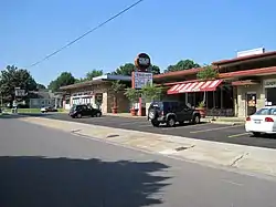 High Point Terrace Historic District |
December 12, 2002 (#02001513) |
Bounded by Highland, Eastland and Swan Ridge Circle, Walnut Grove and Sam Cooper 35°08′23″N 89°56′18″W |
Memphis | part of the Memphis MPS and the Residential Resources of Memphis MPS |
| 85 | Hotel Claridge | 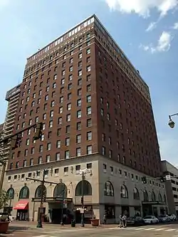 Hotel Claridge |
April 29, 1982 (#82004045) |
109 N. Main St. 35°08′52″N 90°03′06″W |
Memphis | |
| 86 | J.W. Houston House | 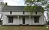 J.W. Houston House |
March 29, 1991 (#91000313) |
259 S. Center St. 35°02′15″N 89°39′58″W |
Collierville | part of the Collierville MPS |
| 87 | L.C. Humes High School | 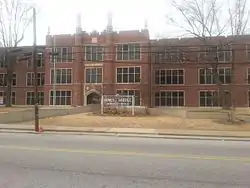 L.C. Humes High School |
July 12, 2004 (#98000368) |
659 N. Manassas 35°09′23″N 90°01′49″W |
Memphis | part of the Public Schools of Memphis 1902-1915 MPS |
| 88 | Hunt-Phelan House | 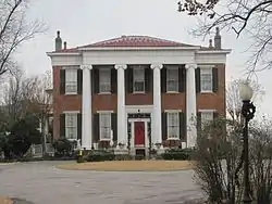 Hunt-Phelan House |
February 11, 1971 (#71000834) |
533 Beale Ave. 35°08′15″N 90°02′38″W |
Memphis | |
| 89 | Idlewild Historic District | March 5, 1999 (#99000278) |
Roughly bounded by S. Cooper St., Linden Ave., Rembert St., and Central Ave. 35°07′47″N 89°59′35″W |
Memphis | part of the Memphis MPS and the Residential Resources of Memphis MPS | |
| 90 | Idlewild Presbyterian Church | _1.jpg.webp) Idlewild Presbyterian Church |
July 7, 2009 (#09000539) |
1750 Union Ave. 35°08′09″N 90°00′12″W |
Memphis | part of the Memphis MPS |
| 91 | The Knickerbocker Apartments |  The Knickerbocker Apartments |
November 8, 2007 (#07001165) |
23-25 S. McLean Boulevard 35°08′13″N 89°59′59″W |
Memphis | |
| 92 | Lauderdale Courts Public Housing Project |  Lauderdale Courts Public Housing Project |
July 25, 1996 (#96000819) |
Danny Thomas Boulevard, Alabama Ave., Exchange Ave., 3rd St., and Winchester 35°09′03″N 90°02′41″W |
Memphis | part of the Memphis MPS and the Public Housing Projects in Memphis MPS |
| 93 | Lee and Fontaine Houses of the James Lee Memorial | 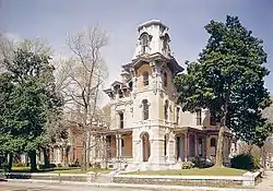 Lee and Fontaine Houses of the James Lee Memorial |
February 11, 1971 (#71000835) |
680-690 Adams Ave. 35°08′38″N 90°02′07″W |
Memphis | Includes Woodruff-Fontaine House and James Lee House |
| 94 | James Lee House | 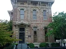 James Lee House |
October 2, 1978 (#78002633) |
239 Adams Ave. 35°08′49″N 90°02′51″W |
Memphis | |
| 95 | Lt. George W. Lee House |  Lt. George W. Lee House |
May 2, 1994 (#94000372) |
563 Stephens Pl. 35°07′14″N 90°02′36″W |
Memphis | |
| 96 | LeMoyne College Historic District | November 9, 2005 (#05001215) |
Roughly bounded by Walker, Hollis Price, Crown, and the alley to the rear of Sweeney Hall 35°07′15″N 90°02′05″W |
Memphis | ||
| 97 | Lenox School |  Lenox School |
July 30, 1981 (#81000579) |
519 S. Edgewood Ave. 35°07′53″N 89°59′12″W |
Memphis | |
| 98 | George Collins Love House |  George Collins Love House |
April 2, 1979 (#79002472) |
619 N. 7th St. 35°09′33″N 90°02′22″W |
Memphis | |
| 99 | Lowenstein House | 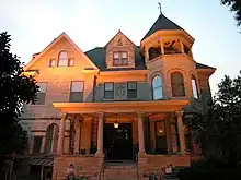 Lowenstein House |
March 23, 1979 (#79002473) |
756 Jefferson Ave. 35°08′34″N 90°02′07″W |
Memphis | |
| 100 | Abraham Lowenstein House | January 5, 1984 (#84003705) |
217 N. Waldran Boulevard 35°08′44″N 90°01′26″W |
Memphis | ||
| 101 | B. Lowenstein & Brothers Building | 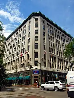 B. Lowenstein & Brothers Building |
June 16, 1983 (#83003063) |
27 S. Main St. 35°08′39″N 90°03′11″W |
Memphis | |
| 102 | Madison-Monroe Historic District |  Madison-Monroe Historic District |
May 19, 1983 (#83003064) |
Madison and Monroe Aves., Main and 2nd Sts. 35°08′38″N 90°03′09″W |
Memphis | |
| 103 | Magevney House |  Magevney House |
November 6, 1973 (#73001831) |
198 Adams Ave. 35°08′50″N 90°02′53″W |
Memphis | |
| 104 | Martin Memorial Temple CME Church |  Martin Memorial Temple CME Church |
November 20, 2002 (#02001379) |
65 S. Parkway West 35°06′27″N 90°03′51″W |
Memphis | |
| 105 | Mason Temple, Church of God in Christ | 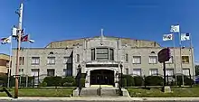 Mason Temple, Church of God in Christ |
April 10, 1992 (#92000286) |
958 Mason St. 35°07′18″N 90°02′56″W |
Memphis | |
| 106 | Maxwelton |  Maxwelton |
March 10, 1980 (#80003866) |
3105 Southern Ave. 35°06′53″N 89°57′27″W |
Memphis | |
| 107 | John H. McFadden House | June 10, 1994 (#94000577) |
3712 Broadway 35°13′34″N 89°49′05″W |
Bartlett | ||
| 108 | John B. McFerrin House |  John B. McFerrin House |
March 29, 1991 (#91000316) |
156 W. Poplar Ave. 35°02′46″N 89°40′02″W |
Collierville | part of the Collierville MPS |
| 109 | Medical Arts Building and Garage | 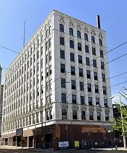 Medical Arts Building and Garage |
August 16, 1984 (#84003707) |
248 Madison Ave. and 11 N. 4th St. 35°08′38″N 90°02′51″W |
Memphis | |
| 110 | Melrose School | 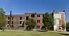 Melrose School |
May 2, 2001 (#98000367) |
843 Dallas St. 35°06′34″N 89°57′52″W |
Memphis | part of the Public Schools of Memphis 1902-1915 MPS |
| 111 | Memphis and Arkansas Bridge |  Memphis and Arkansas Bridge |
February 16, 2001 (#01000139) |
U.S. Route 55 35°07′47″N 90°04′45″W |
Memphis | Extends into Crittenden County, Arkansas |
| 112 | Memphis Bank and Trust Building | 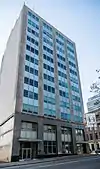 Memphis Bank and Trust Building |
July 17, 2013 (#13000502) |
44 N. 2nd St. 35°08′45″N 90°03′03″W |
Memphis | |
| 113 | Memphis Federation Of Musicians Local 71 Building | May 5, 2017 (#16000812) |
944 Philadelphia St. 35°07′11″N 89°59′11″W |
Memphis | ||
| 114 | Memphis Landing | 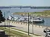 Memphis Landing |
November 25, 2011 (#11000460) |
East side of Wolf River Harbor between Court Ave. and Beale St. 35°08′41″N 90°03′26″W |
Memphis | |
| 115 | Memphis Merchants Exchange | 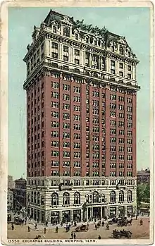 Memphis Merchants Exchange |
May 8, 1979 (#79002474) |
2nd St. and Madison Ave. 35°08′42″N 90°03′06″W |
Memphis | |
| 116 | Memphis National Cemetery |  Memphis National Cemetery |
October 30, 1996 (#96001233) |
3568 Townes Ave. 35°10′23″N 89°56′13″W |
Memphis | part of the Civil War Era National Cemeteries MPS |
| 117 | Memphis Overland Company | April 9, 2021 (#100006385) |
421 Monroe Ave. 35°08′29″N 90°02′34″W |
Memphis | ||
| 118 | Memphis Parkway System | 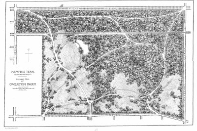 Memphis Parkway System |
July 3, 1989 (#89000520) |
S. Parkway West, S. Parkway East, E Parkway South, E. Parkway North, N. Parkway 35°08′09″N 89°59′00″W |
Memphis | part of the Memphis Park and the Parkway System MPS |
| 119 | Memphis Pink Palace Museum | 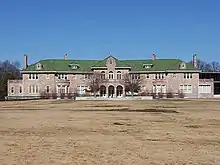 Memphis Pink Palace Museum |
July 9, 1980 (#80003870) |
3050 Central Ave. 35°07′29″N 89°57′37″W |
Memphis | |
| 120 | Memphis Queen II Floating Vessel |  Memphis Queen II Floating Vessel |
July 5, 2006 (#06000550) |
Foot of Monroe at Riverside Dr. 35°08′46″N 90°03′24″W |
Memphis | |
| 121 | Memphis Trust Building | 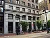 Memphis Trust Building |
November 25, 1980 (#80003867) |
12 S. Main St. 35°08′40″N 90°03′09″W |
Memphis | |
| 122 | Mid-South Coliseum | 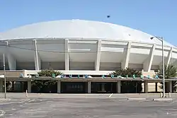 Mid-South Coliseum |
December 6, 2000 (#00001429) |
996 Early Maxwell Boulevard 35°07′04″N 89°58′51″W |
Memphis | |
| 123 | Missouri Portland Cement Terminal | April 9, 2021 (#100006384) |
48 Henry Ave. 35°09′59″N 90°02′44″W |
Memphis | ||
| 124 | William R. Moore Dry Goods Building | 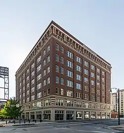 William R. Moore Dry Goods Building |
August 26, 1982 (#82004049) |
183 Monroe Ave. 35°08′34″N 90°03′01″W |
Memphis | Aka the Hein Building, now the Toyota Center |
| 125 | Mosby-Bennett House | 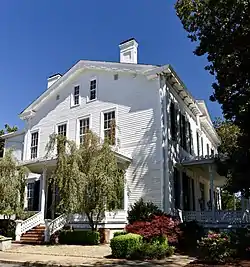 Mosby-Bennett House |
May 27, 1980 (#80003868) |
6256 Poplar Avenue 35°06′05″N 89°51′17″W |
Memphis | |
| 126 | Mt. Airy | 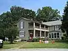 Mt. Airy |
February 14, 2002 (#02000011) |
10700 Latting Rd. 35°10′50″N 89°42′01″W |
Cordova | |
| 127 | National Cotton Council Building | 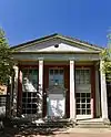 National Cotton Council Building |
July 30, 2012 (#12000441) |
1918 North Parkway 35°09′10″N 89°59′41″W |
Memphis | |
| 128 | National Trust Life Insurance Company Building | August 2, 2018 (#100002756) |
2701 Union Ave. Extended 35°08′06″N 89°58′25″W |
Memphis | ||
| 129 | Joseph Newburger House | 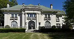 Joseph Newburger House |
April 29, 1982 (#82004050) |
168 E. Parkway South 35°07′58″N 89°58′58″W |
Memphis | |
| 130 | Normal Station Historic District | August 10, 2005 (#05000866) |
Roughly bounded by Highland, Goodlett, the former Southern railroad line, and the rear property lines of Marion and parcels on Park 35°05′49″N 89°55′57″W |
Memphis | part of the Memphis MPS | |
| 131 | Oaklawn Garden | 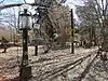 Oaklawn Garden |
March 28, 2018 (#100002262) |
7831 Poplar Pike 35°04′49″N 89°48′08″W |
Germantown | |
| 132 | One Hundred North Main Building | 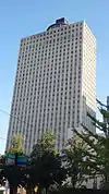 One Hundred North Main Building |
April 24, 2015 (#15000187) |
100 N. Main St. 35°08′53″N 90°03′03″W |
Memphis | |
| 133 | Orpheum Theatre |  Orpheum Theatre |
August 15, 1977 (#77001289) |
197 S. Main St. 35°08′23″N 90°03′18″W |
Memphis | |
| 134 | Overton Park Historic District | 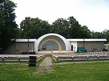 Overton Park Historic District |
October 25, 1979 (#79002475) |
Roughly bounded by Poplar Ave., E. Parkway North, N. Parkway East, and Kenilworth St. 35°08′48″N 89°59′21″W |
Memphis | |
| 135 | Overton Park Court Apartments | June 28, 2021 (#100006712) |
2095 Poplar Ave. 35°08′30″N 89°59′26″W |
Memphis | ||
| 136 | Overton Parkway Historic District | November 18, 1999 (#99001370) |
Roughly bounded by Cooper St., E. Parkway, Poplar and Madison Sts. 35°08′19″N 89°59′13″W |
Memphis | part of the Memphis MPS and the Residential Resources of Memphis MPS | |
| 137 | Paisley Hall | 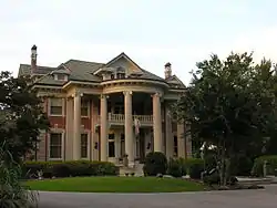 Paisley Hall |
February 12, 1980 (#80003869) |
1822 Overton Park Ave. 35°08′55″N 89°59′54″W |
Memphis | |
| 138 | Parkview Hotel Apartments | July 7, 2022 (#100007910) |
1914 Poplar Ave. 35°08′33″N 89°59′49″W |
Memphis | ||
| 139 | Patton-Bejach House | 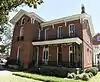 Patton-Bejach House |
July 27, 1979 (#79002476) |
1085 Poplar St. 35°08′38″N 90°01′25″W |
Memphis | |
| 140 | Peabody Elementary School | 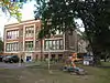 Peabody Elementary School |
September 17, 1982 (#82004051) |
2086 Young Ave. 35°07′11″N 89°59′33″W |
Memphis | part of the Public Schools of Memphis 1902-1915 TR |
| 141 | Peabody Hotel | 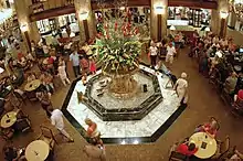 Peabody Hotel |
September 14, 1977 (#77001290) |
149 Union Ave. 35°08′33″N 90°03′11″W |
Memphis | |
| 142 | Picardy Place Historic District | July 25, 2014 (#14000450) |
157-205 S. Fenwick Rd., 160-201 Picardy Place 35°07′38″N 89°58′04″W |
Memphis | ||
| 143 | Pinch-North Main Commercial District | 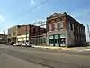 Pinch-North Main Commercial District |
October 18, 1979 (#79002477) |
Roughly bounded by N. Front and N. 2nd Sts., Commerce and Auction Aves.; also 122 Jackson Ave. 35°09′20″N 90°02′56″W |
Memphis | 122 Jackson represents a boundary increase of October 25, 1990 |
| 144 | Dr. D.T. Porter Building | 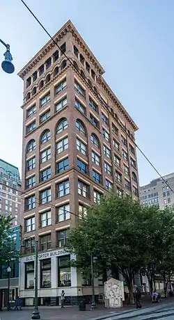 Dr. D.T. Porter Building |
April 18, 1977 (#77001291) |
10 N. Main St. 35°08′43″N 90°03′08″W |
Memphis | |
| 145 | Porter-Leath House | 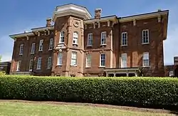 Porter-Leath House |
May 8, 1979 (#79002471) |
850 N. Manassas St. 35°09′54″N 90°01′53″W |
Memphis | |
| 146 | Elvis Presley House |  Elvis Presley House |
March 9, 2006 (#05001217) |
1034 Audubon Dr. 35°06′19″N 89°55′12″W |
Memphis | part of the Memphis MPS |
| 147 | Eli Rayner House | 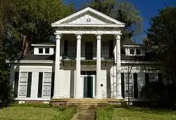 Eli Rayner House |
May 9, 1977 (#77001292) |
1020 Rayner St. 35°07′06″N 90°00′40″W |
Memphis | |
| 148 | Rock of Ages Christian Methodist Episcopal Church | April 10, 2017 (#100000859) |
478 Scott St. 35°08′43″N 89°58′02″W |
Memphis | ||
| 149 | Rosemark Historic District | June 14, 2013 (#13000400) |
8501-8760 Kerrville-Rosemark Rd.; 8519-8727, 8736 Rosemark Rd. 35°21′44″N 89°46′20″W |
Rosemark | ||
| 150 | Dr. Christopher M. Roulhac House | 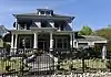 Dr. Christopher M. Roulhac House |
April 15, 2004 (#04000301) |
810 McLemore Ave. 35°07′04″N 90°02′07″W |
Memphis | part of the Memphis MPS |
| 151 | Rozelle Elementary School |  Rozelle Elementary School |
September 17, 1982 (#82004052) |
993 Roland St. 35°07′08″N 90°00′34″W |
Memphis | part of the Public Schools of Memphis 1902-1915 TR |
| 152 | St. Mary's Cathedral, Chapel, and Diocesan House | 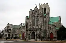 St. Mary's Cathedral, Chapel, and Diocesan House |
January 19, 1979 (#79002480) |
700, 714, and 692 Poplar Avenue 35°08′47″N 90°02′11″W |
Memphis | |
| 153 | St. Mary's Catholic Church | 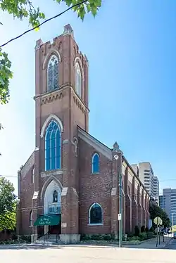 St. Mary's Catholic Church |
August 7, 1974 (#74001929) |
155 Market St. 35°09′04″N 90°02′52″W |
Memphis | |
| 154 | St. Paul Avenue Historic District | December 17, 1998 (#98001533) |
751-53 to 775-77 St. Paul Ave., and 558 Boyd St. 35°07′59″N 90°02′11″W |
Memphis | part of the Memphis MPS | |
| 155 | St. Thomas Catholic Church and Convent | 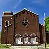 St. Thomas Catholic Church and Convent |
March 15, 2005 (#05000185) |
588 E. Trigg Ave. 35°06′52″N 90°02′36″W |
Memphis | part of the Religious Resources of Memphis, Shelby County, TN MPS |
| 156 | Scimitar Building | 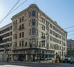 Scimitar Building |
June 30, 1983 (#83003065) |
179 Madison Ave. 35°08′38″N 90°03′00″W |
Memphis | aka Winchester Building, aka Madison Avenue Building, aka Memphis Gas, Light, and Water Building, now Hotel Napoleon. |
| 157 | Sculptures of Dionicio Rodriguez at Memorial Park Cemetery | 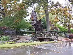 Sculptures of Dionicio Rodriguez at Memorial Park Cemetery |
January 31, 1991 (#90001867) |
5668 Poplar Ave. 35°06′30″N 89°52′25″W |
Memphis | |
| 158 | Sears, Roebuck and Company Catalog Distribution Center and Retail Store | 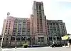 Sears, Roebuck and Company Catalog Distribution Center and Retail Store |
December 18, 2013 (#13000954) |
495 N. Watkins St. 35°09′07″N 90°00′54″W |
Memphis | |
| 159 | Second Congregational Church | 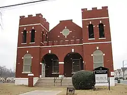 Second Congregational Church |
August 26, 1982 (#82004053) |
764 Walker Ave. 35°07′10″N 90°02′11″W |
Memphis | |
| 160 | Second Presbyterian Church | 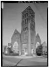 Second Presbyterian Church |
September 4, 1979 (#79002478) |
280 Hernando St. 35°08′07″N 90°03′04″W |
Memphis | Listed again in 2017 as Clayborn Temple (reference number 100001370) |
| 161 | Shadowlawn Historic District | August 14, 1995 (#95000941) |
Roughly bounded by Shadowlawn, Wellington, S. Parkway and Essex Sts. 35°06′15″N 90°02′50″W |
Memphis | ||
| 162 | Shrine Building | 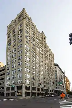 Shrine Building |
March 29, 1979 (#79002479) |
66 Monroe Ave. 35°08′40″N 90°03′16″W |
Memphis | |
| 163 | South Bluffs Warehouse Historic District | June 4, 1987 (#87000453) |
Roughly S. Front St., Wagner Pl., and Tennessee St. from Beale St. to Calhoun Ave. 35°08′09″N 90°03′36″W |
Memphis | ||
| 164 | South Main Street Historic District | 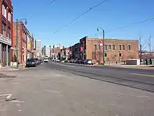 South Main Street Historic District |
September 2, 1982 (#82004054) |
Roughly S. Main St. between Webster and Linden, and Mulberry between Calhoun and Vance Aves.; also 663 S. Main St.; also 384 Mulberry and 129 Talbot; also 124-125, 136-137, 148, 153, 154, 158, and 161 G.E. Patterson Ave., and 138 St. Paul Ave. 35°08′01″N 90°03′28″W |
Memphis | Second, third, and fourth sets of addresses represent boundary increases of March 8, 1997, July 9, 1999, and August 13, 2013 |
| 165 | South Parkway-Heiskell Farm Historic District | February 11, 1983 (#83003066) |
S. Parkway East and E. Parkway South 35°06′47″N 89°59′27″W |
Memphis | ||
| 166 | Southern Railway Industrial Historic District | April 24, 2007 (#07000361) |
Roughly bounded by Beale, Myrtle, and the former Southern railroad tracks, Linden, Jessamine and Orleans 35°08′14″N 90°02′24″W |
Memphis | ||
| 167 | Southwestern at Memphis Historic District |  Southwestern at Memphis Historic District |
July 20, 1978 (#78002635) |
2000 N. Parkway 35°09′13″N 89°59′24″W |
Memphis | |
| 168 | Southwestern at Memphis Sorority Row Historic District | July 12, 2006 (#06000583) |
2000 North Parkway at Rhodes College 35°09′24″N 89°59′15″W |
Memphis | ||
| 169 | Speedway Terrace Historic District |  Speedway Terrace Historic District |
March 19, 1999 (#99000280) |
Roughly bounded by N. Watkins, Snowden, N. Bellevue, and Forrest Ave. 35°09′23″N 90°01′04″W |
Memphis | part of the Memphis MPS and the Residential Resources of Memphis MPS |
| 170 | Squire's Rest | Squire's Rest |
May 31, 2007 (#07000533) |
8993 Barret Rd. 35°22′19″N 89°45′54″W |
Barretville | |
| 171 | Steele Hall | March 23, 1979 (#79002481) |
LeMoyne-Owen College campus 35°07′09″N 90°02′09″W |
Memphis | ||
| 172 | Sterick Building | 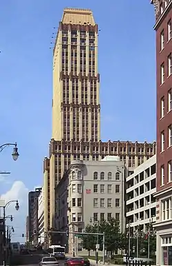 Sterick Building |
October 2, 1978 (#78002636) |
8 N. 3rd St. 35°08′40″N 90°02′59″W |
Memphis | |
| 173 | Sterick North Garage and Hotel | March 26, 2018 (#100002263) |
22 N B.B. King Blvd. 35°08′43″N 90°03′00″W |
Memphis | ||
| 174 | Stonewall Place Historic District | March 25, 1982 (#82004055) |
Stonewall St. between Poplar Ave. and North Parkway 35°08′52″N 90°00′36″W |
Memphis | ||
| 175 | Strathmore Place Historic District |  Strathmore Place Historic District |
December 17, 1998 (#98001532) |
Strathmore Circle East, North, and South, and 280 and 292 East Parkway 35°08′04″N 89°58′51″W |
Memphis | part of the Memphis MPS |
| 176 | Leslie M. Stratton YMCA |  Leslie M. Stratton YMCA |
June 30, 1983 (#83003067) |
245 Madison Ave. 35°08′36″N 90°02′52″W |
Memphis | |
| 177 | Sun Record Company, Memphis Recording Service |  Sun Record Company, Memphis Recording Service |
July 31, 2003 (#03001031) |
706 Union Ave. 35°08′21″N 90°02′15″W |
Memphis | |
| 178 | Tennessee Brewery |  Tennessee Brewery |
November 25, 1980 (#80004482) |
477 Tennessee St. 35°08′05″N 90°03′39″W |
Memphis | |
| 179 | Tennessee Club-Overall Goodbar Building |  Tennessee Club-Overall Goodbar Building |
April 22, 1982 (#82004056) |
128-130 Court Ave. 35°08′47″N 90°03′04″W |
Memphis | |
| 180 | Tennessee Trust Building | 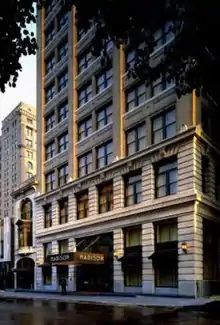 Tennessee Trust Building |
December 9, 1982 (#82001732) |
81 Madison Ave. 35°08′42″N 90°03′12″W |
Memphis | |
| 181 | Third Addition to Jackson Terrace Historic District | November 21, 2001 (#01001260) |
Henry Ave., Hardin Ave., Atlantic Ave., and Crump Ave. 35°09′46″N 89°57′12″W |
Memphis | part of the Memphis MPS and the Residential Resources of Memphis MPS | |
| 182 | John W. Thomas House |  John W. Thomas House |
March 29, 1991 (#91000312) |
245 W. Poplar Ave. 35°02′43″N 89°40′13″W |
Collierville | part of the Collierville MPS |
| 183 | Toof Building |  Toof Building |
August 26, 1982 (#82004057) |
195 Madison Ave. 35°08′37″N 90°02′58″W |
Memphis | |
| 184 | John S. Toof House |  John S. Toof House |
March 25, 1982 (#82004058) |
246 Adams Ave. 35°08′49″N 90°02′48″W |
Memphis | |
| 185 | Tri State Iron Works | 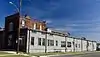 Tri State Iron Works |
April 17, 1997 (#97000339) |
61 Keel Ave. 35°09′48″N 90°02′47″W |
Memphis | |
| 186 | Tri-State Bank | 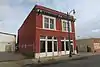 Tri-State Bank |
February 11, 1971 (#71000836) |
386 Beale St. 35°08′22″N 90°02′53″W |
Memphis | |
| 187 | U.S. Marine Hospital | 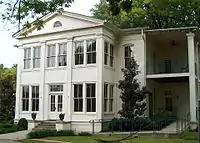 U.S. Marine Hospital |
May 13, 2019 (#100003905) |
360 Metal Museum Dr. 35°07′23″N 90°04′27″W |
Memphis | |
| 188 | U.S. Marine Hospital Executive Building and Laundry-Kitchen | U.S. Marine Hospital Executive Building and Laundry-Kitchen |
July 2, 1980 (#80003872) |
360 and 374 W. California Ave. 35°07′25″N 90°04′27″W |
Memphis | |
| 189 | U.S. Post Office-Front Street Station | 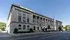 U.S. Post Office-Front Street Station |
June 30, 1980 (#80003873) |
1 N. Front St. 35°08′43″N 90°03′16″W |
Memphis | Now home to the Cecil C. Humphreys School of Law. |
| 190 | Universal Life Insurance Company | 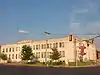 Universal Life Insurance Company |
July 24, 2007 (#07000762) |
480 Linden Ave. 35°08′13″N 90°02′44″W |
Memphis | |
| 191 | Victorian Village District | Victorian Village District |
December 11, 1972 (#72001253) |
Adams and Jefferson Sts. 35°08′42″N 90°02′20″W |
Memphis | |
| 192 | Vollintine Evergreen Avalon Historic District | May 23, 1997 (#97000476) |
Roughly bounded by Stonewall, Vollintine, and Evergreen Sts., and Cypress Creek 35°09′57″N 90°00′14″W |
Memphis | ||
| 193 | Vollintine Evergreen Historic District | April 12, 1996 (#96000410) |
Roughly bounded by Watkins St., Vollintine Ave., Faxon Ave., Jackson Ave., and University St. 35°09′26″N 90°00′35″W |
Memphis | ||
| 194 | Vollintine Evergreen North Historic District | 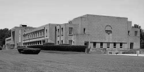 Vollintine Evergreen North Historic District |
May 23, 1997 (#97000475) |
Roughly bounded by Mclean Boulevard, Vollintine Ave., University St., and Rainbow Cir. 35°09′52″N 89°59′35″W |
Memphis | |
| 195 | Vollintine Hills Historic District | July 11, 2007 (#07000684) |
Roughly bounded by Vollintine, Brown, McLean, and Evergreen 35°09′53″N 89°59′56″W |
Memphis | part of the Memphis MPS | |
| 196 | Wells School | March 31, 1995 (#95000292) |
4140 Collierville-Arlington Rd. 35°14′20″N 89°38′58″W |
Eads | ||
| 197 | Wildwood Farms | 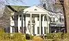 Wildwood Farms |
July 24, 2017 (#100001371) |
2737 S. Germantown Rd. 35°04′22″N 89°48′54″W |
Germantown | |
| 198 | Ernest C. Withers House | July 7, 2022 (#100007909) |
480 West Brooks Rd. 35°03′49″N 90°04′48″W |
Memphis | ||
| 199 | Wooten Fallout Shelter | November 27, 2019 (#100004683) |
Lions Gate Dr. 35°00′50″N 90°01′30″W |
Memphis | ||
| 200 | Zion Cemetery | 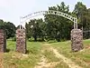 Zion Cemetery |
February 23, 1990 (#90000301) |
S. Parkway East at Pillow St. 35°06′39″N 90°00′51″W |
Memphis |
Former listings
Twenty-three other properties were once listed, but have now been removed:
| [3] | Name on the Register | Image | Date listed | Date removed | Location | City or town | Description |
|---|---|---|---|---|---|---|---|
| 1 | Robert S. Bowles House | December 26, 1979 (#79002461) | July 22, 1980 | 544-548 Vance Avenue |
Memphis | Removed due to procedural error during nomination. Included in the Vance-Pontotoc Historic District. | |
| 2 | Douglass High School | March 12, 1998 (#98000241) | November 9, 2007 | 3200 Mount Olive Rd. 35°10′32″N 89°57′06″W |
Memphis | Demolished in 2006. | |
| 3 | First Methodist Church | March 19, 1976 (#76001804) | November 9, 2007 | 204 North 2nd Street |
Memphis | Destroyed by a multi-block fire in downtown Memphis on October 6, 2006.[6][7] | |
| 4 | Gartly-Ramsay Hospital | July 12, 1984 (#84003700) | November 9, 2007 | 696 Jackson Avenue |
Memphis | ||
| 5 | Guthrie Elementary School | September 17, 1982 (#82004043) | November 9, 2007 | 951 Chelsea Avenue |
Memphis | ||
| 6 | Patrick Hayley House | October 10, 1979 (#79002469) | July 21, 1980 | 604 Vance Ave. |
Memphis | Removed due to procedural error during nomination. Included in the Vance-Pontotoc Historic District. | |
| 7 | A. B. Hill Elementary School | September 17, 1982 (#82004044) | November 9, 2007 | 1372 Latham Street |
Memphis | ||
| 8 | Lauderdale Walker Elementary School | September 17, 1982 (#82004046) | November 9, 2007 | 995 South Lauderdale Street |
Memphis | ||
| 9 | LeMoyne Gardens Public Housing Project | July 25, 1996 (#96000820) | June 10, 2022 | Walker, Porter, Provine, and Neptune Sts. 35°07′18″N 90°02′04″W |
Memphis | part of the Memphis MPS and the Public Housing Projects in Memphis MPS | |
| 10 | Libertyland Grand Carousel | July 3, 1989 (#80003865) | November 18, 2009 | Libertyland Theme Park 35°07′31″N 89°58′38″W |
Memphis | Carousel put in storage when the Park closed in 2009. Reinstalled next to the Children's Museum of Memphis in 2017.[8] | |
| 11 | Linden Station and Reichman-Crosby Warehouse | September 8, 1978 (#78002634) | November 9, 2007 | 245, 281, 291 Wagner Place |
Memphis | ||
| 12 | Maury Elementary School | September 17, 1982 (#82004047) | November 9, 2007 | 272 North Bellevue Boulevard |
Memphis | ||
| 13 | Memphis Street Railway Company Office and Streetcar Complex | September 17, 1982 (#82004048) | November 9, 2007 | 821 Beale St |
Memphis | ||
| 14 | Nelson-Kirby House | October 23, 1986 (#86002913) | May 5, 2023 | 6792 Poplar Pike 35°05′48″N 89°50′10″W |
Germantown | Demolished in 2013?[9] | |
| 15 | Pippin Roller Coaster | 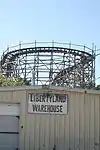 Pippin Roller Coaster |
November 8, 2007 (#07001166) | March 21, 2011 | Mid-South Fairgrounds bounded by E. Parkway, Central and Southern Aves. and Early Maxwell Boulevard 35°07′08″N 89°58′53″W |
Memphis | Wooden roller coaster moved to Bay Beach Amusement Park at Green Bay, Wisconsin by May 2011.[10] |
| 16 | Leroy Pope Elementary School | September 17, 1982 (#82005387) | November 9, 2007 | 190 Chelsea Avenue |
Memphis | ||
| 17 | Randolph House | February 11, 1971 (#71001073) | December 13, 1976 | 546 Beale St. |
Memphis | Destroyed by arsonist on April 10, 1976.[11][12] | |
| 18 | Newton Copeland Richards House | 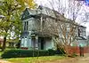 Newton Copeland Richards House |
July 12, 1984 (#84003709) | April 12, 2022 | 975 Peabody Ave. 35°07′57″N 90°01′44″W |
Memphis | Destroyed by fire in March 2017[13] |
| 19 | Clarence Saunders Estate | November 13, 1989 (#89001969) | February 22, 2002 | 5922 Quince |
Memphis | Built by Clarence Saunders in 1928. Housed the main complex for the Lichterman Nature Center. Destroyed by fire on February 25, 1994.[14] | |
| 20 | Stephens-Cochran House | July 9, 1980 (#80003871) | January 17, 1985 | 784 Poplar Ave. |
Memphis | Demolished in September, 1984.[15] | |
| 21 | Union Avenue Methodist Episcopal Church, South | March 6, 1987 (#87000399) | March 27, 2013 | 2117 Union Ave. |
Memphis | Demolished in March, 2011.[16] | |
| 22 | Vance-Pontotoc Historic District | March 19, 1980 (#80003874) | March 18, 1987 | An irregular pattern along Vance and Pontotoc Aves. |
Memphis | Twelve of the buildings were destroyed by fire between 1979 and 1982. Only 12 of the 65 listed buildings remain. | |
| 23 | Veterans Administration Hospital Complex, No. 88--Memphis | November 29, 1995 (#95001371) | November 9, 2007 | 1025 E. H. Crump Blvd. E. |
Memphis | ||
| 24 | Wells-Arrington Historic District | April 22, 1999 (#99000463) | July 22, 2014 | 563-610 Arrington Ave. and 556-601 Wells Ave. 35°10′23″N 90°02′18″W |
Memphis | part of the Memphis MPS and the Residential Resources of Memphis MPS |
See also
References
- The latitude and longitude information provided in this table was derived originally from the National Register Information System, which has been found to be fairly accurate for about 99% of listings. Some locations in this table may have been corrected to current GPS standards.
- National Park Service, United States Department of the Interior, "National Register of Historic Places: Weekly List Actions", retrieved October 20, 2023.
- Numbers represent an alphabetical ordering by significant words. Various colorings, defined here, differentiate National Historic Landmarks and historic districts from other NRHP buildings, structures, sites or objects.
- "National Register Information System". National Register of Historic Places. National Park Service. April 24, 2008.
- The eight-digit number below each date is the number assigned to each location in the National Register Information System database, which can be viewed by clicking the number.
- "Downtown Inferno". The Commercial Appeal. October 7, 2006. p. A1. Retrieved August 29, 2022 – via Newspapers.com.
- "Blaze gust church, rips Court Square". The Commercial Appeal. October 7, 2006. p. A9. Retrieved August 29, 2022 – via Newspapers.com.
- "CMOM brings carousel back to life". The Commercial Appeal. February 3, 2015. p. 1. Retrieved August 29, 2022 – via Newspapers.com.
- Sells, Toby. "Demolition of Germantown historic house approved". The Commercial Appeal. Retrieved July 29, 2016.
- "Coasting to a stop". The Commercial Appeal. February 12, 2010. p. 1. Retrieved August 29, 2022 – via Newspapers.com.
- "Arson Suspected in Blaze At Historic Randolph House". Memphis Press-Scimitar. May 11, 1976. p. 12. Retrieved August 29, 2022 – via Newspapers.com.
- Dye, Robert W. Shelby County. p. 40. ISBN 9780738541921.
- "Newton Copeland Richards House". memphisheritage.org.
- "Blaze devours Lichterman Center". The Commercial Appeal. February 26, 1994. p. 1. Retrieved August 29, 2022 – via Newspapers.com.
- "Time claims tribute to earlier architecture". The Commercial Appeal. September 14, 1984. p. D16. Retrieved August 29, 2022 – via Newspapers.com.
- "Down it goes". The Commercial Appeal. March 13, 2011. p. B5. Retrieved August 29, 2022 – via Newspapers.com.
Municipalities and communities of Shelby County, Tennessee, United States | ||
|---|---|---|
| Cities | ||
| Towns | ||
| Unincorporated communities | ||
| Topics | |
|---|---|
| Lists by state |
|
| Lists by insular areas | |
| Lists by associated state | |
| Other areas | |
| Related | |