Guilliers
Guilliers (French pronunciation: [ɡilje]; Breton: Gwiler-Porc'hoed) is a commune in the Morbihan department of Brittany in north-western France.[3] Inhabitants of Guilliers are called in French Guilliérois.
Guilliers
Gwiler-Porc'hoed | |
|---|---|
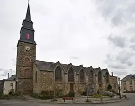 The parish church | |
.svg.png.webp) Coat of arms | |
Location of Guilliers | |
 Guilliers  Guilliers | |
| Coordinates: 48°02′36″N 2°24′15″W | |
| Country | France |
| Region | Brittany |
| Department | Morbihan |
| Arrondissement | Pontivy |
| Canton | Ploërmel |
| Intercommunality | Ploërmel Communauté |
| Government | |
| • Mayor (2020–2026) | Joël Lemazurier[1] |
| Area 1 | 35.14 km2 (13.57 sq mi) |
| Population | 1,301 |
| • Density | 37/km2 (96/sq mi) |
| Time zone | UTC+01:00 (CET) |
| • Summer (DST) | UTC+02:00 (CEST) |
| INSEE/Postal code | 56080 /56490 |
| Elevation | 47–114 m (154–374 ft) |
| 1 French Land Register data, which excludes lakes, ponds, glaciers > 1 km2 (0.386 sq mi or 247 acres) and river estuaries. | |
Geography
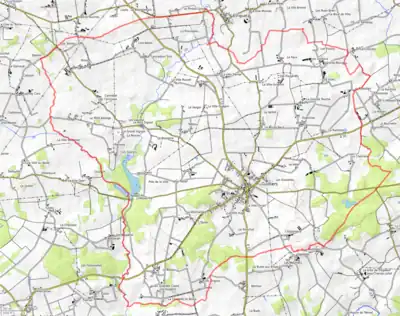
The town is located 49 km (30 mi) northeast of Vannes. Historically, Guiiliers belongs to Porhoët and Upper Brittany.
Map
See also
References
- "Maires du Morbihan" (PDF). Préfecture du Morbihan. 7 July 2020.
- "Populations légales 2020". The National Institute of Statistics and Economic Studies. 29 December 2022.
- INSEE commune file
External links
- Mayors of Morbihan Association (in French)
Wikimedia Commons has media related to Guilliers.
This article is issued from Wikipedia. The text is licensed under Creative Commons - Attribution - Sharealike. Additional terms may apply for the media files.