Priziac
Priziac (French pronunciation: [pʁizjak]; Breton: Prizieg) is a commune in the Morbihan department of Brittany in north-western France.[3]
Priziac
Prizieg | |
|---|---|
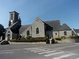 The Church of Saint-Beheau in Priziac | |
.svg.png.webp) Coat of arms | |
Location of Priziac | |
 Priziac  Priziac | |
| Coordinates: 48°03′43″N 3°24′29″W | |
| Country | France |
| Region | Brittany |
| Department | Morbihan |
| Arrondissement | Pontivy |
| Canton | Gourin |
| Intercommunality | Roi Morvan Communauté |
| Government | |
| • Mayor (2020–2026) | Dominique Le Niniven[1] |
| Area 1 | 44.63 km2 (17.23 sq mi) |
| Population | 965 |
| • Density | 22/km2 (56/sq mi) |
| Time zone | UTC+01:00 (CET) |
| • Summer (DST) | UTC+02:00 (CEST) |
| INSEE/Postal code | 56182 /56320 |
| Elevation | 56–230 m (184–755 ft) |
| 1 French Land Register data, which excludes lakes, ponds, glaciers > 1 km2 (0.386 sq mi or 247 acres) and river estuaries. | |
Population
Inhabitants of Priziac are called in French Priziacois. The commune's population has been divided by three within a century because of rural exodus.
|
| |||||||||||||||||||||||||||||||||||||||||||||||||||||||||||||||||||||||||||||||||||||||||||||||||||||||||||||||||||||
| Source: EHESS[4] and INSEE (1968-2020)[5][6] | ||||||||||||||||||||||||||||||||||||||||||||||||||||||||||||||||||||||||||||||||||||||||||||||||||||||||||||||||||||||
Geography
Priziac is located in the northwestern part of the Morbihan, 33 km (21 mi) west of Pontivy and 35 km (22 mi) north of Lorient. Historically, it belongs to Vannetais. Near the village centre is the Bel Air lake, with an area of 54 hectares. Apart from the village centre, there are about one hundred hamlets. Most of the hamlets consist in two or three houses but others are larger. In the past, the hamlet of Botquenven had more inhabitants than the village of Priziac.
Neighbouring communes
Priziac is border by Le Faouët and Langonnet to the west, by Plouray to he north, by Meslan to the south, Saint-Tugdual and Le Croisty to the east.
Map

History
Middle Ages
The fortified castle of La Roche Piriou stood on the top of a hill near the confluence of the river Ellé and the river Aër. It was besieged unsuccessfully by the troops of Walter of Mauny during the War of the Breton Succession
Guy Éder de La Fontenelle, a nobleman at the head of a band of 400 riders, seized the fortified castle of Cremenec, in Priziac, on February 10, 1595.
French Revolution
The first mayor of Priziac, Jean Le Roux, was murdered by a band of chouans in his house in the village of Kerveno, on decembre 23, 1794.
Galery
Chapels
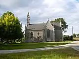 Chapel Saint Yves.
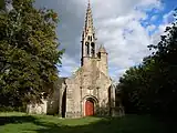 Chapel Saint-Nicolas.
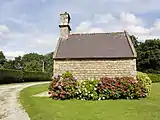 Chapel La Madeleine.
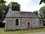 Chapel de Notre-Dame de Poulran.
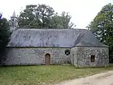 Chapel Notre-Dame de Lotavy.
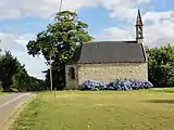 Chapel Saint-Guénolé.
Civil heritage
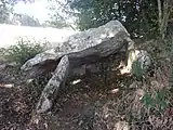 Gallery grave of Botquenven.
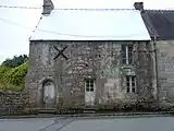 Manor of the Bourg.
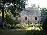 Manor of Plascaër.
Landscapes
 River Ellé
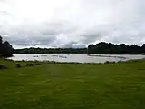 Lake Bel Air
 Lake Bel Air
See also
- Communes of the Morbihan department
- Gaston-Auguste Schweitzer Sculptor of Priziac war memorial
References
- "Maires du Morbihan" (PDF). Préfecture du Morbihan. 7 July 2020.
- "Populations légales 2020". The National Institute of Statistics and Economic Studies. 29 December 2022.
- INSEE commune file
- Des villages de Cassini aux communes d'aujourd'hui: Commune data sheet Priziac, EHESS (in French).
- Population en historique depuis 1968, INSEE
- Populations légales 2020, INSEE
External links
- Official website (in French)
- Base Mérimée: Search for heritage in the commune, Ministère français de la Culture. (in French)
- Mayors of Morbihan Association (in French)