Plouray
Plouray (French pronunciation: [pluʁɛ]; Breton: Plourae) is a commune in the Morbihan department of Brittany in north-western France.[3] Inhabitants of Plouray are called in French Plouraysiens.
Plouray
Plourae | |
|---|---|
 The church of Saint-Yves, in Plouray | |
.svg.png.webp) Coat of arms | |
Location of Plouray | |
 Plouray  Plouray | |
| Coordinates: 48°08′47″N 3°23′12″W | |
| Country | France |
| Region | Brittany |
| Department | Morbihan |
| Arrondissement | Pontivy |
| Canton | Gourin |
| Intercommunality | Roi Morvan Communauté |
| Government | |
| • Mayor (2020–2026) | Michel Morvant[1] |
| Area 1 | 39.09 km2 (15.09 sq mi) |
| Population | 1,046 |
| • Density | 27/km2 (69/sq mi) |
| Time zone | UTC+01:00 (CET) |
| • Summer (DST) | UTC+02:00 (CEST) |
| INSEE/Postal code | 56170 /56770 |
| Elevation | 170–296 m (558–971 ft) |
| 1 French Land Register data, which excludes lakes, ponds, glaciers > 1 km2 (0.386 sq mi or 247 acres) and river estuaries. | |
Population
Plouray's population peaked at 1,991 in 1936 and declined to 1,046 in 2020. This represents a 47% decrease in total population since the peak census figure.
|
| |||||||||||||||||||||||||||||||||||||||||||||||||||||||||||||||||||||||||||||||||||||||||||||||||||||||||||||||||||||
| Source: EHESS[4] and INSEE (1968-2020)[5][6] | ||||||||||||||||||||||||||||||||||||||||||||||||||||||||||||||||||||||||||||||||||||||||||||||||||||||||||||||||||||||
Geography
Plouray is located in the northwestern part of Morbihan, 12 km (7.5 mi) southwest of Rostrenen, 40 km (25 mi) northwest of Pontivy and 44 km (27 mi) north of Lorient. Historically, the village belongs to Vannetais. Plouray is border by Glomel and Mellionnec to the north, by Ploërdut to the east, by Saint-Tugdual and Priziac to the south and by Langonnet to the west.
Map

Environment
Planning a base for automotive recycling by the French company GDE, a subsidiary of the industrial group Trafigura, which sent the ship Probo-Koala to Abidjan in 2006 (see 2006 Ivory Coast toxic waste spill). The proposal was defeated and no longer applies, however recent pollution of the rivers has destroyed a mature fish population and is expected to take several years to recover (article in the Telegram July 2017).
Gallery
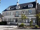 The town hall
 Manor of Penguilly
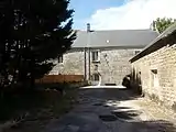 Manor of Restromar
 Dolmen of Guidfoss
See also
References
- "Maires du Morbihan" (PDF). Préfecture du Morbihan. 7 July 2020.
- "Populations légales 2020". The National Institute of Statistics and Economic Studies. 29 December 2022.
- INSEE commune file
- Des villages de Cassini aux communes d'aujourd'hui: Commune data sheet Plouray, EHESS (in French).
- Population en historique depuis 1968, INSEE
- Populations légales 2020, INSEE
External links
- Base Mérimée: Search for heritage in the commune, Ministère français de la Culture. (in French)
- Mayors of Morbihan Association (in French)