Mazinghien
Mazinghien (French pronunciation: [mazɛ̃ɡjɛ̃]) is a commune in the Nord department in northern France.[3]

Map of Mazinghien
Mazinghien | |
|---|---|
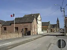 The town hall in Mazinghien | |
.svg.png.webp) Coat of arms | |
Location of Mazinghien | |
 Mazinghien  Mazinghien | |
| Coordinates: 50°03′01″N 3°36′16″E | |
| Country | France |
| Region | Hauts-de-France |
| Department | Nord |
| Arrondissement | Cambrai |
| Canton | Le Cateau-Cambrésis |
| Intercommunality | CA Caudrésis–Catésis |
| Government | |
| • Mayor (2020–2026) | Michel Hennequart[1] |
| Area 1 | 9.01 km2 (3.48 sq mi) |
| Population | 297 |
| • Density | 33/km2 (85/sq mi) |
| Time zone | UTC+01:00 (CET) |
| • Summer (DST) | UTC+02:00 (CEST) |
| INSEE/Postal code | 59395 /59360 |
| Elevation | 143–161 m (469–528 ft) |
| 1 French Land Register data, which excludes lakes, ponds, glaciers > 1 km2 (0.386 sq mi or 247 acres) and river estuaries. | |
Heraldry
Arms of Mazinghien |
The arms of Mazinghien are blazoned : Vert, a titmouse proper perched on a branch, on a chief per pale 1: purpure, ??? and 2: Or, a lion sable, armed and langued gules. Note1: as drawn, this is a 'per fess' rather than field and chief. Note2: the bird shown is a great tit (Parus major)
|
See also
References
- "Répertoire national des élus: les maires" (in French). data.gouv.fr, Plateforme ouverte des données publiques françaises. 13 September 2022.
- "Populations légales 2020". The National Institute of Statistics and Economic Studies. 29 December 2022.
- INSEE commune file
Wikimedia Commons has media related to Mazinghien.
This article is issued from Wikipedia. The text is licensed under Creative Commons - Attribution - Sharealike. Additional terms may apply for the media files.