Saint-Momelin
Saint-Momelin (French pronunciation: [sɛ̃ mɔmlɛ̃]; West Flemish: Sint-Momelingn; Dutch: Sint-Momelijn) is a commune in the Nord department in northern France.[3]
Saint-Momelin | |
|---|---|
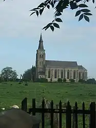 The church in Saint-Momelin | |
_Nord-France.svg.png.webp) Coat of arms | |
Location of Saint-Momelin | |
 Saint-Momelin  Saint-Momelin | |
| Coordinates: 50°47′39″N 2°15′06″E | |
| Country | France |
| Region | Hauts-de-France |
| Department | Nord |
| Arrondissement | Dunkerque |
| Canton | Wormhout |
| Intercommunality | CC Hauts de Flandre |
| Government | |
| • Mayor (2020–2026) | Marie-Noëlle Macrel[1] |
| Area 1 | 6 km2 (2 sq mi) |
| Population | 420 |
| • Density | 70/km2 (180/sq mi) |
| Time zone | UTC+01:00 (CET) |
| • Summer (DST) | UTC+02:00 (CEST) |
| INSEE/Postal code | 59538 /59143 |
| Elevation | 0–71 m (0–233 ft) (avg. 20 m or 66 ft) |
| 1 French Land Register data, which excludes lakes, ponds, glaciers > 1 km2 (0.386 sq mi or 247 acres) and river estuaries. | |
Heraldry
Arms of Saint-Momelin |
The arms of Saint-Momelin are blazoned : Gules, an escarbuncle pommy and fleury Or, the middle branch ending in a crozier Or, all within a bordure compony argent and sable. (Craywick and Saint-Momelin use the same arms.)
|
See also
References
- "Répertoire national des élus: les maires". data.gouv.fr, Plateforme ouverte des données publiques françaises (in French). 9 August 2021.
- "Populations légales 2020". The National Institute of Statistics and Economic Studies. 29 December 2022.
- INSEE commune file
Wikimedia Commons has media related to Saint-Momelin.
This article is issued from Wikipedia. The text is licensed under Creative Commons - Attribution - Sharealike. Additional terms may apply for the media files.