Winnezeele
Winnezeele (French pronunciation: [winzɛl]; from Flemish; Winnezele in modern Dutch spelling) is a commune in the Nord department in northern France.[3]
Winnezeele
Winnezele | |
|---|---|
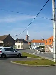 A view within Winnezeele | |
.svg.png.webp) Coat of arms | |
Location of Winnezeele | |
 Winnezeele  Winnezeele | |
| Coordinates: 50°50′30″N 2°33′06″E | |
| Country | France |
| Region | Hauts-de-France |
| Department | Nord |
| Arrondissement | Dunkerque |
| Canton | Wormhout |
| Intercommunality | Flandre Intérieure |
| Government | |
| • Mayor (2020–2026) | Anne Vanpeene[1] |
| Area 1 | 15.54 km2 (6.00 sq mi) |
| Population | 1,319 |
| • Density | 85/km2 (220/sq mi) |
| Time zone | UTC+01:00 (CET) |
| • Summer (DST) | UTC+02:00 (CEST) |
| INSEE/Postal code | 59662 /59670 |
| Elevation | 5–41 m (16–135 ft) (avg. 25 m or 82 ft) |
| 1 French Land Register data, which excludes lakes, ponds, glaciers > 1 km2 (0.386 sq mi or 247 acres) and river estuaries. | |
Heraldry
Arms of Winnezeele |
The arms of Winnezeele are blazoned : Argent, 4 lozenges gules, on a canton Or 2 fesses gules. (NB: one of the lozenges is covered by the canton).
|
Population
| Year | Pop. | ±% p.a. |
|---|---|---|
| 1968 | 1,033 | — |
| 1975 | 988 | −0.63% |
| 1982 | 957 | −0.45% |
| 1990 | 998 | +0.53% |
| 1999 | 1,108 | +1.17% |
| 2007 | 1,228 | +1.29% |
| 2012 | 1,214 | −0.23% |
| 2017 | 1,306 | +1.47% |
| Source: INSEE[4] | ||
See also
References
- "Répertoire national des élus: les maires". data.gouv.fr, Plateforme ouverte des données publiques françaises (in French). 2 December 2020.
- "Populations légales 2020". The National Institute of Statistics and Economic Studies. 29 December 2022.
- INSEE commune file
- Population en historique depuis 1968, INSEE
Wikimedia Commons has media related to Winnezeele.
This article is issued from Wikipedia. The text is licensed under Creative Commons - Attribution - Sharealike. Additional terms may apply for the media files.