Oxelaëre
Oxelaëre (French pronunciation: [ɔksəlaʁ]; from Flemish; Okselare in modern Dutch spelling) is a commune in the Nord department in northern France.[3]
Oxelaëre
Okselare | |
|---|---|
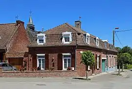 Houses in the centre of the village | |
.svg.png.webp) Coat of arms | |
Location of Oxelaëre | |
 Oxelaëre  Oxelaëre | |
| Coordinates: 50°47′22″N 2°28′24″E | |
| Country | France |
| Region | Hauts-de-France |
| Department | Nord |
| Arrondissement | Dunkerque |
| Canton | Bailleul |
| Intercommunality | Flandre Intérieure |
| Government | |
| • Mayor (2020–2026) | Stéphane Dieusaert[1] |
| Area 1 | 4.72 km2 (1.82 sq mi) |
| Population | 522 |
| • Density | 110/km2 (290/sq mi) |
| Demonym | Oxelaërois (es) |
| Time zone | UTC+01:00 (CET) |
| • Summer (DST) | UTC+02:00 (CEST) |
| INSEE/Postal code | 59454 /59670 |
| Elevation | 29–103 m (95–338 ft) (avg. 36 m or 118 ft) |
| 1 French Land Register data, which excludes lakes, ponds, glaciers > 1 km2 (0.386 sq mi or 247 acres) and river estuaries. | |
Heraldry
Arms of Oxelaëre |
The arms of Oxelaëre are blazoned : Chequy Or and gules. (Oxelaëre, Quesnoy-sur-Deûle and Sars-et-Rosières use the same arms.)
|
See also
References
- "Répertoire national des élus: les maires". data.gouv.fr, Plateforme ouverte des données publiques françaises (in French). 2 December 2020.
- "Populations légales 2020". The National Institute of Statistics and Economic Studies. 29 December 2022.
- INSEE commune file
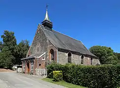 St Martin's church
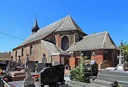 St Martin's church
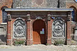 Porch of St Martin's church
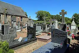 Cemetery
Wikimedia Commons has media related to Oxelaëre.
This article is issued from Wikipedia. The text is licensed under Creative Commons - Attribution - Sharealike. Additional terms may apply for the media files.