Urban area
An urban area, or built-up area, is a human settlement with a high population density and infrastructure of built environment. Urban areas are created through urbanization and are categorized by urban morphology as cities, towns, conurbations or suburbs. In urbanism, the term contrasts to rural areas such as villages and hamlets; in urban sociology or urban anthropology it contrasts with natural environment. The creation of earlier predecessors of urban areas during the urban revolution led to the creation of human civilization with modern urban planning, which along with other human activities such as exploitation of natural resources led to a human impact on the environment. "Agglomeration effects" are in the list of the main consequences of increased rates of firm creation since. This is due to conditions created by a greater level of industrial activity in a given region. However, a favorable environment for human capital development would also be generated simultaneously.[1]


In 1950, around the world, 764 million people lived in urban areas. By 2014, it was 3.9 billion. The change was driven by a combination of increased total population and increased percent of population living in urban areas.[2] In 2009, the number of people living in urban areas (3.42 billion) surpassed the number living in rural areas (3.41 billion), and since then the world has become more urban than rural.[3] This was the first time that the majority of the world's population lived in a city.[4] In 2014 there were 7.3 billion people living on the planet,[5] of which the global urban population comprised 3.9 billion. The Population Division of the United Nations Department of Economic and Social Affairs at that time predicted the urban population would occupy 68% of the world population by 2050, with 90% of that growth coming from Africa and Asia.[6]
The UN publishes data on cities, urban areas and rural areas, but relies almost entirely on national definitions of these areas. The UN principles and recommendations state that due to different characteristics of urban and rural areas across the globe, a global definition is not possible.[7]
Urban areas are created and further developed by the process of urbanization. Urban areas are measured for various purposes, including analyzing population density and urban sprawl.
Unlike an urban area, a metropolitan area includes not only the urban area, but also satellite cities plus intervening rural land that is socio-economically connected to the urban core city, typically by employment ties through commuting, with the urban core city being the primary labor market.
The concept of an "urban area" as used in economic statistics should not be confused with the concept of the "urban area" used in road safety statistics. This term was first created by Geographer Brian Manning. The last concept is also known as "built-up area in road safety". According to the definition by the Office for National Statistics, "Built-up areas are defined as land which is 'irreversibly urban in character', meaning that they are characteristic of a town or city. They include areas of built-up land with a minimum of 20 hectares (200,000 m2; 49 acres). Any areas [separated by] less than 200 metres [of non-urban space] are linked to become a single built-up area.[8]
%252C_OWID.svg.png.webp)

Largest urban areas in the world
 Tokyo (Japan) - 37,274,000
 New Delhi (India) - 32,066,000
 Shanghai (China) - 28,517,000
 Dhaka (Bangladesh) - 22,478,000
 Sao Paulo (Brazil) - 22,430,000
 Mexico City (Mexico) - 22,085,000
 Cairo (Egypt) - 21,750,000
- Beijing (China) - 21,333,000
- Mumbai (India) - 20,961,000
 New York - Newark (United States) - 18,867,000
Largest urban areas, by continent
Africa
- Cairo (Egypt) - 21,750,000
 Kinshasa (DR Congo) - 15,628,000
 Lagos (Nigeria) - 15,388,000
 Johannesburg (South Africa) - 10,110,000
 Luanda (Angola) - 8,952,000
 Dar es Salaam (Tanzania) - 7,405,000
 Khartoum (Sudan) - 6,160,000
 Abidjan (Ivory Coast) - 5,516,000
- Alexandria (Egypt) - 5,484,000
 Addis Ababa (Ethiopia) - 5,228,000
Asia
Europe
North America
- Mexico City (Mexico) - 22,085,000
- New York - Newark (United States) - 18,867,000
- Los Angeles - Long Beach - Santa Ana (United States) - 12,488,000
- Chicago (United States) - 8,901,000
- Houston (United States) - 6,603,000
- Dallas - Fort Worth (United States) - 6,488,400
.svg.png.webp) Toronto (Canada) - 6,313,000
Toronto (Canada) - 6,313,000- Miami (United States) - 6,079,000
- Philadelphia (United States) - 5,705,000
- Washington, D.C. - Baltimore (United States) - 5,434,000
Oceania
.svg.png.webp) Melbourne (Australia) - 4,870,000
Melbourne (Australia) - 4,870,000- Sydney (Australia) - 4,859,000
- Brisbane (Australia) - 2,372,000
- Perth (Australia) - 2,016,000
 Auckland (New Zealand) - 1,582,000
- Adelaide (Australia) - 1,328,000
- Gold Coast (Australia) - 687,000
- Canberra (Australia) - 452,000
- Newcastle (Australia) - 447,000
- Wellington (New Zealand) - 413,000
South America
- São Paulo (Brazil) - 22,430,000
 Buenos Aires (Argentina) - 15,370,000
- Rio de Janeiro (Brazil) - 13,634,000
 Bogotá (Colombia) - 11,344,000
 Lima - Callao (Peru) - 11,176,000
 Santiago (Chile) - 6,857,000
- Belo Horizonte (Brazil) - 6,194,000
- Brasília (Brazil) - 4,804,000
- Recife (Brazil) - 4,220,000
- Porto Alegre (Brazil) - 4,185,000
Largest urban areas, by country
Afghanistan
4.458 million KABUL (capital) (2022)
Albania
512,000 TIRANA (capital) (2022)
Algeria
2.854 million ALGIERS (capital) ; 922,000 Oran (2022)
American Samoa
49,000 PAGO PAGO (capital) (2018)
Andorra
23,000 ANDORRA LA VELLA (capital) (2018)
Angola
8.952 million LUANDA (capital) ; 914,000 Lubango ; 862,000 Cabinda ; Benguela 777,000 (2022)
Anguilla
1,000 THE VALLEY (capital) (2018)
Antigua and Barbuda
21,000 SAINT JOHN'S (capital) (2018)
Argentina
15.370 million BUENOS AIRES (capital) ; 1.598 million Cordoba ; 1.574 million Rosario ; 1.209 million Mendoza ; 1.014 million San Miguel de Tucuman ; 904,000 La Plata (2022)
Armenia
1.092 million YEREVAN (capital) (2022)
Aruba
30,000 ORANJESTAD (capital) (2018)
Australia
5,151 million Melbourne ; 5.057 million Sydney ; 2.472 million Brisbane ; 2.093 million Perth ; 1.356 million Adelaide ; 467,000 CANBERRA (capital) (2022)
Austria
1.960 million VIENNA (capital) (2022)
Azerbaijan
2.401 million BAKU (capital) (2022)
Bahamas, The
280,000 NASSAU (capital) (2018)
Bahrain
689,000 MANAMA (capital) (2022)
Bangladesh
22.478 million DHAKA (capital) ; 5.253 million Chittagong ; 950,000 Khulna ; 942,000 Rajshahi ; 928,000 Sylhet ; Bogra 864,000 (2022); Narayanganj:294,8000
Barbados
89,000 BRIDGETOWN (capital) (2018)
Belarus
2.049 million MINSK (capital) (2022)
Belgium
2.110 million BRUSSELS (capital); 1.053 million Antwerp (2022)
Belize
23,000 BELMOPAN (capital) (2018)
Benin
285,000 PORTO-NOVO (capital) (2018) ; 1.189 million Abomey-Calavi ; 709,000 COTONOU (seat of government) (2022)
Bermuda
10,000 HAMILTON (capital) (2018)
Bhutan
203,000 THIMPHU (capital) (2018)
Bolivia
1.908 million LA PAZ (capital) ; 1.784 million Santa Cruz ; 1.369 million Cochabamba ; 278,000 Sucre (constitutional capital) (2022)
Bosnia and Herzegovina
344,000 SARAJEVO (capital) (2022)
Botswana
269,000 GABORONE (capital) (2018)
Brazil
22.430 million Sao Paulo ; 13.634 million Rio de Janeiro ; 6.194 million Belo Horizonte ; 4.804 million BRASILIA (capital) ; 4.220 million Recife ; 4.185 million Porto Alegre (2022)
British Virgin Islands
15,000 ROAD TOWN (capital) (2018)
Brunei
241,000 BANDAR SERI BEGAWAN (capital) (2011)
Bulgaria
1.287 million SOFIA (capital) (2022)
Burkina Faso
3.056 million OUAGADOUGOU (capital) ; 1.074 million Bobo-Dioulasso (2022)
Burundi
1.139 million BUJUMBURA (capital) (2022)
Cabo Verde
168,000 PRAIA (capital) (2018)
Cambodia
2.211 million PHNOM PENH (capital) (2022)
Cameroon
4.164 million YAOUNDE (capital) ; 3.927 million Douala (2022)
Canada
6.313 million Toronto ; 4.277 million Montreal ; 2.632 million Vancouver ; 1.611 million Calgary ; 1.519 million Edmonton ; 1.423 million OTTAWA (capital) (2022)
Cayman Islands
35,000 GEORGE TOWN (capital) (2018)
Central African Republic
933,000 BANGUI (capital) (2022)
Chad
1.533 million N'DJAMENA (capital) (2022)
Chile
6.857 million SANTIAGO (capital) ; 1.000 million Valparaiso ; 902,000 Concepcion (2022)
China
28.517 million Shanghai ; 20.133 million BEIJING (capital) ; 16.875 million Chongqing ; 14.012 million Tianjin ; 13.965 million Guangzhou ; 12.831 million Shenzhen (2022)
Colombia
11.344 million BOGOTA (capital) ; 4.068 million Medellin ; 2.837 million Cali ; 2.325 million Barranquilla ; 1.366 million Bucaramanga ; 1.079 million Cartagena (2022)
Comoros
62,000 MORONI (capital) (2018)
Congo, Democratic Republic of the
15.628 million KINSHASA (capital) ; 2.765 million Mbuji-Mayi ; 2.695 million Lubumbashi ; 1.593 million Kananga ; 1.366 million Kisangani ; 1.190 million Bukavu (2022)
Congo, Republic of the
2.553 million BRAZZAVILLE (capital) ; 1.295 million Pointe-Noire (2022)
Costa Rica
1.441 million SAN JOSE (capital) (2022)
Cote d'Ivoire
231,000 YAMOUSSOUKRO (capital) (2018) ; 5.516 million ABIDJAN (seat of government) (2022)
Croatia
684,000 ZAGREB (capital) (2022)
Cuba
2.146 million HAVANA (capital) (2022)
Curacao
144,000 WILLEMSTAD (capital) (2018)
Cyprus
269,000 NICOSIA (capital) (2018)
Czech Republic
1.318 million PRAGUE (capital) (2022)
Denmark
1.370 million COPENHAGEN (capital) (2022)
Djibouti
591,000 DJIBOUTI (capital) (2022)
Dominica
15,000 ROSEAU (capital) (2018)
Dominican Republic
3.458 million SANTO DOMINGO (capital) (2022)
Ecuador
3.092 million Guayaquil, 1.928 million QUITO (capital) (2022)
Egypt
21.750 million CAIRO (capital) ; 5.484 million Alexandria ; 764,000 Bur Sa'id (2022)
El Salvador
1.111 million SAN SALVADOR (capital) (2022)
Equatorial Guinea
297,000 MALABO (capital) (2018)
Eritrea
1.035 million ASMARA (capital) (2022)
Estonia
452,000 TALLINN (capital) (2022)
Eswatini
68,000 MBABANE (capital) (2018)
Ethiopia
5.228 million ADDIS ABABA (capital) (2022)
Falkland Islands
2,000 STANLEY (capital) (2018)
Faroe Islands
21,000 TÓRSHAVN (capital) (2018)
Fiji
178,000 SUVA (capital) (2018)
Finland
1.328 million HELSINKI (capital) (2022)
France
11.142 million PARIS (capital) ; 1.748 million Lyon ; 1.620 million Marseille-Aix-en-Provence ; 1.073 million Lille ; 1.049 million Toulouse ; 991,000 Bordeaux (2022)
French Polynesia
136,000 PAPEETE (capital) (2018)
Gabon
857,000 LIBREVILLE (capital) (2022)
Gambia, The
470,000 BANJUL (capital) (2022)
Georgia
1.080 million TBILISI (capital) (2022)
Germany
3.571 million BERLIN (capital) ; 1.788 million Hamburg ; 1.566 million Munich ; 1.137 million Cologne ; 800,376 Nuremberg;[11] 791,000 Frankfurt (2022)
Ghana
3.630 million Kumasi ; 2.605 million ACCRA (capital) ; 1.035 million Sekondi Takoradi (2022)
Gibraltar
35,000 GIBRALTAR (capital) (2018)
Greece
3.154 million ATHENS (capital) ; 814,000 Thessaloniki (2022)
Greenland
18,000 NUUK (capital) (2018)
Grenada
39,000 SAINT GEORGE'S (capital) (2018)
Guam
147,000 HAGATNA (capital) (2018)
Guatemala
3.036 million GUATEMALA CITY (capital) (2022)
Guernsey
16,000 SAINT PETER PORT (capital) (2018)
Guinea
2.049 million CONAKRY (capital) (2022)
Guinea-Bissau
643,000 BISSAU (capital) (2022)
Guyana
110,000 GEORGETOWN (capital) (2018)
Haiti
2.915 million PORT-AU-PRINCE (capital) (2022)
Holy See
1,000 VATICAN CITY (capital) (2018)
Honduras
1.527 million TEGUCIGALPA (capital) ; 956,000 San Pedro Sula (2022)
Hong Kong
7.643 million Hong Kong (2022)
Hungary
1.775 million BUDAPEST (capital) (2022)
Iceland
216,000 REYKJAVÍK (capital) (2018)
India
32.066 million NEW DELHI (capital) ; 20.961 million Mumbai ; 15.134 million Kolkata ; 13.193 million Bangalore ; 11.503 million Chennai ; 10.534 million Hyderabad (2022)
Indonesia
11.075 million JAKARTA (capital) ; 3.622 million Bekasi ; 3.005 million Surabaya ; 2.942 million Depok ; 2.638 million Bandung ; 2.456 million Tangerang (2022)
Iran
9.382 million TEHRAN (capital) ; 3.318 million Mashhad ; 2.219 million Esfahan ; 1.699 million Shiraz ; 1.644 million Tabriz ; 1.587 million Karaj (2022)
Iraq
7.512 million BAGHDAD (capital) ; 1.737 million Mosul ; 1.414 million Basra ; 1.052 million Kirkuk ; 930,000 Najaf ; 878,000 Erbil (2022)
Ireland
1.256 million DUBLIN (capital) (2022)
Isle of Man
27,000 DOUGLAS (capital) (2018)
Israel
4.344 million Tel Aviv-Yafo ; 1.254 million JERUSALEM (capital) ; 1.164 million Haifa (2022)
Italy
4.298 million ROME (capital) ; 3.149 million Milan ; 2.180 million Naples ; 1.798 million Turin ; 907,000 Bergamo ; 850,000 Palermo (2022)
Jamaica
595,000 KINGSTON (capital) (2022)
Japan
37.274 million TOKYO (capital) ; 19.060 million Osaka ; 9.572 million Nagoya ; 5.503 million Kitakyushu-Fukuoka ; 2.935 million Shizuoka-Hamamatsu ; 2.669 million Sapporo (2022)
Jersey
34,000 SAINT HELIER (capital) (2018)
Jordan
2.210 million AMMAN (capital) (2022)
Kazakhstan
1.958 million Almaty ; 1.254 million NUR-SULTAN (capital) ; 1.126 million Shimkent (2022)
Kenya
5.119 million NAIROBI (capital), 1.389 million Mombasa (2022)
Kiribati
64,000 TARAWA (capital) (2018)
Korea, North
3.133 million PYONGYANG (capital) (2022)
Korea, South
9.976 million SEOUL (capital) ; 3.468 million Busan ; 2.834 million Incheon ; 2.185 million Daegu (Taegu) ; 1.573 million Daejon (Taejon) ; 1.526 million Gwangju (Kwangju) (2022)
Kosovo
216,870 PRISTINA (capital) (2019)
Kuwait
3.239 million KUWAIT (capital) (2022)
Kyrgyzstan
1.082 million BISHKEK (capital) (2022)
Laos
706,000 VIENTIANE (capital) (2022)
Latvia
625,000 RIGA (capital) (2022)
Lebanon
2.433 million BEIRUT (capital) (2022)
Lesotho
202,000 MASERU (capital) (2018)
Liberia
1.623 million MONROVIA (capital) (2022)
Libya
1.176 million TRIPOLI (capital) ; 953,000 Misratah ; 848,000 Benghazi (2022)
Liechtenstein
5,000 VADUZ (capital) (2018)
Lithuania
541,000 VILNIUS (capital) (2022)
Luxembourg
120,000 LUXEMBOURG (capital) (2018)
Madagascar
3.700 million ANTANANARIVO (capital) (2022)
Malawi
1.222 million LILONGWE (capital) ; 995,000 Blantyre-Limbe (2022)
Malaysia
7.860 million KUALA LUMPUR (capital) ; 1.815 million Johor Bahru ; 1.470 million Penang ; 785,000 Ipoh ; 755,000 Kuching ; 605,000 Seremban (2019)[12]
Maldives
177,000 MALE (capital) (2018)
Mali
2.817 million BAMAKO (capital) (2022)
Malta
213,000 VALLETTA (capital) (2018)
Marshall Islands
31,000 MAJURO (capital) (2018)
Mauritania
1.432 million NOUAKCHOTT (capital) (2022)
Mauritius
149,000 PORT LOUIS (capital) (2018)
Mexico
22.085 million MEXICO CITY (capital) ; 5.340 million Guadalajara ; 5.037 million Monterrey ; 3.295 million Puebla ; 2.576 million Toluca de Lerdo ; 2.221 million Tijuana (2022)
Federated States of Micronesia
7,000 PALIKIR (capital) (2018)
Moldova
491,000 CHISINAU (capital) (2022)
Monaco
39,000 MONACO (capital) (2018)
Mongolia
1.645 million ULAANBAATAR (capital) (2022)
Montenegro
177,000 PODGORICA (capital) (2018)
Morocco
3.840 million Casablanca ; 1.932 million RABAT (capital) ; 1.267 million Fes ; 1.238 million Tangier ; 1.277 million Marrakech, 960,000 Agadir (2022)
Mozambique
1.797 million Matola ; 1.139 million MAPUTO (capital) ; 927,000 Nampula (2022)
Myanmar (Burma)
5.514 million Rangoon (Yangon) ; 1.501 million Mandalay ; 925,000 NAYPYIDAW (capital) (2022)
Namibia
461,000 WINDHOEK (capital) (2022)
Nepal
1.521 million KATHMANDU (capital) (2022)
Netherlands
2.48 million AMSTERDAM (capital), 2.40 million Rotterdam - The Hague (2022)
New Caledonia
198,000 NOUMEA (capital) (2018)
New Zealand
1.652 million Auckland, 419,000 WELLINGTON (capital) (2022)
Nicaragua
1.083 million MANAGUA (capital) (2022)
Niger
1.384 million NIAMEY (capital) (2022)
Nigeria
15.388 million Lagos ; 4.219 million Kano ; 3.756 million Ibadan ; 3.652 million ABUJA (capital) ; 3.325 million Port Harcourt ; 1.841 million Benin City (2022)
Niue
1,000 ALOFI (capital) (2018)
North Macedonia
606,000 SKOPJE (capital) (2022)
Northern Mariana Islands
51,000 SAIPAN (capital) (2018)
Norway
1.071 million OSLO (capital) (2022)
Oman
1.623 million MUSCAT (capital) (2022)
Pakistan
16.840 million Karachi ; 13.542 million Lahore ; 3.625 million Faisalabad ; 2.353 million Gujranwala ; 2.343 million Peshawar ; 1.198 million ISLAMABAD (capital) (2022)
Palau
277 NGERULMUD (capital) (2018)
Palestine
756,000 Gaza ; 153,237 RAMALLAH (Capital) (2022)
Panama
1.938 million PANAMA CITY (capital) (2022)
Papua New Guinea
400,000 PORT MORESBY (capital) (2022)
Paraguay
3.452 million ASUNCION (capital) (2022)
Peru
10.004 million LIMA (capital) ; 1.226 million Arequipa ; Callao 1.172 million ; 1.163 million Trujillo ; 929,055 Piura ; 605,300 Chiclayo (2022)
Philippines
13.484 million MANILA (capital) ; 3.339 million Metro Davao ; 3.165 million Metro Cebu ; 1.687 Metro Cagayan de Oro
Poland
1.795 million WARSAW (capital) ; 770,000 Krakow (2022)
Portugal
3.035 million LISBON (capital) ; 1.737 million Porto (2022)
Puerto Rico
2.443 million SAN JUAN (capital) (2022)
Qatar
779,000 Ar-Rayyan ; 652,000 DOHA (capital) (2022)
Romania
1.785 million BUCHAREST (capital) (2022)
Russia
12.641 million MOSCOW (capital) ; 5.536 million Saint Petersburg ; 1.686 million Novosibirsk ; 1.521 million Yekaterinburg ; 1.286 million Kazan ; 1.253 million Nizhniy Novgorod (2022)
Rwanda
1.208 million KIGALI (capital) (2022)
Saint Helena, Ascension, and Tristan da Cunha
1,000 JAMESTOWN (capital) (2018)
Saint Kitts and Nevis
14,000 BASSETERRE (capital) (2018)
Saint Lucia
22,000 CASTRIES (capital) (2018)
Saint Pierre and Miquelon
6,000 SAINT - PIERRE (capital) (2018)
Saint Vincent and the Grenadines
27,000 KINGSTOWN (capital) (2018)
Samoa
36,000 APIA (capital) (2018)
San Marino
4,000 SAN MARINO (2018)
São Tomé and Príncipe
80,000 SÃO TOMÉ (capital) (2018)
Saudi Arabia
7.538 million RIYADH (capital) ; 4.781 million Jeddah ; 2.115 million Mecca ; 1.545 million Medina ; 1.305 million Ad Dammam ; 860,000 million Hufuf-Mubarraz (2022)
Senegal
3.326 million DAKAR (capital) (2022)
Serbia
1.405 million BELGRADE (capital) (2022)
Seychelles
28,000 VICTORIA (capital) (2018)
Sierra Leone
1.272 million FREETOWN (capital) (2022)
Sint Maarten
1,327 PHILIPSBURG (capital) (2011)
Slovakia
439,000 BRATISLAVA (capital) (2022)
Slovenia
286,000 LJUBLJANA (capital) (2018)
Solomon Islands
82,000 HONIARA (capital) (2018)
Somalia
2.497 million MOGADISHU (capital) ; 1.079 million Hargeysa (2022)
South Africa
10.110 million Johannesburg (includes Ekurhuleni) ; 4.801 million Cape Town (legislative capital) ; 3.199 million Durban ; 2.74 million PRETORIA (administrative capital) ; 1.281 million Port Elizabeth ; 909,000 West Rand (2022)
South Sudan
440,000 JUBA (capital) (2022)
Spain
6.714 million MADRID (capital) ; 5.658 million Barcelona ; 837,000 Valencia (2022)
Sri Lanka
626,000 COLOMBO (capital) ; 103,000 Sri Jayewardenepura Kotte (legislative capital) (2022)
Sudan
6.160 million KHARTOUM (capital) ; 1.012 million Nyala (2022)
Suriname
239,000 PARAMARIBO (capital) (2018)
Sweden
1.659 million STOCKHOLM (capital) (2022)
Switzerland
1.420 million Zurich, 437,000 BERN (capital) (2022)
Syria
2.503 million DAMASCUS (capital) ; 2.098 million Aleppo ; 1.398 million Hims (Homs) ; 964,000 Hamah (2022)
Taiwan
4.471 million New Taipei City ; 2.821 million Taichung ; 2.770 million Kaohsiung ; 2.742 million TAIPEI (capital) ; 2.296 million Taoyuan ; 863,000 Tainan (2022)
Tajikistan
962,000 DUSHANBE (capital) (2022)
Tanzania
7.405 million DAR ES SALAAM (administrative capital) ; 1.245 million Mwanza ; 766,000 Zanzibar ; 262,000 Dodoma (legislative capital) (2022)
Thailand
10.700 million BANGKOK (capital) ; 1.198 million Chiang Mai ; 500,000 Nakhon Ratchasima ; 420,000 Khon Kaen ; 410,000 Udon Thani (2022)
Timor-Leste
281,000 DILI (capital) (2018)
Togo
1.926 million LOME (capital) (2022)
Tonga
23,000 NUKU'ALOFA (2018)
Trinidad and Tobago
545,000 PORT OF SPAIN (capital) (2022)
Tunisia
2.439 million TUNIS (capital) (2022)
Turkey (Türkiye)
15.636 million Istanbul ; 5.310 million ANKARA (capital) ; 3.056 million Izmir ; 2.055 million Bursa ; 1.814 million Adana ; 1.773 million Gaziantep (2022)
Turkmenistan
883,000 ASHGABAT (capital) (2022)
Turks and Caicos Islands
5,000 GRAND TURK (capital) (2018)
Tuvalu
7,000 FUNAFUTI (capital) (2018)
Uganda
3.652 million KAMPALA (capital) (2022)
Ukraine
3.010 million KYIV (capital) ; 1.423 million Kharkiv ; 1.008 million Odesa ; 952,000 Dnipro ; 893,000 Donetsk (2022)
United Arab Emirates
2.964 million Dubai ; 1.786 million Sharjah ; 1.540 million ABU DHABI (capital) (2022)
United Kingdom
9.426 million LONDON (capital) ; 2.750 million Manchester ; 2.626 million Birmingham ; 2.240 million Liverpool; 1.902 million West Yorkshire ; 1.681 million Glasgow ; 944,000 Southampton/Portsmouth (2022)
United States
18.867 million New York - Newark ; 12.488 million Los Angeles - Long Beach - Santa Ana ; 8.901 million Chicago ; 6.603 million Houston ; 6.488 million Dallas - Fort Worth ; 5.434 million WASHINGTON, D.C. (capital) (2022)
Uruguay
1.767 million MONTEVIDEO (capital) (2022)
Uzbekistan
2.574 million TASHKENT (capital) (2022)
Vanuatu
53,000 PORT - VILA (capital) (2018)
Venezuela
2.957 million CARACAS (capital) ; 2.333 million Maracaibo ; 1.959 million Valencia ; 1.241 million Barquisimeto ; 1.230 million Maracay ; 950,000 Ciudad Guayana (2022)
Vietnam
9.077 million Ho Chi Minh City ; 5.067 million HANOI (capital) ; 1.786 million Can Tho ; 1.382 million Hai Phong ; 1.188 million Da Nang ; 1.078 million Bien Hoa (2022)
Virgin Islands
52,000 CHARLOTTE AMALIE (capital) (2018)
Wallis and Futuna
1,000 MATA - UTU (capital) (2018)
Yemen
3.182 million SANAA (capital), 1.045 million Aden (2022)
Zambia
3.042 million LUSAKA (capital) (2022)
Zimbabwe
1.558 million HARARE (capital) (2022)
Definitions
European countries define urbanized areas on the basis of urban-type land use, not allowing any gaps of typically more than 200 metres (220 yd), and use satellite imagery instead of census blocks to determine the boundaries of the urban area. In less-developed countries, in addition to land use and density requirements, a requirement that a large majority of the population, typically 75%, is not engaged in agriculture and/or fishing is sometimes used.
China
Since 2000, China's cities have expanded at an average rate of 10% annually. It is estimated that China's urban population will increase by 292 million people by 2050,[2] when its cities will house a combined population of over one billion.[14] The country's urbanization rate increased from 17.4% to 46.6% between 1978 and 2009.[15] Between 150 and 200 million migrant workers work part-time in the major cities, returning home to the countryside periodically with their earnings.[16][17]
Today, China has more cities with one million or more long-term residents than any other country, including the three global cities of Beijing, Hong Kong, and Shanghai; by 2025, the country will be home to 221 cities with over a million inhabitants.[14] The figures in the table below are from the 2008 census, and are only estimates of the urban populations within administrative city limits; a different ranking exists when considering the total municipal populations (which includes suburban and rural populations). The large "floating populations" of migrant workers make conducting censuses in urban areas difficult;[18] the figures below include only long-term residents.

| Rank | Name | Province | Pop. | Rank | Name | Province | Pop. | ||
|---|---|---|---|---|---|---|---|---|---|
 Shanghai .jpg.webp) Beijing |
1 | Shanghai | SH | 24,281,400 | 11 | Hong Kong | HK | 7,448,900 |  Guangzhou  Shenzhen |
| 2 | Beijing | BJ | 19,164,000 | 12 | Zhengzhou | HA | 7,179,400 | ||
| 3 | Guangzhou | GD | 13,858,700 | 13 | Nanjing | JS | 6,823,500 | ||
| 4 | Shenzhen | GD | 13,438,800 | 14 | Xi'an | SN | 6,642,100 | ||
| 5 | Tianjin | TJ | 11,744,400 | 15 | Jinan | SD | 6,409,600 | ||
| 6 | Chongqing | CQ | 11,488,000 | 16 | Shenyang | LN | 5,900,000 | ||
| 7 | Dongguan | GD | 9,752,500 | 17 | Qingdao | SD | 5,501,400 | ||
| 8 | Chengdu | SC | 8,875,600 | 18 | Harbin | HL | 5,054,500 | ||
| 9 | Wuhan | HB | 8,652,900 | 19 | Hefei | AH | 4,750,100 | ||
| 10 | Hangzhou | ZJ | 8,109,000 | 20 | Changchun | JL | 4,730,900 | ||
- Population of Hong Kong as of 2018 estimate.[20]
- The data of Chongqing in the list is the data of "Metropolitan Developed Economic Area", which contains two parts: "City Proper" and "Metropolitan Area". The "City proper" are consist of 9 districts: Yuzhong, Dadukou, Jiangbei, Shapingba, Jiulongpo, Nan'an, Beibei, Yubei, & Banan, has the urban population of 5,646,300 as of 2018. And the "Metropolitan Area" are consist of 12 districts: Fuling, Changshou, Jiangjin, Hechuan, Yongchuan, Nanchuan, Qijiang, Dazu, Bishan, Tongliang, Tongnan, & Rongchang, has the urban population of 5,841,700.[21] Total urban population of all 26 districts of Chongqing are up to 15,076,600.
Japan
In Japan urbanized areas are defined as contiguous areas of densely inhabited districts (DIDs) using census enumeration districts as units with a density requirement of 4,000 inhabitants per square kilometre (10,000/sq mi).
India
For the Census of India 2011, the definition of urban area is a place having a minimum population of 5,000 of density 400 persons per square kilometre (1,000/sq mi) or higher, and 75% plus of the male working population employed in non-agricultural activities. Places administered by a municipal corporation, cantonment board or notified town area committee are automatically considered urban areas.[22]
The Census of India 2011 also defined the term "urban agglomeration" as an integrated urban area consisting of a core town together with its "outgrowths" (contiguous suburbs).[23]


_2013-06-30_22-44.jpg.webp)


Pakistan
In Pakistan, an area is a major city and municipality if it has more than 100,000 inhabitants according to census results. Cities include adjacent cantonments. Urbanisation in Pakistan has increased since the time of independence and has several different causes. The majority of southern Pakistan's population lives along the Indus River. Karachi is its most populous city.[26] In the northern half of the country, most of the population lives in an arc formed by the cities of Lahore, Faisalabad, Rawalpindi, Islamabad, Gujranwala, Sialkot, Gujrat, Jhelum, Sargodha, Sheikhupura, Nowshera, Mardan and Peshawar. During 1990–2008, city dwellers made up 36% of Pakistan's population, making it the most urbanised nation in South Asia. Furthermore, 50% of Pakistanis live in towns of 5,000 people or more.[27] Karachi is the most populated city in Pakistan closely followed by Lahore according to the 2017 Census.
Bangladesh
In Bangladesh, there are total 532 urban areas, which are divided into three categories. Those are City Corporation, Municipal Corporation (Pourasova) and Upazila town. Among those urban areas, Dhaka is the largest city by population and area, with a population of 19.10 million.[28] In Bangladesh, there are total 11 City Corporations and 329 Municipal Corporations and 203 Small towns, which serves as the center for Upazilas. According to 2011 population census, Bangladesh has an urban population of 28%, with a growth rate of 2.8%.[29] At this growth rate, it is estimated that the urban population of Bangladesh will reach 79 million or 42% of total population by 2035.
Southeast Asia
| Rank | Name | Country | Pop. | Rank | Name | Country | Pop. | ||
|---|---|---|---|---|---|---|---|---|---|
 Jakarta  Manila |
1 | Jakarta | Indonesia | 34,540,000 | 11 | Medan | Indonesia | 3,632,000 |  Bangkok .jpg.webp) Ho Chi Minh City |
| 2 | Manila | Philippines | 23,088,000 | 12 | Cebu City | Philippines | 2,275,000 | ||
| 3 | Bangkok | Thailand | 17,066,000 | 13 | Phnom Penh | Cambodia | 2,177,000 | ||
| 4 | Ho Chi Minh City | Vietnam | 13,312,000 | 14 | Semarang | Indonesia | 1,992,000 | ||
| 5 | Kuala Lumpur | Malaysia | 8,285,000 | 15 | Johor Bahru | Malaysia | 1,981,000 | ||
| 6 | Bandung | Indonesia | 7,065,000 | 16 | Makassar | Indonesia | 1,952,000 | ||
| 7 | Hanoi | Vietnam | 6,576,000 | 17 | Palembang | Indonesia | 1,889,000 | ||
| 8 | Surabaya | Indonesia | 6,499,000 | 18 | Mandalay | Myanmar | 1,633,000 | ||
| 9 | Yangon | Myanmar | 6,314,000 | 19 | Hai Phong | Vietnam | 1,623,000 | ||
| 10 | Singapore | Singapore | 5,745,000 | 20 | Yogyakarta | Indonesia | 1,568,000 | ||
Philippines
With an estimated population of 16.3 million, Metro Manila is the most populous metropolitan area in the Philippines and the 11th in the world. However, the greater urban area is the 5th largest in the world with a population of 20,654,307 people (2010 estimate).[30]
Singapore
As an island city-state, about 5.6 million people live and work within 700 square kilometres (270 sq mi). With 64 islands and islets, Singapore Island makes up the largest urban area in the country. According to the United Nations Economic and Social Commission for Asia and the Pacific, the country has the highest urbanised population in Southeast Asia, with 100 percent of its population living in an urban area.[31] The Urban Redevelopment Authority (URA) is responsible for the urban land-use planning, which designates land use and urban density of the country.[32] The country is divided into 5 regions for planning purposes by the URA, even though as a city state Singapore is defined as a single continuous urban area. It is further subdivided into 55 urban planning areas, which acts as the boundaries of planned towns within the country.[33]
Vietnam
In Vietnam, there are 6 types of urban areas:
- Special urban area (2 municipalities): Hanoi and Ho Chi Minh City.
- Type I urban area (18 provincial cities and 3 municipalities): Long Xuyên, Pleiku, Mỹ Tho, Thủ Dầu Một, Bắc Ninh, Biên Hòa, Hải Dương, Thanh Hóa, Hạ Long, Việt Trì, Thái Nguyên, Nam Định, Vũng Tàu, Buôn Ma Thuột, Đà Lạt, Quy Nhơn, Nha Trang, Huế, Vinh, Cần Thơ, Đà Nẵng and Hải Phòng.
- Type II urban area (21 provincial cities and 1 district):Châu Đốc, Đồng Hới, Uông Bí, Bắc Giang, Ninh Bình, Bạc Liêu, Bà Rịa, Thái Bình, Rạch Giá, Cà Mau, Phan Rang–Tháp Chàm, Tuy Hòa, Phan Thiết, Vĩnh Yên, Lào Cai and Phú Quốc.
- Type III urban area (31 provincial cities and 12 towns).
- Type IV urban area (35 towns and 35 townships).
- Type V urban area (586 townships and 54 communes).
Finland

As in other Nordic countries, an urban area (taajama in Finnish) in Finland must have a building at least every 200 m (660 ft) and at least 200 people. To be considered a town or a city (kaupunki) for statistical purposes, an urban area must have at least 15,000 people. This is not to be confused with the city / town designation used by municipalities.[34][35]
France
In France, an urban area (Fr: aire d'attraction d'une ville) is a zone encompassing an area of built-up growth (called an "urban unit" (unité urbaine)[36] – close in definition to the North American urban area) and its commuter belt (couronne). Americans would find the INSEE definition of the urban area[37] to be similar to their metropolitan area.
The largest cities in France, in terms of urban area population (2017), are Paris (12,628,266), Lyon (2,323,221), Marseille (1,760,653), Toulouse (1,360,829), Bordeaux (1,247,977), Lille (1,191,117), Nice (1,006,201), Nantes (972,828), Strasbourg (790,087) and Rennes (733,320).[38]

Germany
Germany has a number of large cities. The largest conurbation is the Rhine-Ruhr region (11 million in 2008), including Düsseldorf (the capital of North Rhine-Westphalia), Cologne, Bonn, Dortmund, Essen, Duisburg, and Bochum.[39]
Largest urban agglomerations in Germany Federal Statistical Office of Germany (31 December 2017) | |||||||||
|---|---|---|---|---|---|---|---|---|---|
| Rank | Name | State | Pop. | Rank | Name | State | Pop. | ||
 Rhine-Ruhr  Berlin |
1 | Rhine-Ruhr | North Rhine-Westphalia | 11,108,117 | 11 | Chemnitz | Saxony | 873,745 | 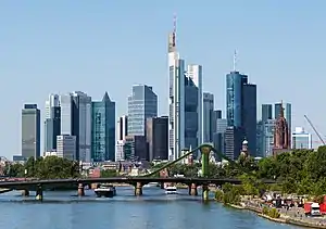 Rhine-Main  Stuttgart |
| 2 | Berlin | Berlin | 4,544,525 | 12 | Hanover | Lower Saxony | 796,298 | ||
| 3 | Rhine-Main | Hesse | 3,146,343 | 13 | Dresden | Saxony | 790,534 | ||
| 4 | Stuttgart | Baden-Württemberg | 3,016,208 | 14 | Saar | Saarland | 758,249 | ||
| 5 | Munich | Bavaria | 2,374,272 | 15 | Bremen | Bremen | 664,603 | ||
| 6 | Hamburg | Hamburg | 2,342,356 | 16 | Aachen | North Rhine-Westphalia | 655,276 | ||
| 7 | Rhine-Neckar | Baden-Württemberg | 1,410,711 | 17 | Karlsruhe | Baden-Württemberg | 611,319 | ||
| 8 | Nuremberg | Bavaria | 1,228,597 | 18 | Augsburg | Bavaria | 543,503 | ||
| 9 | Leipzig | Saxony | 1,038,996 | 19 | Freiburg im Breisgau | Baden-Württemberg | 332,013 | ||
| 10 | Bielefeld | North Rhine-Westphalia | 929,005 | 20 | Kassel | Hesse | 330,654 | ||
Netherlands
The Netherlands is the 30th most densely populated country in the world, with 404.6 inhabitants per square kilometre (1,048/sq mi)—or 497 inhabitants per square kilometre (1,287/sq mi) if only the land area is counted. The Randstad is the country's largest conurbation located in the west of the country and contains the four largest cities: Amsterdam, Rotterdam, The Hague, and Utrecht. The Randstad has a population of 7 million inhabitants and is the 6th largest metropolitan area in Europe.
Sweden
Urban areas in Sweden (tätorter) are statistically defined localities, totally independent of the administrative subdivision of the country. There are 1,956 such localities in Sweden, with a population ranging from 200 to 1,372,000 inhabitants.[40]
United Kingdom
In 2013 the United Kingdom's Office for National Statistics (ONS) published 2011 Built-up Areas - Methodology and Guidance which sets out its definition of a built-up area as an area of built-up land of at least 20 hectares (0.077 sq mi), separated from other settlements by at least 200 metres (660 ft). For 2011 census data there are 5,493 built-up areas, of which 501 are divided into sub-divisions for which data is also available. Each built-up area is named algorithmically, using Ordnance Survey place-name data.[41]
The ONS has produced census results from urban areas since 1951, since 1981 based upon the extent of irreversible urban development indicated on Ordnance Survey maps. The definition is an extent of at least 20 ha and at least 1,500 census residents. Separate areas are linked if less than 200 m (220 yd) apart. Included are transportation features.[42] The UK has five Urban Areas with a population over a million and a further sixty nine with a population over one hundred thousand.
| Rank | Urban area | Pop. | Principal settlement | Rank | Urban area | Pop. | Principal settlement | ||
|---|---|---|---|---|---|---|---|---|---|
 Greater London |
1 | Greater London | 9,787,426 | London | 11 | Bristol | 617,280 | Bristol | |
| 2 | West Midlands | 2,919,600 | Birmingham | 12 | Edinburgh | 512,150 | Edinburgh | ||
| 3 | Greater Manchester | 2,553,379 | Manchester | 13 | Leicester | 508,916 | Leicester | ||
| 4 | West Yorkshire | 1,777,934 | Leeds | 14 | Belfast | 483,418 | Belfast | ||
| 5 | Greater Glasgow | 985,290 | Glasgow | 15 | Brighton & Hove | 474,485 | Brighton & Hove | ||
| 6 | Liverpool | 864,122 | Liverpool | 16 | Bournemouth/ Poole | 466,266 | Bournemouth | ||
| 7 | South Hampshire | 855,569 | Southampton | 17 | Cardiff | 390,214 | Cardiff | ||
| 8 | Tyneside | 774,891 | Newcastle | 18 | Teesside | 376,633 | Middlesbrough | ||
| 9 | Nottingham | 729,977 | Nottingham | 19 | Stoke-on-Trent | 372,775 | Stoke | ||
| 10 | Sheffield | 685,368 | Sheffield | 20 | Coventry | 359,262 | Coventry | ||

Norway
Statistics Norway defines urban areas ("tettsteder") similarly to the other Nordic countries. Unlike in Denmark and Sweden, the distance between each building has to be of less than 50 m, although exceptions are made due to parks, industrial areas, rivers, and similar. Groups of houses less than 400 m from the main body of an urban area are included in the urban area.[47]
Poland
In Poland, official "urban" population figures simply refer to those localities which have the status of towns (miasta). The "rural" population is that of all areas outside the boundaries of these towns. This distinction may give a misleading impression in some cases, since some localities with only village status may have acquired larger and denser populations than many many smaller towns[48] with most excessive example of Poznań, most spread urban area of the country with population of the city app. 534 thousand and urban area above 1,100 thousand inhabitants. On the other hand, the Upper Silesian Industrial Region conurbation with numerous large and medium cities covers 3,200 km and has approximately 3 million people.
Russia
Moscow, the capital and largest city of Russia, has a population estimated at 12.4 million residents within the city limits,[49] while over 17 million residents in the urban area,[50] and over 20 million residents in the Moscow Metropolitan Area.[51] It is among the world's largest cities, being the most populous city entirely within Europe, the most populous urban area in Europe,[50] the most populous metropolitan area in Europe,[51] and also the largest city by land area on the European continent.[52] Saint Petersburg, the cultural capital, is the second-largest city, with a population of roughly 5.4 million inhabitants.[53] Other major urban areas are Yekaterinburg, Novosibirsk, Kazan, Nizhny Novgorod, and Chelyabinsk.

 Saint Petersburg, the cultural capital and the second-largest city
 Novosibirsk, the largest city in Siberia and the third-largest city
 Yekaterinburg, the fourth-largest city in the country.
| Rank | Name | Federal subject | Pop. | Rank | Name | Federal subject | Pop. | ||
|---|---|---|---|---|---|---|---|---|---|
 Moscow Saint Petersburg |
1 | Moscow | Moscow | 13,010,112 | 11 | Rostov-na-Donu | Rostov Oblast | 1,142,162 | Novosibirsk Yekaterinburg |
| 2 | Saint Petersburg | Saint Petersburg | 5,601,911 | 12 | Omsk | Omsk Oblast | 1,125,695 | ||
| 3 | Novosibirsk | Novosibirsk Oblast | 1,633,595 | 13 | Krasnodar | Krasnodar Krai | 1,099,344 | ||
| 4 | Yekaterinburg | Sverdlovsk Oblast | 1,544,376 | 14 | Voronezh | Voronezh Oblast | 1,057,681 | ||
| 5 | Kazan | Tatarstan | 1,308,660 | 15 | Perm | Perm Krai | 1,034,002 | ||
| 6 | Nizhny Novgorod | Nizhny Novgorod Oblast | 1,228,199 | 16 | Volgograd | Volgograd Oblast | 1,028,036 | ||
| 7 | Chelyabinsk | Chelyabinsk Oblast | 1,189,525 | 17 | Saratov | Saratov Oblast | 901,361 | ||
| 8 | Krasnoyarsk | Krasnoyarsk Krai | 1,187,771 | 18 | Tyumen | Tyumen Oblast | 847,488 | ||
| 9 | Samara | Samara Oblast | 1,173,299 | 19 | Tolyatti | Samara Oblast | 684,709 | ||
| 10 | Ufa | Bashkortostan | 1,144,809 | 20 | Barnaul | Altai Krai | 630,877 | ||
Australia
The Australian Bureau of Statistics refers to urban areas as Urban Centres, which it generally defines as population clusters of 1,000 or more people.[55] Australia is one of the most urbanised countries in the world, with more than 50% of the population residing in Australia's three biggest urban centres.[55]

New Zealand
Statistics New Zealand defines urban areas in New Zealand, which are independent of any administrative subdivisions and have no legal basis.[57] There are four classes of urban area: major urban areas (population 100,000+), large urban areas (population 30,000-99,999), medium urban areas (population 10,000-29,999) and small urban areas (population 1000-9,999). As of 2021, there are 7 major urban areas, 13 large urban areas, 22 medium urban areas and 136 small urban areas. Urban areas are reclassified after each New Zealand census, so population changes between censuses does not change an urban area's classification.
Largest cities or towns in New Zealand Statistics New Zealand June 2022 estimate (SSGA18 boundaries)[58] | |||||||||
|---|---|---|---|---|---|---|---|---|---|
| Rank | Name | Region | Pop. | Rank | Name | Region | Pop. | ||
.jpeg.webp) Auckland .jpg.webp) Christchurch |
1 | Auckland | Auckland | 1,440,300 | 11 | Hibiscus Coast | Auckland | 60,000 | .jpg.webp) Wellington  Hamilton |
| 2 | Christchurch | Canterbury | 377,900 | 12 | New Plymouth | Taranaki | 58,500 | ||
| 3 | Wellington | Wellington | 212,000 | 13 | Rotorua | Bay of Plenty | 57,900 | ||
| 4 | Hamilton | Waikato | 179,900 | 14 | Whangārei | Northland | 54,900 | ||
| 5 | Tauranga | Bay of Plenty | 158,300 | 15 | Nelson | Nelson | 50,800 | ||
| 6 | Lower Hutt | Wellington | 111,500 | 16 | Hastings | Hawke's Bay | 50,400 | ||
| 7 | Dunedin | Otago | 102,400 | 17 | Invercargill | Southland | 49,800 | ||
| 8 | Palmerston North | Manawatū-Whanganui | 81,200 | 18 | Upper Hutt | Wellington | 44,800 | ||
| 9 | Napier | Hawke's Bay | 66,800 | 19 | Whanganui | Manawatū-Whanganui | 42,600 | ||
| 10 | Porirua | Wellington | 60,200 | 20 | Gisborne | Gisborne | 37,700 | ||
Canada
According to Statistics Canada, an urban area in Canada is an area with a population of at least 1,000 people where the density is no fewer than 400 persons per square kilometre (1,000/sq mi).[59] If two or more urban areas are within 2 km (1.2 mi) of each other by road, they are merged into a single urban area, provided they do not cross census metropolitan area or census agglomeration boundaries.[60]
In the Canada 2011 Census, Statistics Canada redesignated urban areas with the new term "population centre";[61] the new term was chosen in order to better reflect the fact that urban vs. rural is not a strict division, but rather a continuum within which several distinct settlement patterns may exist. For example, a community may fit a strictly statistical definition of an urban area, but may not be commonly thought of as "urban" because it has a smaller population, or functions socially and economically as a suburb of another urban area rather than as a self-contained urban entity, or is geographically remote from other urban communities. Accordingly, the new definition set out three distinct types of population centres: small (population 1,000 to 29,999), medium (population 30,000 to 99,999) and large (population 100,000 or greater).[61] Despite the change in terminology, however, the demographic definition of a population centre remains unchanged from that of an urban area: a population of at least 1,000 people where the density is no fewer than 400 persons per km2.
Largest metropolitan areas in Canada 2021 Canadian census | |||||||||
|---|---|---|---|---|---|---|---|---|---|
| Rank | Name | Province | Pop. | Rank | Name | Province | Pop. | ||
| 1 | Toronto | Ontario | 6,202,225 | 11 | London | Ontario | 543,551 | ||
| 2 | Montreal | Quebec | 4,291,732 | 12 | Halifax | Nova Scotia | 465,703 | ||
| 3 | Vancouver | British Columbia | 2,642,825 | 13 | St. Catharines–Niagara | Ontario | 433,604 | ||
| 4 | Ottawa–Gatineau | Ontario–Quebec | 1,488,307 | 14 | Windsor | Ontario | 422,630 | ||
| 5 | Calgary | Alberta | 1,481,806 | 15 | Oshawa | Ontario | 415,311 | ||
| 6 | Edmonton | Alberta | 1,418,118 | 16 | Victoria | British Columbia | 397,237 | ||
| 7 | Quebec City | Quebec | 839,311 | 17 | Saskatoon | Saskatchewan | 317,480 | ||
| 8 | Winnipeg | Manitoba | 834,678 | 18 | Regina | Saskatchewan | 249,217 | ||
| 9 | Hamilton | Ontario | 785,184 | 19 | Sherbrooke | Quebec | 227,398 | ||
| 10 | Kitchener–Cambridge–Waterloo | Ontario | 575,847 | 20 | Kelowna | British Columbia | 222,162 | ||
United States
In the United States, there are two categories of urban area. The term urbanized area denotes an urban area of 50,000 or more people. Urban areas under 50,000 people are called urban clusters. Urbanized areas were first delineated in the United States in the 1950 census, while urban clusters were added in the 2000 census. There are 1,371 urban areas and urban clusters with more than 10,000 people.
The U.S. Census Bureau defines an urban area as "core census block groups or blocks that have a population density of at least 1,000 people per square mile (386 per square kilometer) and surrounding census blocks that have an overall density of at least 500 people per square mile (193 per square kilometer)".[62]
The largest urban area in the United States is the New York metropolitan area. The population of New York City, the core of the metropolitan area, exceeds 8.8 million people, its metropolitan statistical area has a population that is over 20 million, and its combined statistical area population is over 23 million. The next seven largest urban areas in the U.S. are Los Angeles, Chicago, Miami, Philadelphia, San Francisco, Houston, and Atlanta.[63] About 82 percent of the population of the United States lives within the boundaries of an urbanized area as of December, 2010.[64] Combined, these areas occupy about 2 percent of the land area of the United States. Many Americans live in agglomerations of cities, suburbs, and towns that are adjacent to a metropolitan area's largest city.

The concept of Urbanized Areas as defined by the U.S. Census Bureau is often used as a more accurate gauge of the size of a city, since in different cities and states the lines between city borders and the urbanized area of that city are often not the same. For example, the city of Greenville, South Carolina has a city population just over 68,000 and an urbanized area population of around 400,000, while Greensboro, North Carolina has a city population just over 285,000 and an urbanized area population of around 300,000 — meaning that Greenville is actually "larger" for some intents and purposes, but not for others, such as taxation, local elections, etc.
In the U.S. Department of Agriculture's natural resources inventory, urban areas are officially known as developed areas or urban and built-up areas. Such areas include cities, ethnic villages, other built-up areas of more than 10 ac (4 ha), industrial sites, railroad yards, cemeteries, airports, golf courses, shooting ranges, institutional and public administration sites, and similar areas. The 1997 national resources inventory placed over 98,000,000 ac (40,000,000 ha) in this category, an increase of 25,000,000 ac (10,000,000 ha) since 1982.[65]
Largest metropolitan areas in United States | |||||||||
|---|---|---|---|---|---|---|---|---|---|
| Rank | Region | Pop. | Rank | Region | Pop. | ||||
 New York  Los Angeles |
1 | New York | Northeast | 19,768,458 | 11 | Boston | Northeast | 4,899,932 | |
| 2 | Los Angeles | West | 12,997,353 | 12 | Riverside–San Bernardino | West | 4,653,105 | ||
| 3 | Chicago | Midwest | 9,509,934 | 13 | San Francisco | West | 4,623,264 | ||
| 4 | Dallas–Fort Worth | South | 7,759,615 | 14 | Detroit | Midwest | 4,365,205 | ||
| 5 | Houston | South | 7,206,841 | 15 | Seattle | West | 4,011,553 | ||
| 6 | Washington, D.C. | South | 6,356,434 | 16 | Minneapolis–Saint Paul | Midwest | 3,690,512 | ||
| 7 | Philadelphia | Northeast | 6,228,601 | 17 | San Diego | West | 3,286,069 | ||
| 8 | Atlanta | South | 6,144,050 | 18 | Tampa–St. Petersburg | South | 3,219,514 | ||
| 9 | Miami | South | 6,091,747 | 19 | Denver | West | 2,972,566 | ||
| 10 | Phoenix | West | 4,946,145 | 20 | Baltimore | South | 2,838,327 | ||
Argentina
Argentina is highly urbanized.[66] The ten largest metropolitan areas account for half of the population, and fewer than one in ten live in rural areas. About 3 million people live in Buenos Aires City and the Greater Buenos Aires metropolitan area totals around 15 million, making it one of the largest urban areas in the world, with a population of 18 million all up.[67]
Córdoba has around 1.5 million people living in the urban area, while Rosario, Mendoza and Tucumán have around 1.2 million inhabitants each[67] and La Plata, Mar del Plata, Salta and Santa Fe[67][68] have at least 500,000 people each.
Brazil
| Rank | Name | State | Pop. | Rank | Name | State | Pop. | ||
|---|---|---|---|---|---|---|---|---|---|
 São Paulo  Rio de Janeiro |
1 | São Paulo | São Paulo | 21,314,716 | 11 | Belém | Pará | 2,157,180 |  Belo Horizonte  Recife |
| 2 | Rio de Janeiro | Rio de Janeiro | 12,389,775 | 12 | Manaus | Amazonas | 2,130,264 | ||
| 3 | Belo Horizonte | Minas Gerais | 5,142,260 | 13 | Campinas | São Paulo | 2,105,600 | ||
| 4 | Recife | Pernambuco | 4,021,641 | 14 | Vitória | Espírito Santo | 1,837,047 | ||
| 5 | Brasília | Federal District | 3,986,425 | 15 | Baixada Santista | São Paulo | 1,702,343 | ||
| 6 | Porto Alegre | Rio Grande do Sul | 3,894,232 | 16 | São José dos Campos | São Paulo | 1,572,943 | ||
| 7 | Salvador | Bahia | 3,863,154 | 17 | São Luís | Maranhão | 1,421,569 | ||
| 8 | Fortaleza | Ceará | 3,594,924 | 18 | Natal | Rio Grande do Norte | 1,349,743 | ||
| 9 | Curitiba | Paraná | 3,387,985 | 19 | Maceió | Alagoas | 1,231,965 | ||
| 10 | Goiânia | Goiás | 2,347,557 | 20 | João Pessoa | Paraíba | 1,168,941 | ||
See also
- Developed environments
- Urban climatology
- Urban culture
- Urban decay
- Urban exploration
- Urban planning
- Urban renewal
- Urbanization
- Urban vitality
References
- Baten, Joerg (2003). "Creating Firms for a New Century: Determinants of Firm Creation around 1900". European Review of Economic History. 7 (3): 301–329. doi:10.1017/S136149160300011X. hdl:10419/76463. S2CID 51520898 – via EBSCO.
- "City population to reach 6.4bn by 2050". Herald Globe. Archived from the original on 2014-07-14. Retrieved 11 July 2014.
- "United Nations Population Division – Department of Economic and Social Affairs".
- "Urban population growth". World Health Organization. Archived from the original on March 8, 2012.
- "Current world population". United Nations, Department of Economic and Social Affairs. Archived from the original on 2 July 2014. Retrieved 11 July 2014.
- "Climate Change 2022: Mitigation of Climate Change". www.ipcc.ch. Retrieved 2022-04-04.
- Dijkstra, Lewis; Poelman, Hugo (2014). "A harmonised definition of cities and rural areas: the new degree of urbanisation" (PDF). Regional Working Paper. Europa Commission. Retrieved 16 August 2021.
- "2011 Census: Characteristics of Built-Up Areas (4. Introduction)". Office for National Statistics. 28 June 2013. Retrieved 20 October 2019.
- "Urban land area (km²)". Our World in Data. Retrieved 6 March 2020.
- "CIA The World Factbook - Major urban areas: population".
- Region Nürnberg on hey.bayern
- "Wayback Machine" (PDF). web.archive.org. 2020-02-07. Retrieved 2022-10-17.
- "Wayback Machine" (PDF). web.archive.org. 2020-02-07. Retrieved 2022-10-17.
- "Preparing for China's urban billion". McKinsey Global Institute. February 2009. Archived from the original on 24 December 2012. Retrieved 12 December 2012.
- "China urbanization (PDF)" (PDF). World Bank Institute. 2011. Archived from the original (PDF) on 15 January 2013. Retrieved 12 December 2012.
- Harney, Alexandra (3 February 2008). "Migrants are China's 'factories without smoke'". CNN. Retrieved 27 March 2009.
- Tschang, Chi-Chu (4 February 2009). "A Tough New Year for China's Migrant Workers". Business Week. Retrieved 27 March 2009.
- Francesco Sisci. "China's floating population a headache for census". The Straits Times. 22 September 2000.
- Ministry of Housing and Urban-Rural Development of the People's Republic of China(MOHURD) (2021). 中国城市建设统计年鉴2020 [China Urban Construction Statistical Yearbook 2018] (in Chinese). Beijing: China Statistic Publishing House.
- August 2018 (PDF). Hong Kong Monthly Digest of Statistics (Report). Census and Statistics Department. August 2018. p. 4.
- Chongqing Statistics Bureau (2019). 重庆统计年鉴2019 [Chongqing Statistical Yearbook 2019] (in Chinese). Beijing: China Statistic Publishing House. p. 613. ISBN 978-7-5037-8854-3.
- "Provisional Population Totals Urban Agglomerations and Cities, Data Highlights" (PDF). Census of India 2011. 13 February 2012.
- "Urban Agglomeration". Arthapedia. India Economic Service. 10 April 2015.
- "Table 3: Urban agglomerations having population 1 Lakh and above" (PDF). Provisional Population Totals. Government of India. Retrieved 2011-10-19.
- "Agglomerations & Cities". INDIA: States and Major Agglomerations Population Totals. Office of the Registrar General and Census Commissioner. Retrieved 2020-03-27.
- "The Urban Frontier—Karachi". NPR. National Public Radio. 2 June 2008. Retrieved 2 July 2008.
- Jason Burke (17 August 2008). "Pakistan looks to life without the general". The Guardian. London. Retrieved 20 May 2010.
- "Bangladesh Population & Housing Census-2011" (PDF). Bangladesh Bureau of Statistics. March 2014. Archived (PDF) from the original on 8 December 2015.
- Population and Housing Census 2011 - Volume 3: Urban Area Report (PDF), Bangladesh Bureau of Statistics, Aug 2014
- "World: metropolitan areas". World Gazetteer. Archived from the original on 2007-09-30. Retrieved 2010-01-22.
- "The State of Asian and Pacific Cities 2015" (PDF). United Nations ESCAP. 2015. Retrieved August 18, 2021.
- "Singapore Urban Redevelopment Authority". URA (Singapore). Retrieved August 18, 2021.
- "Urban Redevelopment Authourity". Archived from the original on 2007-06-12. Retrieved 2007-06-02.
- "Locality – Concepts". Statistics Finland.
- "Alueluokkien kuvaukset". Ymparisto.
- "Urban unit". Definitions, methods and quality. INSEE. October 31, 2016. Retrieved 2019-01-18.
- "Urban area". Definitions, methods and quality. INSEE. October 31, 2016. Retrieved 2019-01-18.
- "Tableaux de l'économie française, Édition 2020, Villes et communes de France". INSEE. Retrieved 11 December 2020.
- "Verdichtungsräume nach Fläche, Bevölkerung und Bevölkerungsdichte am 31.12.2017, im November 2018 wegen korrigierter Bevölkerung revidiert" (in German). Statistisches Bundesamt. 2017. p. 10. Retrieved 24 March 2019.
- "Fortsatt stor ökning av befolkning i tätorter". Statistics Sweden. Archived from the original on 2012-01-12. Retrieved 2011-06-24.
- "2011 Built-up Areas - Methodology and Guidance" (PDF). Office for National Statistics. 2013. Retrieved 28 June 2021.
- KS01 Usual resident population: Census 2001, Key Statistics for urban areas
For the OS definition of an Urban Area, see the notes tab on the Excel version. - "2011 Census - Built-up areas". ONS. Retrieved 1 July 2013.
- "NRS – Background Information Settlements and Localities" (PDF). National Records of Scotland. Retrieved 29 September 2020.
- The UK's major urban areas Office for National Statistics (Urban area of Belfast and connected settlements, Table 3.1, page 47)
- "P01 Census 2021: Usual resident population by sex, local authorities in England and Wales". Office for National Statistics. Retrieved 28 June 2021.
- "Population statistics. Population and land area in urban settlements, 1 January 2008". Statistics Norway. June 20, 2008. Retrieved 2009-04-17.
- "Polish official population figures".
- "RUSSIA: Central'nyj Federal'nyj Okrug – Central Federal District". City Population.de. August 8, 2020. Retrieved September 1, 2020.
- "Demographia World Urban Areas" (PDF). Demographia. Retrieved July 22, 2020.
- Alexander Akishin (August 17, 2017). "A 3-Hour Commute: A Close Look At Moscow The Megapolis". Strelka Mag. Retrieved May 23, 2020.
- "Moscow, a City Undergoing Transformation". Planète Énergies. September 11, 2017. Retrieved May 27, 2020.
- "RUSSIA: Severo-Zapadnyj Federal'nyj Okrug: Northwestern Federal District". City Population.de. 8 August 2020. Retrieved October 24, 2020.
- "Оценка численности постоянного населения по субъектам Российской Федерации". Federal State Statistics Service. Retrieved 1 September 2022.
- "Australian Statistical Geography Standard (ASGS)". 23 May 2011. Retrieved 21 October 2021.
- "3218.0 – Regional Population Growth, Australia, 2019–20". Australian Bureau of Statistics. 30 March 2021. Archived from the original on 30 March 2021. Retrieved 30 March 2021.
- "Urban area: Definition". Statistics New Zealand. Archived from the original on 13 November 2013. Retrieved 10 December 2014.
- "Subnational population estimates (RC, SA2), by age and sex, at 30 June 1996-2022 (2022 boundaries)". Statistics New Zealand. Retrieved 25 October 2022. (regional councils); "Subnational population estimates (TA, SA2), by age and sex, at 30 June 1996-2022 (2022 boundaries)". Statistics New Zealand. Retrieved 25 October 2022. (territorial authorities); "Subnational population estimates (urban rural), by age and sex, at 30 June 1996-2022 (2022 boundaries)". Statistics New Zealand. Retrieved 25 October 2022. (urban areas)
- "Urban area (UA)". Statistics Canada. 2009-11-20. Retrieved 2011-01-21.
- "More information on Urban area (UA)". Statistics Canada. 2009-11-20. Retrieved 2011-01-21.
- "From urban areas to population centres" Archived 2012-12-13 at the Wayback Machine. Statistics Canada, May 5, 2011.
- "The Urban and Rural Classifications" (PDF). Geographic Areas Reference Manual. United States Census Bureau.
- United States Census Bureau 2010 Census Urban Area List "Archived copy". Archived from the original on 2012-10-10. Retrieved 2013-05-16.
{{cite web}}: CS1 maint: archived copy as title (link) 2010 Census Urban Area List. Retrieved May 7, 2013. - – accessed January, 2012
-
 This article incorporates public domain material from Jasper Womach. Report for Congress: Agriculture: A Glossary of Terms, Programs, and Laws, 2005 Edition (PDF). Congressional Research Service.
 - "Field listing – Urbanization". The World Factbook. CIA. Archived from the original on July 25, 2009.
- "Major Cities". Government of Argentina. Archived from the original on 19 September 2009.
- "Ubicación de la ciudad de salta" (in Spanish). Directorate-General of Tourism, Municipality of the City of Salta. Archived from the original on 2010-01-17.
- "Metropolitan Areas, Urban Agglomerations and Integrated Development Areas | IBGE". www.ibge.gov.br. Archived from the original on 2021-01-02. Retrieved 2021-04-02.
- "Mais da metade da população vive em 294 arranjos formados por contiguidade urbana e por deslocamentos para trabalho e estudo" (in Portuguese). Brazilian Institute of Geography and Statistics. Retrieved 16 March 2017.
- "Arranjos Populacionais e Concentrações Urbanas do Brasil" (PDF) (in Portuguese). Brazilian Institute of Geography and Statistics. p. 148. Retrieved 16 March 2017.
- "Estimativas da população residente no Brasil e Unidades da Federação com data de referência em 1º de julho de 2017" (PDF) (in Portuguese). Brazilian Institute of Geography and Statistics. Retrieved 14 May 2018.
External links
- United Nations Statistics Division (UNSTAT): Definition of "urban"
- World Urban Areas All identified world urbanized areas 500,000+ and others: Population & Density.
- Geopolis: research group, University of Paris-Diderot, France for world urban areas
- Gridded Population of the World – contains links to urban area definitions and maps for over 230 countries/territories
- City Mayors – The World's Largest Urban Areas in 2006
- City Mayors – The World's Largest Urban Areas Projected for 2020
- PopulationData – World's largest urban areas 1,000,000+ population
| Urban geography |
|
|---|---|
| Urban government |
|
| Urban economics |
|
| Urban planning |
|
| Urban population |
|
| Urbanism |
|
| Environment |
|