Bois-Héroult
Bois-Héroult is a commune in the Seine-Maritime département in the Normandy region in northern France.
Bois-Héroult | |
|---|---|
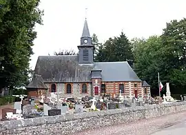 The church in Bois-Héroult | |
.svg.png.webp) Coat of arms | |
Location of Bois-Héroult | |
 Bois-Héroult  Bois-Héroult | |
| Coordinates: 49°33′48″N 1°24′23″E | |
| Country | France |
| Region | Normandy |
| Department | Seine-Maritime |
| Arrondissement | Rouen |
| Canton | Le Mesnil-Esnard |
| Government | |
| • Mayor (2020–2026) | Édouard de Pradel de Lamaze[1] |
| Area 1 | 6.59 km2 (2.54 sq mi) |
| Population | 173 |
| • Density | 26/km2 (68/sq mi) |
| Time zone | UTC+01:00 (CET) |
| • Summer (DST) | UTC+02:00 (CEST) |
| INSEE/Postal code | 76109 /76750 |
| Elevation | 135–232 m (443–761 ft) |
| 1 French Land Register data, which excludes lakes, ponds, glaciers > 1 km2 (0.386 sq mi or 247 acres) and river estuaries. | |
Geography
A farming village situated in the Pays de Bray, some 16 miles (26 km) northeast of Rouen at the junction of the D61 and the D96 roads.
Population
| Year | Pop. | ±% p.a. |
|---|---|---|
| 1968 | 134 | — |
| 1975 | 112 | −2.53% |
| 1982 | 121 | +1.11% |
| 1990 | 130 | +0.90% |
| 1999 | 140 | +0.83% |
| 2007 | 166 | +2.15% |
| 2012 | 178 | +1.41% |
| 2017 | 200 | +2.36% |
| Source: INSEE[3] | ||
Places of interest
- The church of Notre-Dame, dating from the sixteenth century.
- The eighteenth-century chateau, with dovecote and a park.
References
- "Répertoire national des élus: les maires". data.gouv.fr, Plateforme ouverte des données publiques françaises (in French). 2 December 2020.
- "Populations légales 2020". The National Institute of Statistics and Economic Studies. 29 December 2022.
- Population en historique depuis 1968, INSEE
External links
This article is issued from Wikipedia. The text is licensed under Creative Commons - Attribution - Sharealike. Additional terms may apply for the media files.